WEATHER: Winter Unleashed With Arctic Blast
By Steven Strouss
PHILADELPHIA (CBS) -- The Delaware Valley has begun to settle into a multi-day deep freeze. The coldest air mass, since last February, is moving in and temperatures will struggle to get out of the 20s today through the weekend. We are facing over 100 consecutive hours below the freezing point and to add insult to injury, wind chills are about to turn brutal.
A series of Arctic fronts is responsible for this latest Winter blast that will send temperatures tumbling 20 to 25 degrees below average.
READ: Cold Weather Survival Guide
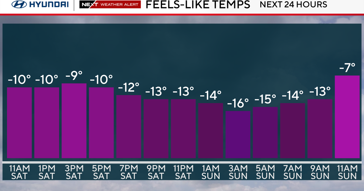
One front moved through yesterday and the next is set to arrive by Saturday morning with a reinforcement of Polar air. Afternoon wind gusts on Saturday will approach 30 mph. Combine this with temperatures in the 20s and the result is biting wind chills near zero degrees.
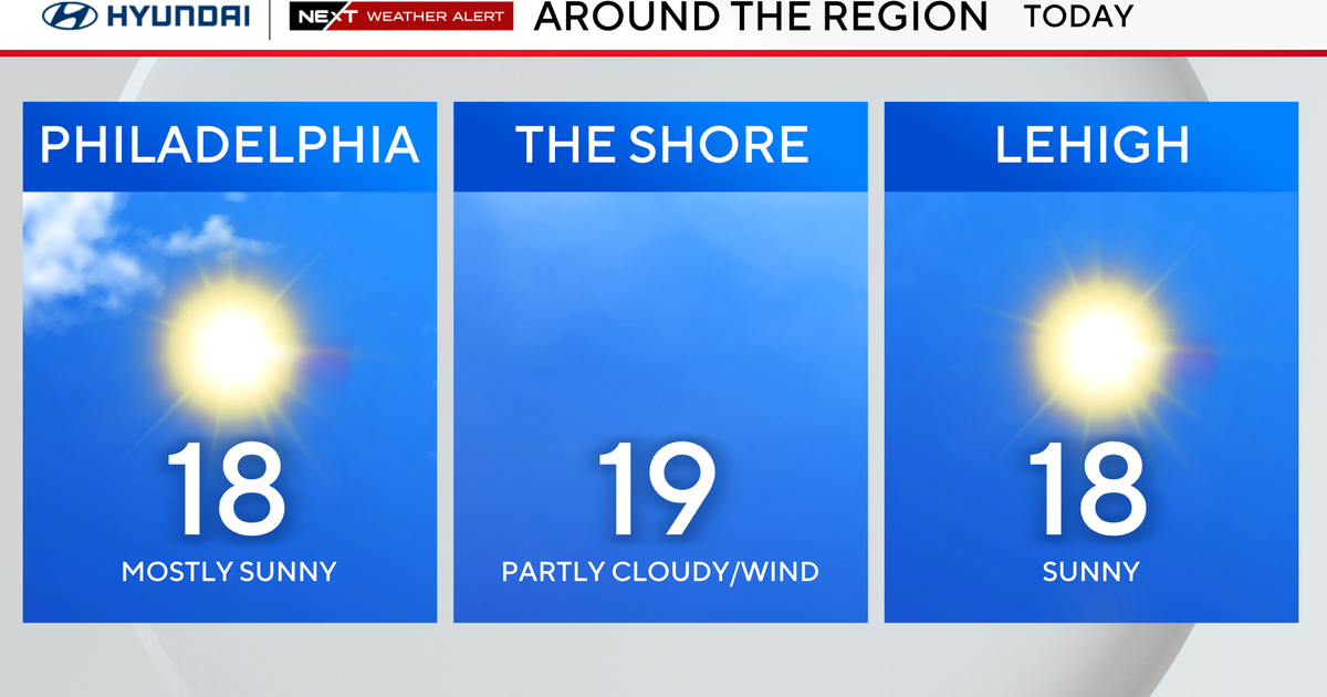
The core of the cold air will actually be felt on Sunday with lows in the single digits. This will challenge records that have stood for over 30 years. In addition, wind chill values Sunday morning will be several degrees below zero, for most locations, and dangerous wind chills are expected in the Poconos with values as much as 25 degrees below zero. Despite plenty of sunshine, Valentine's Day 2016 will easily be the coldest day of the season with highs only in the teens, so grab your sweetheart because this is certainly a day for snuggles and cuddles.
There are more snow opportunities during the next several days as well. As the Arctic air invades on Saturday, snow squalls and snow showers are possible along the front. This could bring a modest accumulation to the region early in the day, but it could be enough to create slippery conditions on the roads.
The bigger concern is on Monday. The active pattern repeats itself as a clipper type system combines with a low that will gather moisture and eventually organize in the deep south. We are several days out and the storm has yet to form but model guidance is in pretty good agreement that our region will see snow later on Monday. The storm then streaks toward the mid-Atlantic and we'll be in the crossfire by Tuesday. It appears the freezing line will sneak north as this storm pushes in warmer air and this will change snow over to sleet then rain by Monday night as temperatures finally climb above freezing. Before the changeover occurs, several inches of snow are possible, especially across northern parts of the region, so we will monitor this situation closely to see how it develops.
It's amazing to think that Philadelphia has nearly met last winter's snowfall totals. Right now we stand at 25" just 2" shy of last winter, and we have a good chance to at least tie that total this weekend. Of course, much can change! As the setup evolves, count on the Eyewitness Weather Team to keep you up to date and informed.
Stay warm!
