Hot, humid weather leads to excessive heat warning in Philadelphia area; storm chances through weekend

PHILADELPHIA (CBS) — The Philadelphia area's hot weather streak continued today, with even more heat and humidity as the region entered Day 3 of what could be a four-day heat wave.
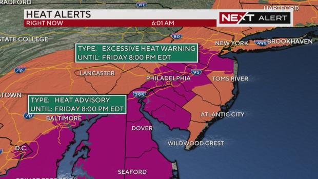
Due to this heat, we've issued a NEXT Weather Alert Day, which includes an excessive heat warning for areas across Pennsylvania, New Jersey, and Delaware. The map below shows these areas shaded in purple.
Anywhere in our coverage area not under an excessive heat warning is under a heat advisory. Both alerts expire at 8 p.m. tonight.
The National Weather Service issued a severe thunderstorm watch for several counties throughout the Delaware Valley effective through 9 p.m. Severe thunderstorm warnings are likely to pop up as storms roll through the region.
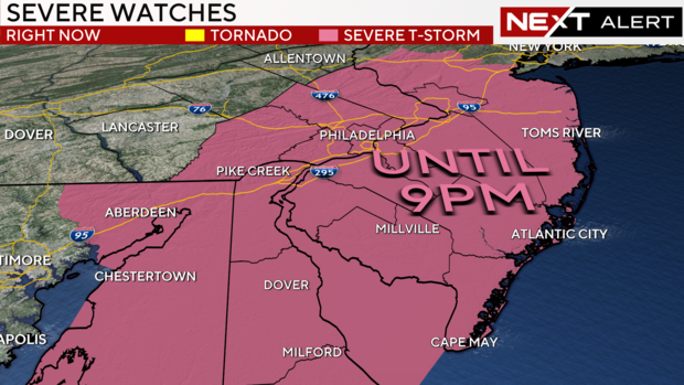
The National Weather Service's damage report confirmed storm damage was found in Medford, NJ.
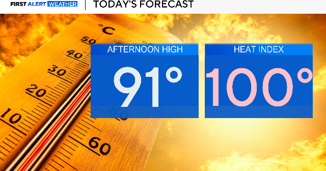
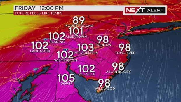
Temperatures will reach 93 in Philadelphia today, but with a high dew point, it will feel as hot as 106 degrees. If you're going to be outside for any period of time, drink plenty of water, take frequent breaks in a shaded (or ideally, air-conditioned) area. CBS News' HealthWatch explained how you can recognize the signs of heat stroke and heat exhaustion.
The actual thermometer temperature today is a few degrees cooler than yesterday, but the humidity will be higher today. Thursday's heat index topped out at 100 degrees.
To your body, today will feel hotter.
Here's a look around the region at how it will feel at noon today.
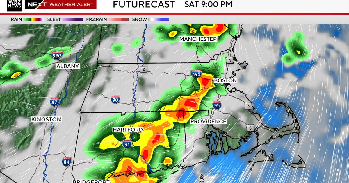
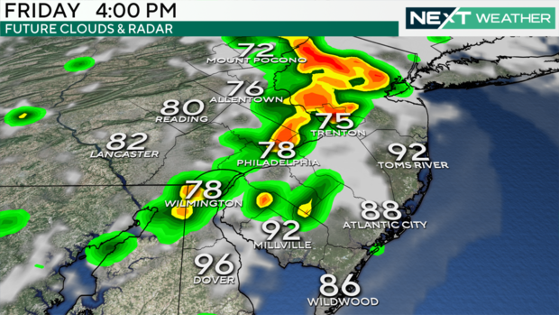
Some morning showers were clipping the Poconos but more rain is expected this afternoon and into the evening, along with each afternoon of this coming weekend.
The heat and humidity will fuel showers and storms through the second half of today. As the storms move into the region, they will begin to produce locally heavy rain and the potential for some gusty winds.
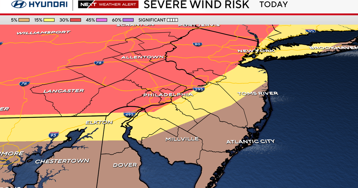
While the threat for scattered showers and storms will be widespread, the general threat for severe weather is marginal. The Storm Prediction Center has the area under a "marginal" or Level 1 out of 5 risk for severe storms, with the primary concern being damaging winds.
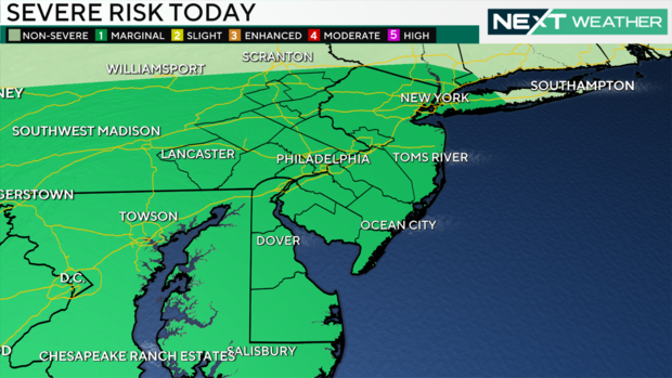
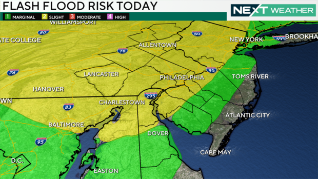
The more likely impact from the storms this afternoon will be the chance for heavy rainfall that could result in some localized flash flooding.
The storms will begin to die down through this evening with the loss of the heat of the day, but a few stray showers will remain possible, especially across South Jersey.
The humidity staying high is helping those storms form each day. We really don't get a break until Monday, which looks drier with a high of 93 degrees.
Stay with us as we track the storms and heat through the weekend.
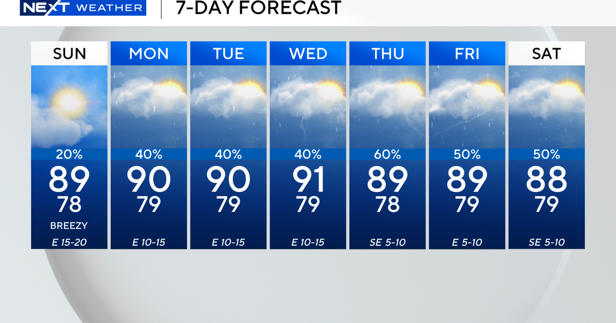
Here's your 7-day forecast:
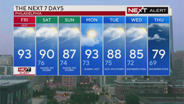
Friday: NEXT Weather Alert Day for excessive heat. High 93, feels like triple digits.
Saturday: Humid with afternoon storms possible. High 90, Low 76
Sunday: Humid with PM T-storm. High 87, Low 74
Monday: Sunny and hot. High 93, Low 73
Tuesday: Hot with a PM T-storm chance. High 88, Low 75
Wednesday: Showers possible. High 85, Low 72
Thursday: Showers possible. High 79, Low 69