Cloudy skies and rainy weather in Philadelphia Sunday, clouds and showers linger heading into the week


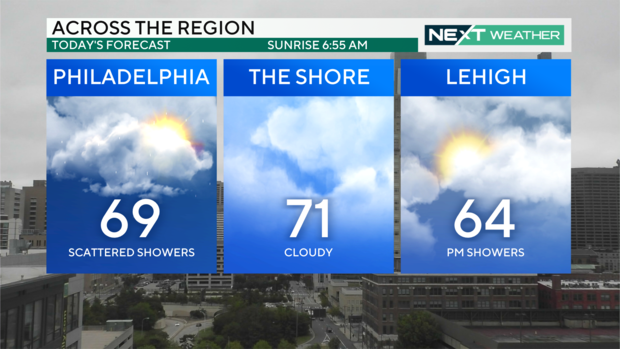
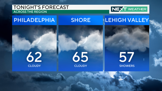
Nuisance showers and drizzle will continue today with cool highs in the upper 60s in the city and low 70s at the shore. Clouds remain with drizzle overnight as temperatures dip to the low 60s.
Tomorrow skies will be mostly cloudy once again with some sun breaks later in the day.
Gray skies and shower chances will persist through Tuesday courtesy of the remnants of what once was Hurricane Helene. On Wednesday a trough and cold front will push the remnants off shore and our skies will turn sunny by Thursday.
Temperatures will rain from the upper 60s to mid 70s through the week ahead.
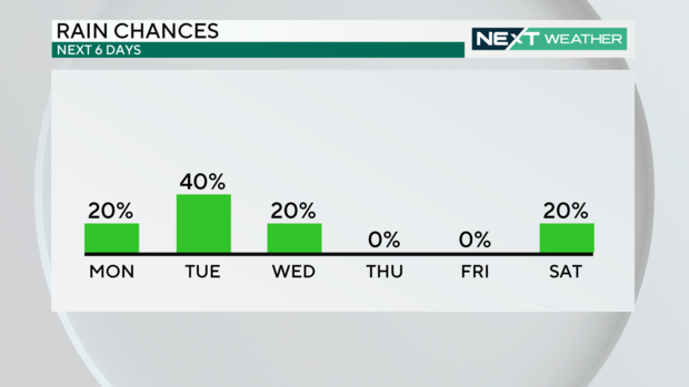
Next weekend another storm passes our area bringing rain showers at some point later on Saturday or Sunday.
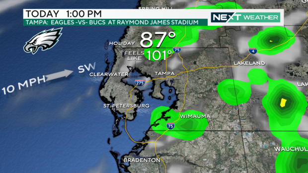
When the Eagles face the Bucs at 1 PM today skies will be partly cloudy with passing showers and a southwest wind to 10 mph. Temperatures inside Raymond James Stadium will be very tropical at game time, with highs in the mid and upper 80s and a heat index of 95 to 100.
Turning to the tropics all eyes are on the development region over the Caribbean, Bay of Campeche and southern Gulf of Mexico. Conditions are favorable for another tropical system to develop there later this week. This is the same region that Helene just emerged from. It is too early to say where a system would track but the entire Gulf Coast will once again be on alert.
Here's your 7-day forecast:
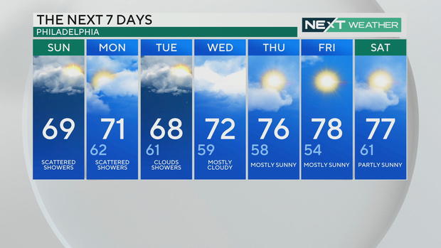
Sunday: Scattered showers. High 69.
Monday: Scattered showers. High 71, Low 62.
Tuesday: Clouds and showers. High 68, Low 61.
Wednesday: Mostly cloudy. High 72, Low 59.
Thursday: Mostly sunny. High 76, Low 58.
Friday: Mostly sunny. High 78, Low 54.
Saturday: Partly sunny. High 77, Low 61.