Severe thunderstorm watch in effect for most of Philadelphia region Wednesday night


PHILADELPHIA (CBS) -- A severe thunderstorm watch has been issued by the National Weather Service for most of the Philadelphia region until midnight on Wednesday.
Below are the counties in our region where the watch will be in effect:
- Pennsylvania: Berks, Bucks, Chester, Delaware, Lehigh, Montgomery, Northampton and Philadelphia
- New Jersey: Burlington, Camden, Gloucester, Mercer and Ocean
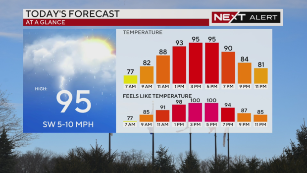
Feels-like temperatures in the afternoon could hit over 100 degrees, and those storms could produce heavy rain, flooding, gusty winds, hail and even an isolated tornado.
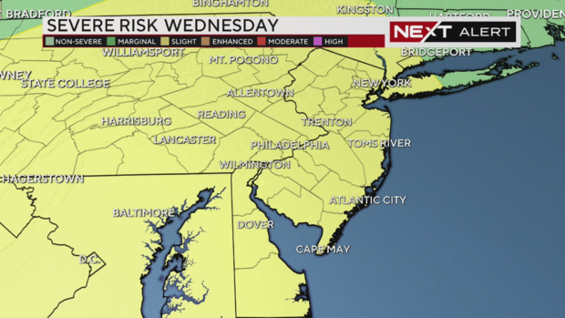
Because of this, we declared Wednesday a NEXT Weather Alert Day as the entire Philadelphia region will be under a slight risk for severe weather, or a Level 2 risk on a five-point scale.
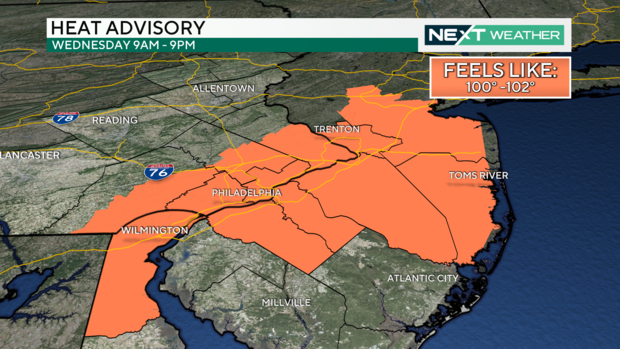
Before storms arrive Wednesday night, it's a hot and humid day. A heat advisory is in effect for much of the area, including Philadelphia, from 9 a.m. to 9 p.m. Residents should drink plenty of water, get plenty of time in air conditioning and take frequent breaks from the heat.
Rip current risk today at NJ, DE beaches
The Jersey Shore and Delaware beaches are great places to cool off from this summer heat, but be careful. There is a High Risk of rip currents at New Jersey beaches today and a moderate risk at Delaware beaches.
Don't swim at a beach where a lifeguard is not present, and always listen to their instructions. If they say to get out of the ocean, get out.
Experts say to stay safe, you should avoid swimming alone. To get out of a rip current, swim parallel to the shore. It will eventually dissipate but you might find yourself out in deeper water.
When storms arrive in Pa. suburbs, Philadelphia, NJ and Delaware
As a cold front moves through the area Wednesday into Thursday, several rounds of showers and thunderstorms will develop. The biggest severe threat with these storms is heavy rain and strong winds, but we can't rule out the possibility of an isolated spin-up tornado and a moderate risk of hail.
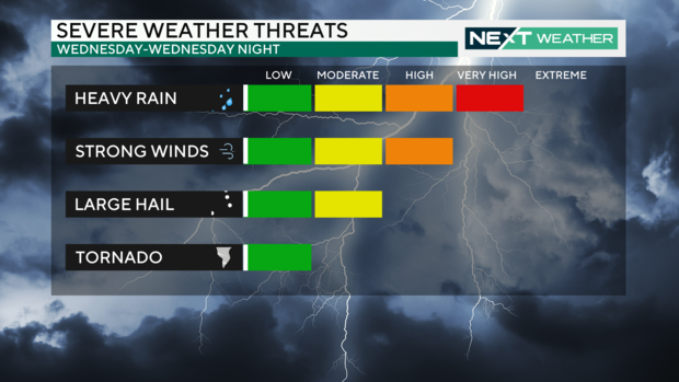
A tornado would be possible if a storm cell breaks apart from the line of storms. If the storms stay in one line we're expecting straight-line winds, though those could still be damaging.
Your evening commute should be rain-free, especially if you're near Philadelphia or New Jersey.
There could be some isolated showers popping up around 6 p.m. to 7 p.m. in the Lehigh Valley.
As of noon, the latest run of our forecast model shows the strongest line of strong storms arriving in the region around 10 p.m. or so. By around 11:30 p.m., this line of storms will be pushing through Philadelphia and into South Jersey.
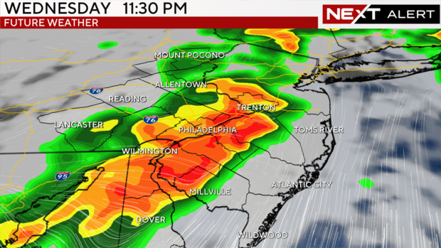
Anywhere under the red and orange spots on our NEXT Weather radar could see heavy downpours as these storms roll through.
Behind this line, we could see trailing showers, not really heavy rain, into the early hours of Thursday morning.
Then, we'll start to clear things out and slowly dry up with sunshine returning by Thursday afternoon.
Here's your 7-day forecast:
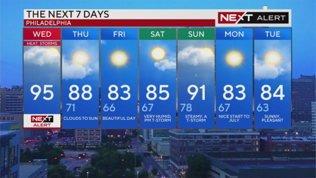
Wednesday: NEXT Weather Alert Day, high of 95, low of 75
Thursday: High of 88, low of 71, clearing and cooler
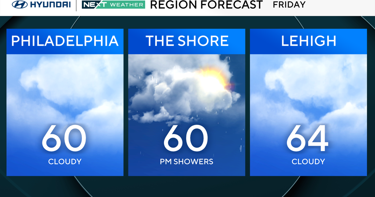
Friday: High of 83, low of 66, sunny and nice
Saturday: High of 85, low of 67, some sun, PM shower possible
Sunday: High of 91, low of 78, steamy and thunderstorms
Monday: High of 83, low of 67, cooler
Tuesday: High of 84, low of 63, pleasant