WEATHER BLOG: Another Shot At Snow!
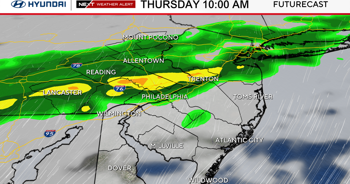
PHILADELPHIA (CBS) -- We woke up Thursday morning to a sugar-dusted wonderland after a clipper system deposited light snow across the area - and it won't be long before we have yet another shot at snow!
Friday will dawn dry and frigid, with morning temperatures in the teens and low twenties across the region. It's in the afternoon after 1 p.m. or so that a system will lift in from the south. This is a quick hitting system but it may briefly intensify along the coast Friday afternoon, leading to a brief period of moderate snowfall there. In the city, we are likely to see scattered snow showers or light snow between 2 and 6 p.m. A quick coating may accumulate around Philadelphia, but also any falling snow could reduce visibilities for the afternoon commute. Down the shore and in coastal Delaware, an inch or so could fall, with as much as 2" in isolated bands. Far northwest suburbs will likely see nothing but flurries or a snow shower.
This will likely clear the coast by 8 p.m. Friday, and then it's another cold night - but temperatures will be on the way up, heading back to the 50's briefly next week.
- THURSDAY NIGHT -- Turning Mostly Cloudy and Cold. Low 21
- FRIDAY -- Mostly Cloudy with PM Scattered Snow Showers. A Quick Coating in Spots. High 35
- SATURDAY -- Still Cold with Some Sunshine. High 39
- SUNDAY -- Becoming Mostly Cloudy, Chance For a Wintry Mix Late. High 44
- MONDAY -- Partly Cloudy and Milder. High 48
- TUESDAY -- Mostly Cloudy and Mild with a Few Rain Showers Possible. High 52