NEXT Weather: Severe thunderstorm watch in NJ, DE
PHILADELPHIA (CBS) -- Thursday is a NEXT Weather Alert Day for strong storms that could be severe in spots.
We are expecting damaging winds with the potential for hail.
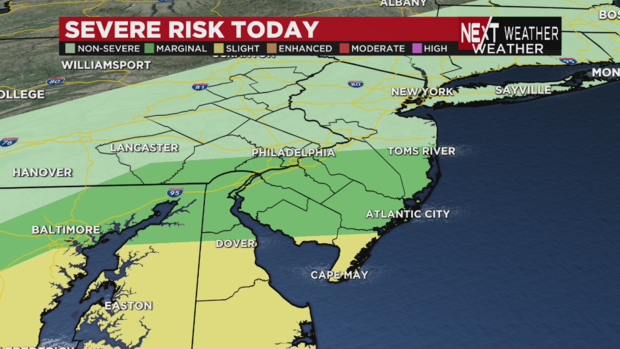
Parts of New Jersey, Delaware, and other states have been issued a severe thunderstorm watch until 10 p.m.
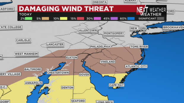
Southern Delaware and the most southern Shore points in New Jersey are at a "slight" risk for severe storms, or 2 out of 5 on the scale. North of that, parts of South Jersey and Delaware as well as Philadelphia, Delaware County, Chester County and Lancaster County are at a "marginal" risk of severe weather, or 1 out of 5 on the scale.
The latest radar models show some heavier storms could pass over Berks and Lancaster counties as well as Philadelphia and the suburbs too.
It's not looking like the Lehigh Valley will see much from these storms.
Timing of today's weather
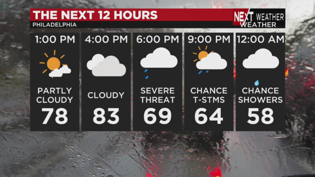
The severe threat across the region lasts between 5 p.m. and 11 p.m.
Mid-afternoon, we could reach above the 80-degree mark.
Through the morning, strong south winds ahead of the approaching front brought in very warm temperatures.
The warmth will increase the instability in the atmosphere, ensuring that severe weather will break out later in the day.
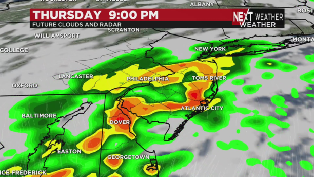
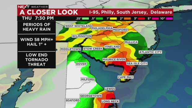
Around 6:30 p.m., we're looking at showers over Lancaster and points west of the city. Heavier showers, but not the strongest of the storms, will cross our region and the city by around 7:30 p.m.
The strongest storms will move across South Jersey and Delaware.
Severe impacts
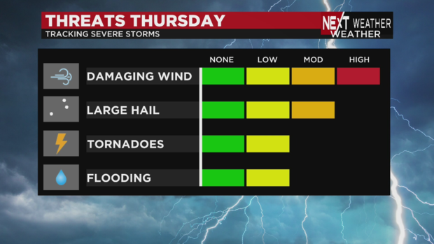
Since this is a fast-moving system, damaging winds will be the most likely form of severe weather we'll see.
Gusts in excess of 60 mph can down trees and powerlines. While the tornado threat is low, it's not zero, and after what we went through last weekend, we'll make sure to be on alert if any rotation is seen.
We could also see large hail.
We're more concerned about straight-line winds.
Looking ahead
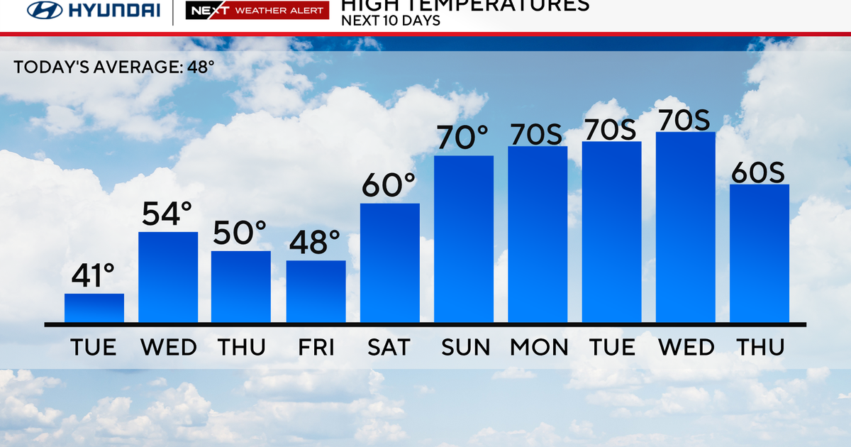
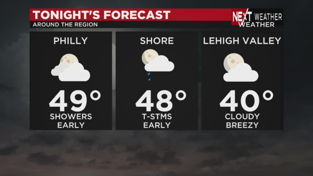
Temperatures will drop into the 40s as the storms move out.
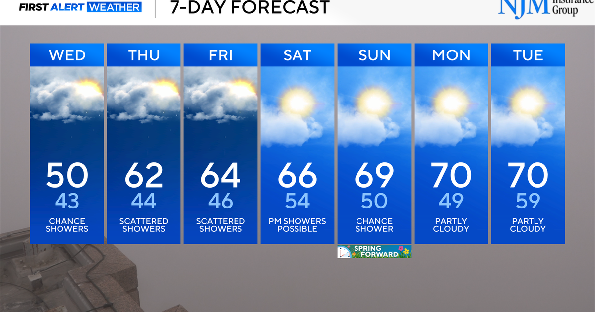
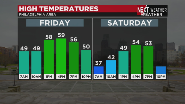
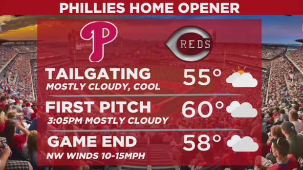
Friday will be dry and much cooler, and we're not expecting significant weather impacts to the Phillies' home opener (now that it's been moved from today).
It's looking to be a cloudy Friday with temperatures around 60 degrees for the first pitch at 3:05 p.m.
Our team of meteorologists are working around the clock to update you here, on stream, on-air and on our Twitter, Instagram and Facebook pages at CBS Philadelphia. Stay informed and stay safe.