NEXT Weather Alert for damaging winds, heavy rain Sunday night in Philadelphia region


The fog has cleared, but clouds and wind will remain for the remainder of the Philadelphia region on Sunday, with rain and storms on the way tonight.
West of Philly, a cold front is producing showers and storms that are marching east as we speak. While this system has slowed down and even weakened for our area, it's still packing quite a punch.
Numerous confirmed tornadoes have been reported in the last 24 hours, along with flash flooding reports and wind damage. Nearly 300 tornado warnings have been issued since Friday. The worst of it occurred over the mid-South and deep South, with the main area of the tornado threat moving east on Sunday. This will include areas like Virginia and the Carolinas, all the way down to the panhandle of Florida.
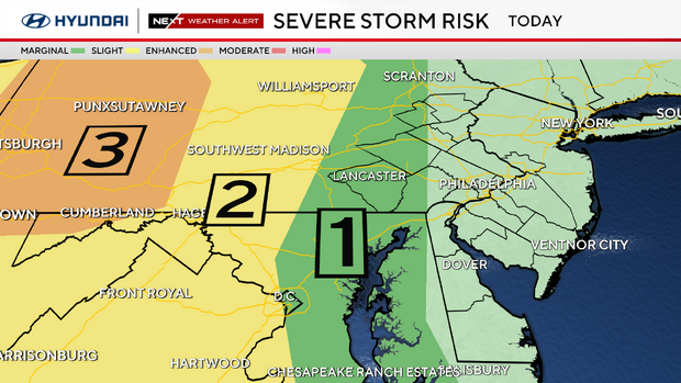
The Storm Prediction Center has the majority of our area in the "general thunderstorms" category, with some of our western counties still in the marginal risk (1 out of 5).
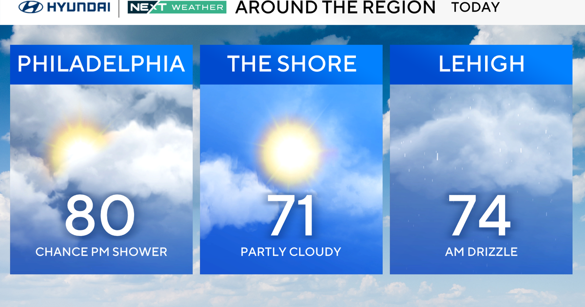
Temperatures for the remainder of the evening will be in the 60s, with gradually cooling temperatures late overnight behind the cold front.
The National Weather Service has issued a wind advisory for the entire area until 9 p.m., with wind gusts now forecast to reach between 40 to 50 mph.

Timing Sunday's storms in the Philadelphia region
Here's the set-up for the evening: Rain and storms are moving in, becoming heavier and steadier late tonight.
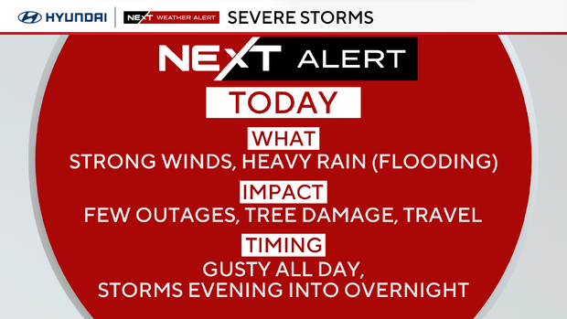
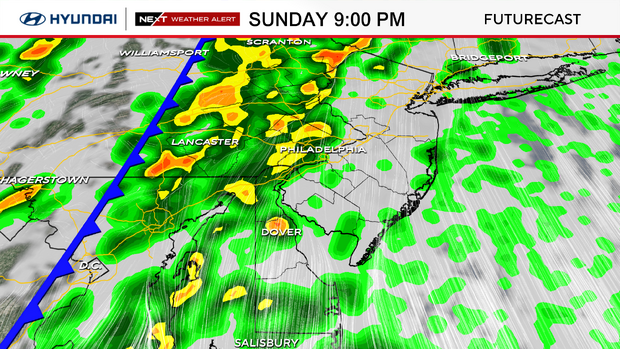
Heavy rain and embedded strong and potentially damaging wind gusts are possible, although the greatest threat is well west of our area. This line of storms will arrive in the Reading and Allentown area between 7-10 p.m. and then track east into the Philadelphia area by 9 p.m.-midnight. The leading edge of the storms will move across South Jersey toward the shore into the first half of the overnight.
The NEXT Weather Team will have frequent updates online, on-air and on our digital stream to help you to plan and stay protected.
Looking ahead to the week
Monday, St. Patrick's Day will start with some green (rain) on the radar before slowly clearing out through midday. The rain and clouds will gradually clear for the afternoon with temperatures near 60 degrees.
The warmth will return through the middle of next week with highs in the mid-upper 60s Tuesday and then around 70 degrees Wednesday. The next chance of rain will arrive with the first day of spring on Thursday as a cold front ushers in another drop in temperatures for next Friday. Temperatures will go from the upper 60s Thursday afternoon to only around 50 degrees Friday afternoon.
7-day forecast
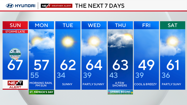
Sunday: NEXT Weather Alert for late storms. High of 67.
Monday: AM shower, PM sun. High of 57, low of 55.
Tuesday: Sunny. High of 62, low 34.
Wednesday: Partly sunny. High of 64, low of 39.
Thursday: Chance for a few showers. High of 63, low of 43.
Friday: Cool and breezy. High of 49, low of 39.
Saturday: Partly sunny. High of 61, low of 36.
Get the latest weather info on the CBS News Philadelphia app.