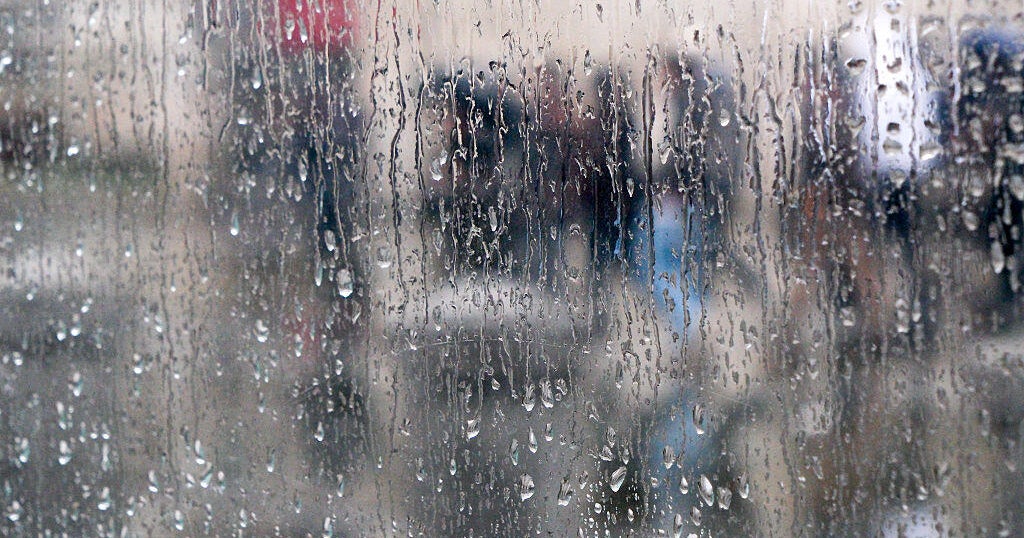
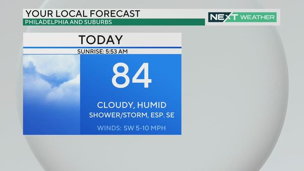
Muggy and cloudy again today in Philadelphia, storms possible before clearing out for a nice weekend
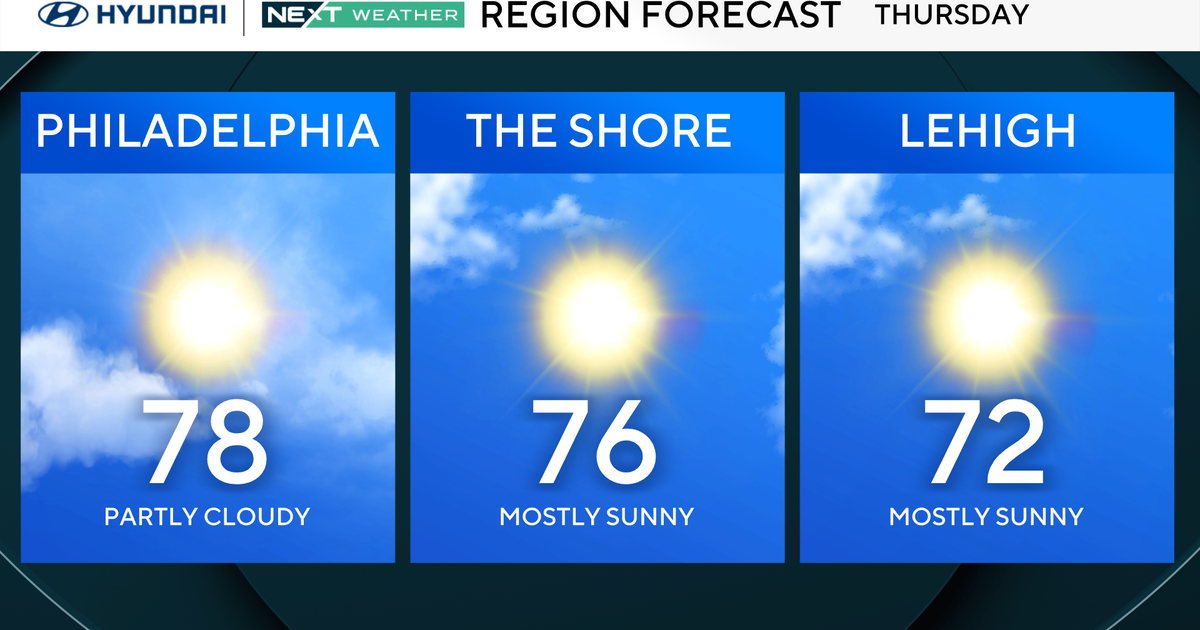
PHILADELPHIA (CBS) — After a muggy and wet day Wednesday (in spots), the pattern continues Thursday with a greater chance for storms during the evening as a front pushes through.
Depending on where the storms line up, pockets will receive 1-2 inches of rain, while others will receive very little. While showers and storms are possible, the threat of severe weather has diminished. The biggest threats with any storm that develops will be heavy rain and flash flooding.
The best chance for showers and storms will be east and south of Philadelphia, but we can't rule out a stray shower further northwest.
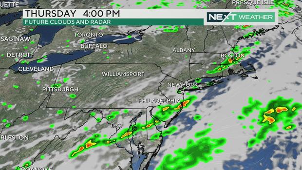
The Jersey Shore and Delaware could see some bands of showers early, then as a front moves in around 9:30/10 a.m., Chester and Berks counties might get hit with some heavier rain.
The heaviest storms will form later in the afternoon, but right now, we don't expect much severe weather. The biggest threat for
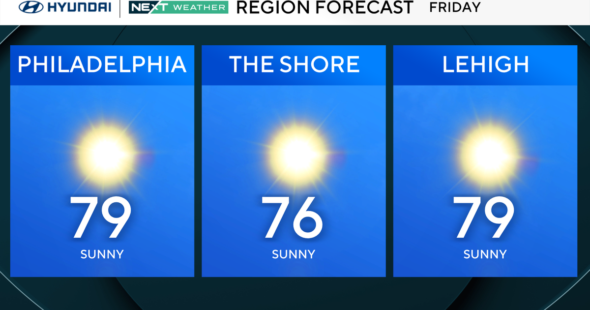
Skies clear by 10 p.m., and once the front crosses, we get some great summer conditions beginning Friday.
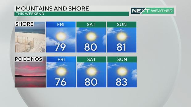
The region will see plenty of sunshine and humidity levels will be fairly low for this time of year. Plan your outdoor weekend activities.
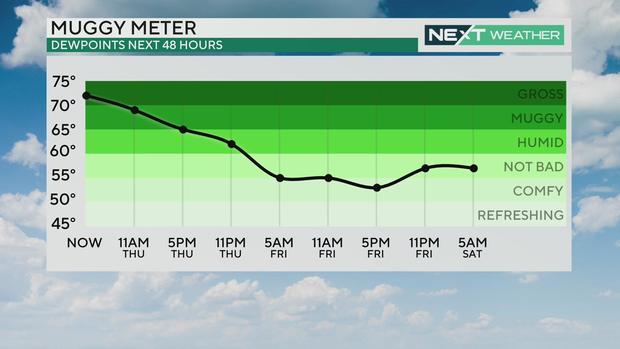
By Sunday, we may get back into the 90-degree range, but humidity levels will stay in check. Expect a dry pattern for at least a few days with rain chances returning in the middle of next week.
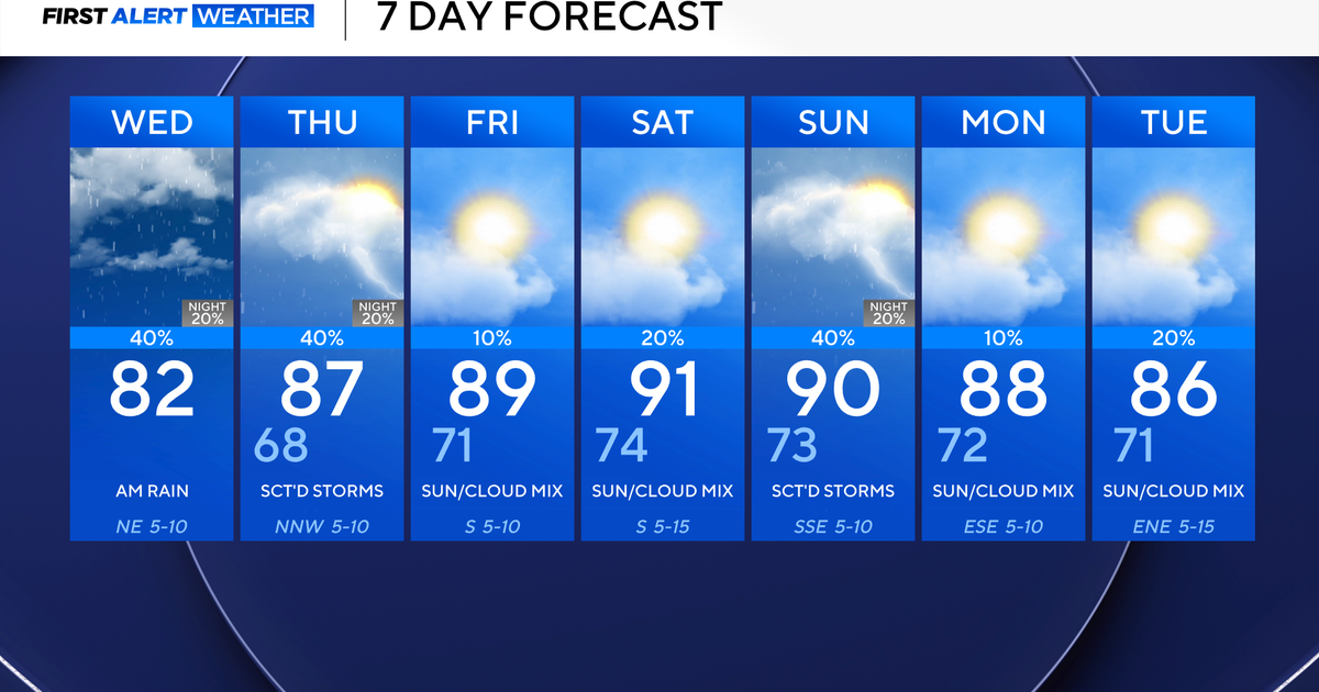
7-day forecast
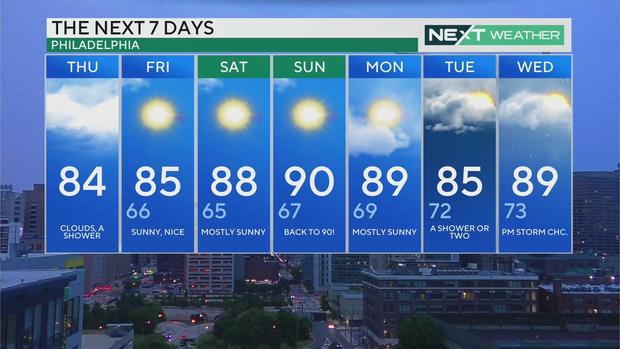
Thursday: High of 85, low of 73, clouds, a shower
Friday: High of 86, low of 67, sunny, nicer
Saturday: High of 89, low of 66, sunny
Sunday: High of 90, low of 66, mostly sunny
Monday: High of 90, low of 68, sunny and warmer
Tuesday: High of 88, low of 71, mainly dry
Wednesday: High of 91, low of 75, shower possible