Seasonable fall weather continues in Philadelphia region, warming up by the weekend; latest on Hurricane Milton

Another perfectly seasonable October day with a high near 70 and lots of sunshine. A weak surface cold front passes through tonight. Thursday and Friday will likely stay in the 60s with morning lows in the 40s. As of now, Friday morning looks to be the chilliest of the week, and then we rebound into the 70s by the weekend.
Speaking of lows in the 40s, the average first occurrence of lows in the 40s in Philly is Sept. 30. We are behind schedule but nowhere near the record latest first occurrence, which is Oct. 20.
The main weather story across the nation is Hurricane Milton.
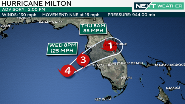
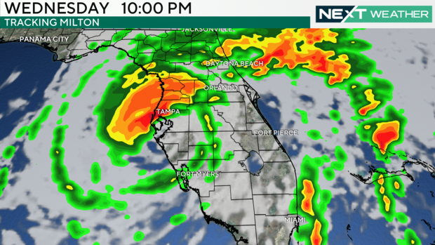
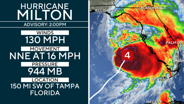
Milton was a Category 5 on Wednesday morning but has weakened slightly to a Category 4. As of 2 p.m., the storm is weakening and is just one mph shy of returning to a Category 3 status. The storm is moving quickly to the northeast and is running a little ahead of schedule. At this pace, landfall is expected before midnight.
Milton's northeast trajectory will bring it to the west coast of Florida, which will be slammed by catastrophic damage, with winds that could likely gust over 150 mph and widespread rainfall of 5 to 12 inches. Storm surge flooding is now expected to reach 10-15 feet in some areas, including the lower Tampa Bay region and points just south, meaning homes that have already been gutted from Helene's flooding will likely be inundated once again.
In addition, the storm surge flooding from Helene wiped out barrier islands and destroyed beaches, meaning the area is less protected from Milton's surge. In addition to the storm surge, winds will scatter the debris piles from Helene all across the region. Some spots in northern Florida could also receive upwards of half a foot of rain from Milton.
As always, the NEXT Weather Team will keep you and your family ahead of the storm and alert you to any potential impacts. As of this writing, our area will not feel any impact from Milton, but if you have friends or family in that area, please urge them to follow the evacuation warnings as this potentially once-in-a-lifetime hurricane bears down on the area.
Here's your 7-day forecast:
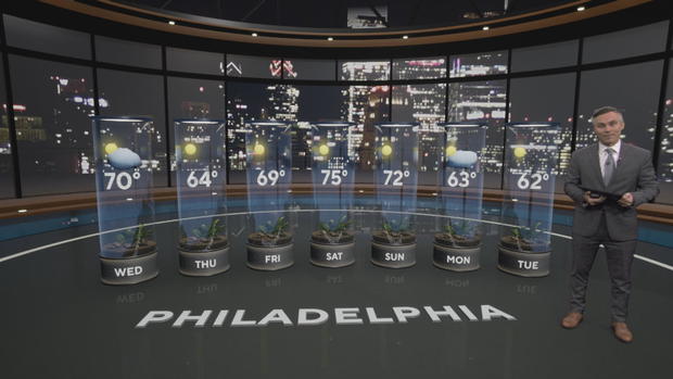
Wednesday: Beautiful fall day. High 70, Low 48.
Thursday: Cool! Some sun. High 64, Low 48.
Friday: Mostly sunny. High 69, Low 44.
Saturday: Sunny, warmer. High 75, Low 53.
Sunday: Gorgeous day! High 72, Low 51.
Monday: Cooling down. High 63, Low 55.
Tuesday: Sunny. High 62.