Parts of Philadelphia region could get light dusting of snow Thursday. Here's the weather forecast.
Thursday will be a breezy and very cold day around the Philadelphia region as cold northwest winds move in behind the major snowmaker that passed by our south Wednesday evening.
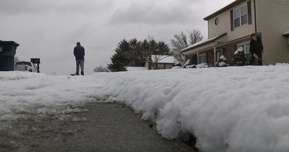
That storm brought up to a FOOT of snow to parts of Virginia and is now well out to sea. The Delaware beaches got about an inch or two of snow from the northern fringe of this storm.
The region could see a few snow showers on Thursday as a second wave of energy moves through, but it should amount to nothing more than a light dusting in spots.
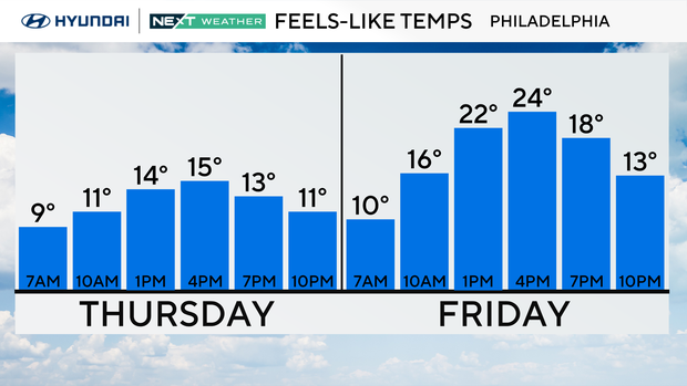
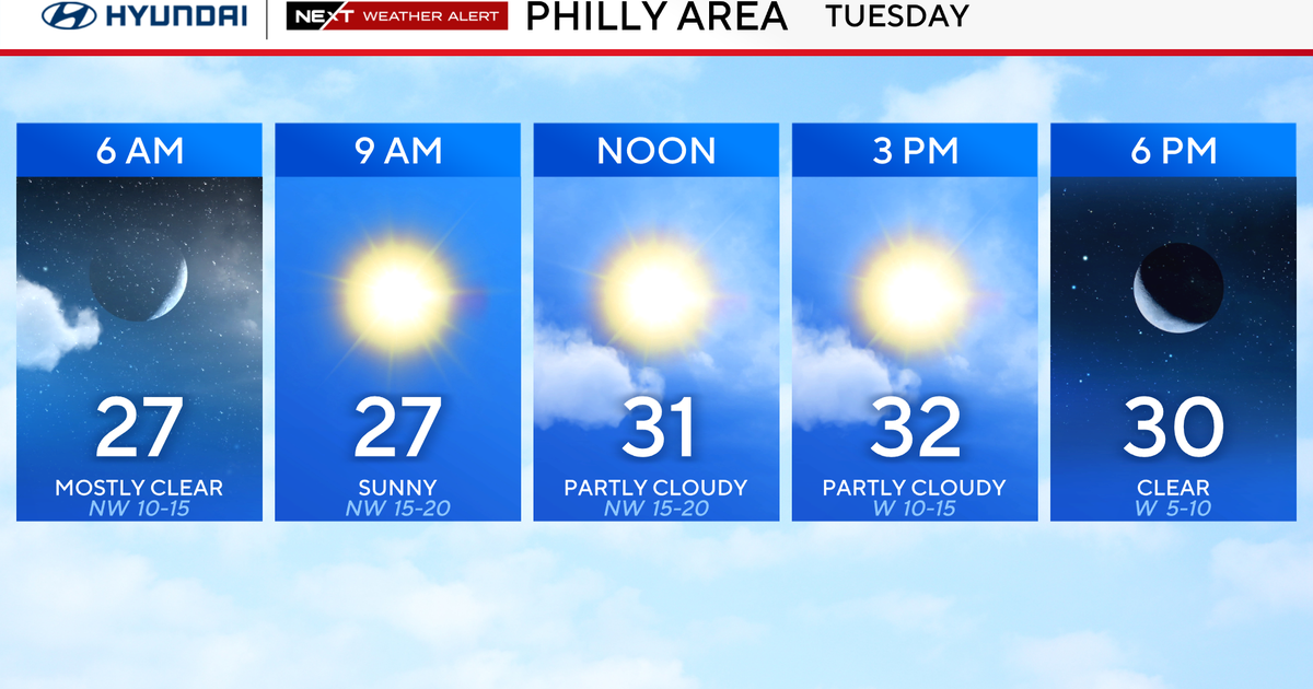
It's another day below freezing and a wind chill is making it feel about 10 degrees colder. Feels-like temps will range from 9 degrees to about 15 degrees in Philadelphia through the day.
Friday and Saturday are looking sunny, dry and cool for now. Friday is windy but Saturday is not too bad if you have any plans. Sunday is trending dry and slightly warmer. Then, we may head into the 50s for a few days next week.
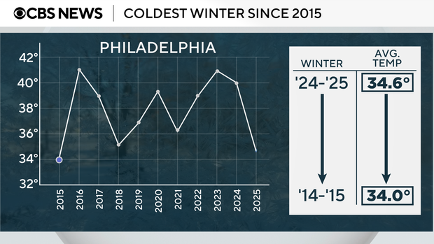
Speaking of cold, so far the winter season of 2024-2025 is the coldest it's been in 10 years, with an average temperature of just 34.6 degrees.
Here's the 7-day forecast:
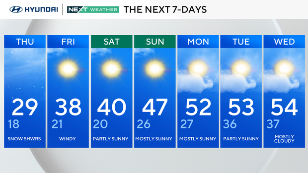
Thursday: Snow showers. High 29, low 18.
Friday: Windy. High 38, low 21.
Saturday: Partly sunny. High 40, low 20.
Sunday: Mostly sunny. High 47, low 26.
Monday: Mostly sunny. High 52, low 27.
Tuesday: Partly sunny. High 53, low 36.
Wednesday: Mostly cloudy. High 54, low 37.
Get the latest weather info on the CBS News Philadelphia app.