Great stretch of weather continues Wednesday in Philadelphia region; tracking Hurricane Ernesto's path
PHILADELPHIA (CBS) -- What a great stretch of weather we're having this week in the Philadelphia region. It's a trend that will continue Wednesday.
Once again, sunny skies, comfortable temperatures and low humidity will rule around the Delaware Valley thanks to a high-pressure cell parked to our west. Winds around that high are clockwise, so we benefit from a nice northerly breeze.
Why is the sky hazy in Philadelphia? Wildfire smoke in the atmosphere
That north wind is pulling some of that smoke south toward us Wednesday.
The skies are a little hazy at times, especially in Philadelphia, due to smoke from wildfires burning out in California and Canada.
This smoke is high in the atmosphere, so it's not causing air quality issues for us down on the ground. The region has moderate to good air quality today, according to Airnow.gov.
The main impact of this smoke is just a blurry, hazy look at the sky in a few spots today. It may also affect the look of the sunset.
What's next: Thursday, Friday and weekend weather
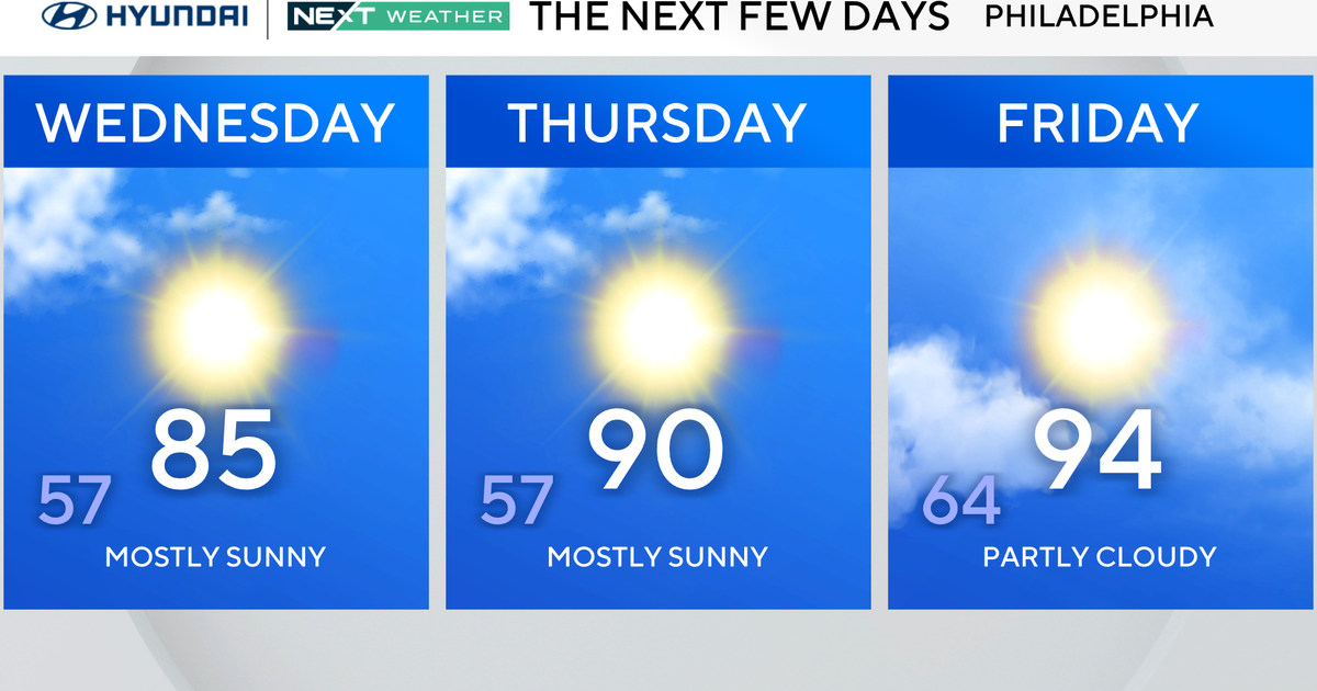
Temperatures will warm up a bit Thursday but will not be out of control or anywhere near the record of 98 degrees set in 1988.
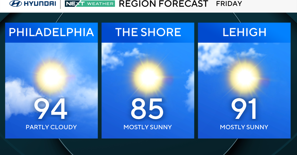
Friday will be a bit more humid and have a bit more cloud cover, but the majority of the day is still trending dry. Friday evening could bring some spotty showers, but our next best chance of any measurable rain will be during the upcoming weekend as the overall pattern changes.
At this point, we are not on any weather alert, but it's possible you may want to have a backup plan in place if you have some outdoor activities scheduled.
Ernesto on track to miss Philadelphia area, could affect beachgoers
Let's talk about Ernesto, which strengthened into a hurricane with 75 mph winds as it pulled up north of Puerto Rico. The storm will continue to strengthen to a Category 3 status with winds of 115 mph as it approaches Bermuda before this weekend.
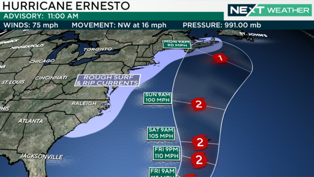
A front that will bring us some storms Saturday and Sunday is also doing its part, holding Ernesto off the coasts in our region.
With Ernesto not making local landfall, our impacts will be primarily felt down the shore and at the Delaware beaches, with high seas and high rip current danger this weekend into early next week.
Stay with the NEXT Weather Team to keep you ahead of the next weathermaker.
Here's your 7-day forecast:
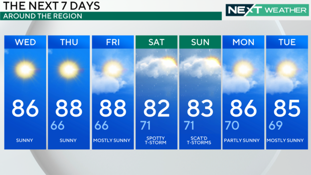
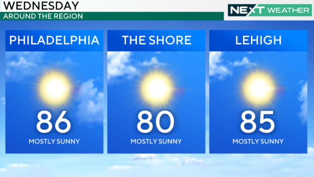
Wednesday: High 86, low 66, sunny
Thursday: High of 88, low of 66, mostly sunny
Friday: High of 88, low of 66, mostly sunny
Saturday: High of 82, low of 71, spotty T-storm
Sunday: High of 83, low of 71, scattered thunderstorms
Monday: High of 86, low of 70, isolated shower
Tuesday: High of 85, low of 69, partly cloudy