NEXT Weather: Rain switches to snow in some parts of Philadelphia region overnight
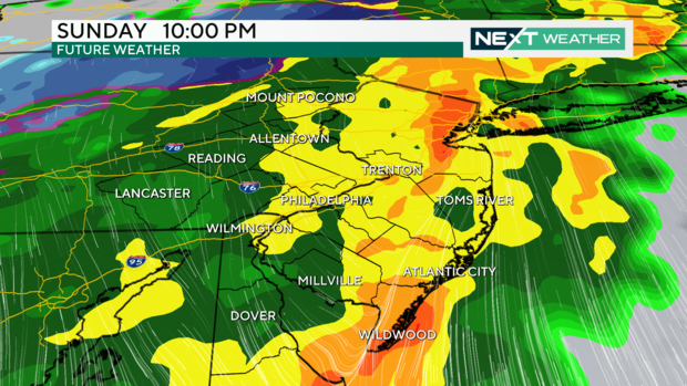
PHILADELPHIA (CBS) -- Rain and wind will continue Sunday evening as a strong cold front crosses the Philadelphia region.
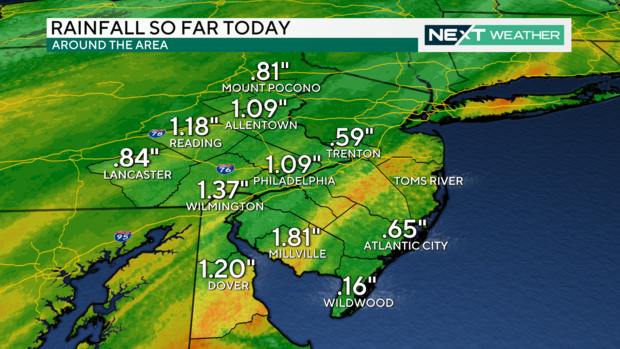
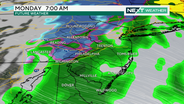
On Sunday night, we saw up to 1.5 inches of rain in spots, and we are not done yet. Some areas northwest of Philadelphia might see snow as the storm moves through and temperatures drop.
A Flood Watch is in effect through 4 p.m. Monday across much of the region, but flash flooding is not expected.
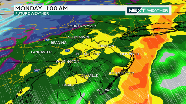
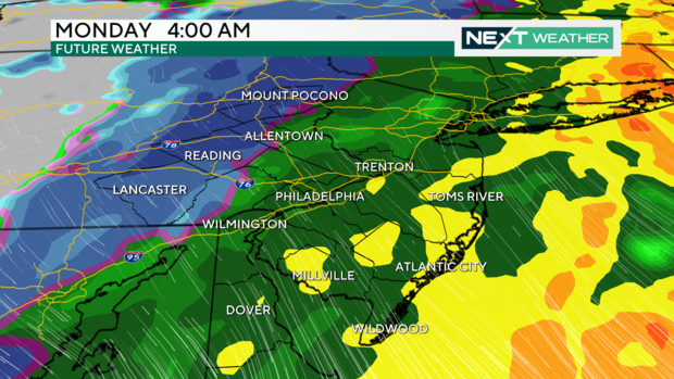
Moderate to heavy rain will continue through the overnight hours. As cold air moves in, areas in the northwest, including Allentown and Carbon and Monroe Counties, might see some light snow, with the highest elevation regions getting 1-2 inches.
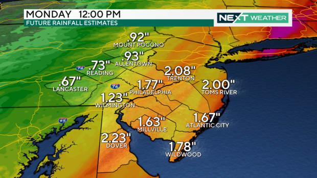
The rain and snow will end by mid-morning Monday after an additional 1-2 inches or more falls around the region.
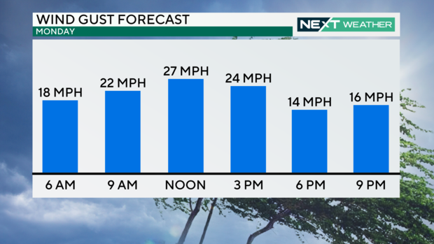
We remain on WEATHER ALERT into Monday due to strong northwest winds and a massive change in temperatures from day to day. It was in the mid-60s Sunday afternoon, but wind chills will likely drop into the mid to low 30s at the same time Monday.
Stay with the NEXT WEATHER team for continual updates.
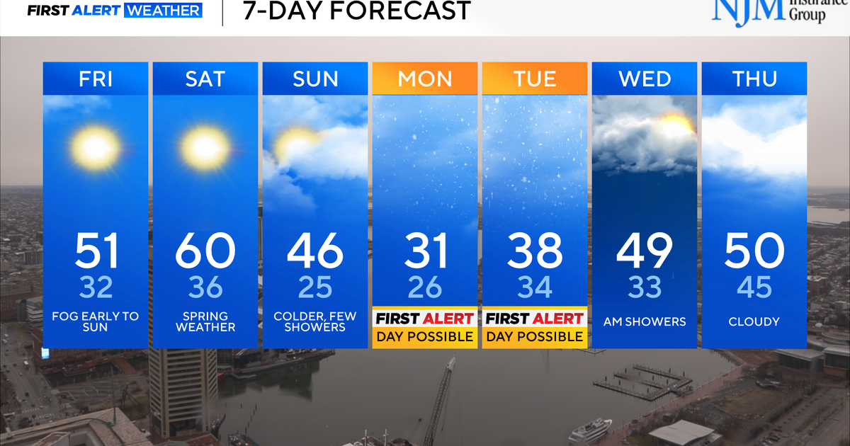
Here's your 7-day forecast
Monday: High of 47, NEXT Weather Alert Day
Tuesday: High of 46, low of 30, sunny and chilly
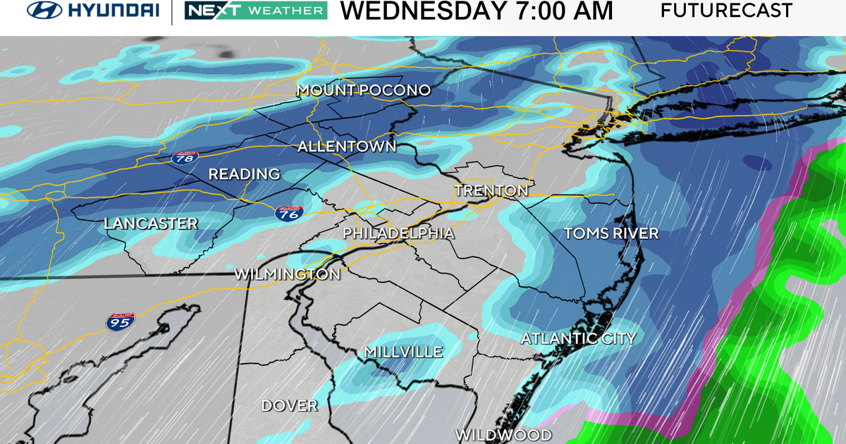
Wednesday: High of 4, low of 34, sunny
Thursday: High of 40, low of 28, coldest day of the week
Friday: High of 51, low of 28
Saturday: High of 52, low of 34, partly sunny
Sunday: High of 53, low of 35, clouds increase
