More hot weather in Philadelphia today as excessive heat warning blankets Delaware Valley

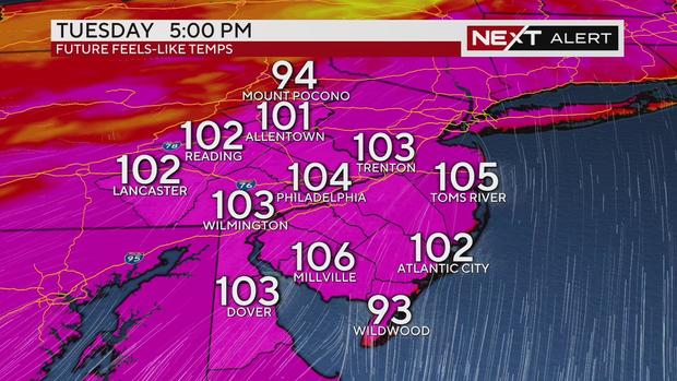
PHILADELPHIA (CBS) -- The searing heat is back, with highs Monday in the mid and upper 90s. Add humidity, and many areas across the Delaware Valley will feel like 103-106 degrees.
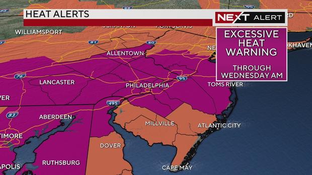
Because of the heat and humidity, an excessive heat warning is in effect through Wednesday morning. After that, an excessive heat watch will go into effect until Wednesday evening.
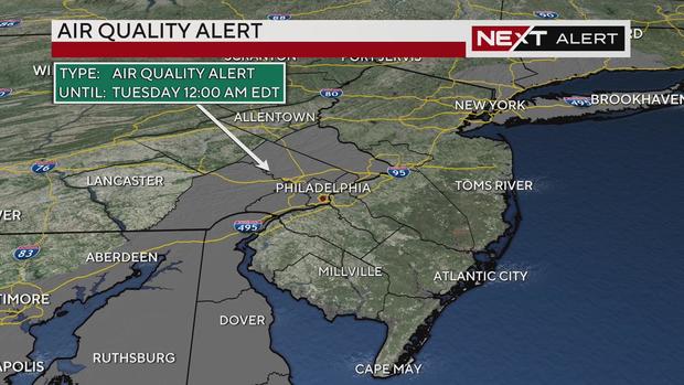
An air quality alert was also issued for Philadelphia and counties west of the 95 corridor until midnight Tuesday.
The Philadelphia Health Department has declared a Heat Health Emergency until Wednesday night. The city is rolling out several safety measures, including opening over 150 cooling centers daily for anyone in need.
In addition, we'll be watching for pop-up showers and storms again, mainly this afternoon and early evening. At this point, the area is under a marginal risk for severe weather, or a level 1 out of 5, which means isolated strong to severe storms are possible. If any storms reach that criteria it will mainly be for damaging winds.
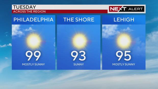
Extreme heat Tuesday
Tuesday will likely be the hottest day of the heat wave, when the air temperature may get to 100.
While not a record for the date (102 degrees set in 1998), it would be the first triple-digit day since 2012. Whether 98 or 99, the heat index will likely be 106-110 during peak heating of the day in the afternoon, so take it seriously.
Check on neighbors, wear loose-fitting, light-colored clothing, and try to limit outdoor activities. Pop-up storms will, once again, impact parts of our area, helping to relieve the heat wherever the rain falls.
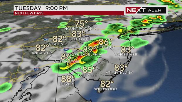
Wednesday will be hot and humid, but more stormy activity may be stronger as a cold front moves through the area. For this reason, we've issued Next Weather Alert days for Monday, Tuesday and Wednesday.
If you've been thinking the summer has been hotter than you remember, you may be right. As of Sunday, the Philadelphia area has had 20 days with a high of 90 or greater, the most to date since 2012.
Stay with the Next Weather Alert Team for the latest on the heat and the storms.
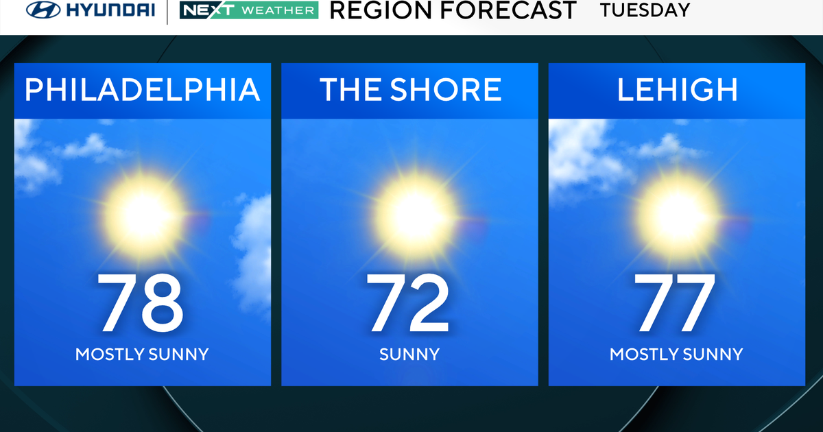
7-day forecast
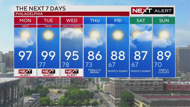
Monday: High of 97, NEXT Weather Alert Day
Tuesday: High of 99, low of 77, NEXT Weather Alert Day
Wednesday: High of 95, low of 78, NEXT Weather Alert Day
Thursday: High of 86, low of 73, finally a break from intense heat
Friday: High of 88, low of 67, mostly sunny
Saturday: High of 87, low of 67, mostly sunny
Sunday: High of 89, low of 70, partly cloudy