Storms clear in Philadelphia, more seasonable temps and low humidity heading into the weekend

PHILADELPHIA (CBS) — Showers and storms packed a punch late Wednesday evening, with frequent lightning, gusty winds and flash flooding for some areas. Now that the cold front has passed through, expect gradual clearing Thursday, with a return to sunshine and most importantly, seasonable temperatures.
Thursday afternoon should bring us partly cloudy and sunny skies after a few spotty showers in the morning. Highs today will be around 86 in Philadelphia, much more seasonable for this time of the year.
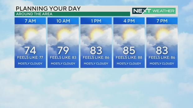
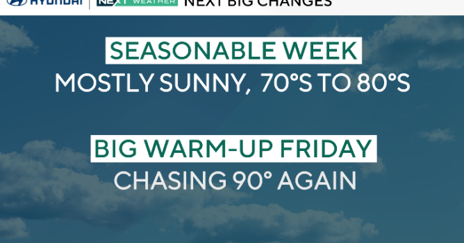
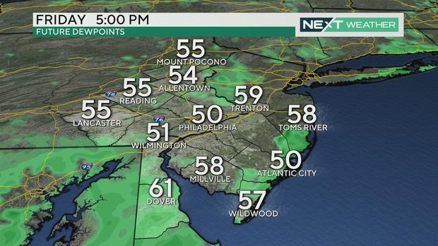
By tonight, low humidity arrives and we'll wake up Friday morning to a comfortable and refreshing air mass. It will still be seasonably hot Friday with highs in the upper 80s, but lower humidity will keep it comfy for outdoor activities.
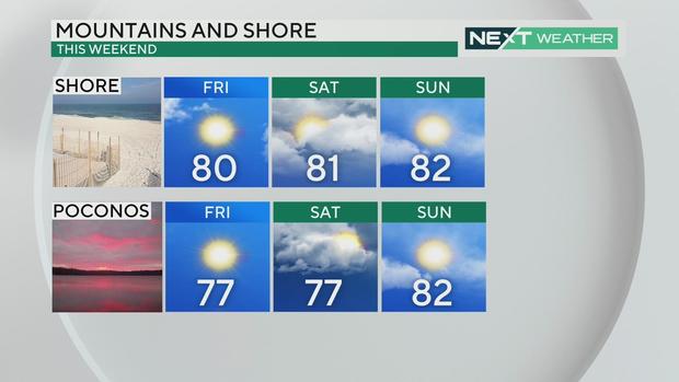
Looking ahead to the weekend
A weak system could bring us a few clouds on Saturday and even a slight chance of an isolated, spotty shower.
Through the weekend and beyond, the temperatures will drop back to seasonably normal levels with only stray summer storms as humidity slightly increases starting Sunday.
Stay with the NEXT Weather Alert Team for the latest updates on the heat and the storms.
7-day forecast
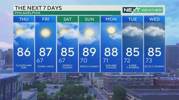
Thursday: High of 86, clouds and sun
Friday: High of 87, low of 67, beautiful day
Saturday: High of 85, low of 67, mostly cloudy
Sunday: High of 89, low of 70, mostly sunny
Monday: High of 88, low of 71, sun and clouds
Tuesday: High of 85, low of 72, a few thunderstorms possible
Wednesday: High of 85, low of 73, scattered thunderstorms