Cloudy Thursday weather, unsettled Labor Day weekend forecast for Philadelphia; rain, but not a washout

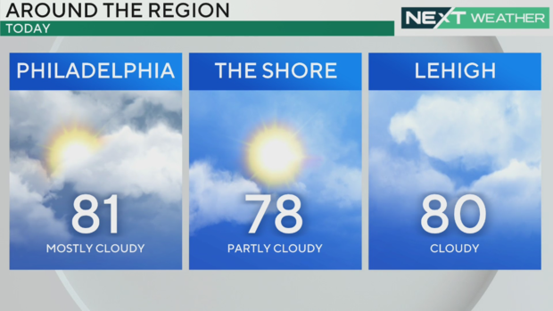
PHILADELPHIA (CBS) -- A cold front pushed south of the Philadelphia area on Thursday morning, which has started to usher in the relief from high heat from Wednesday. The northeasterly flow, however, behind the front will keep a steady stream clouds from off the Atlantic today.
The combination of the northerly winds and marine airmass will keep temperatures in the low 80s for much of the area Thursday, which will be a far cry from the middle 90s that the region experienced Wednesday.
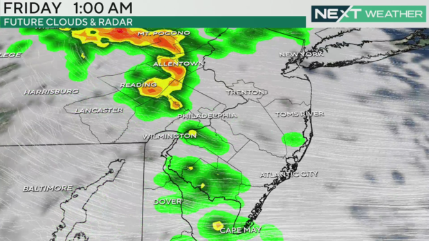
A weak disturbance will approach the area tonight and bring a chance for some scattered showers and even an isolated thunderstorm through early Friday morning. Aside from the chance for rain skies will remain mostly cloudy with overnight lows in the upper 60s.
The rain will clear out early Friday morning, but cloud cover is expected to hang on through a good portion of the day, though a few peaks of sun cannot be ruled out. That said, temperatures will remain cooler than normal for late August with highs in the upper 70s.
Overall, the Labor Day weekend does not look all that bad, but we will have to navigate a couple of cold fronts pegged to sweep through the region. Saturday looks to start off dry with a mix of sun and clouds and high temperatures in the middle 80s.
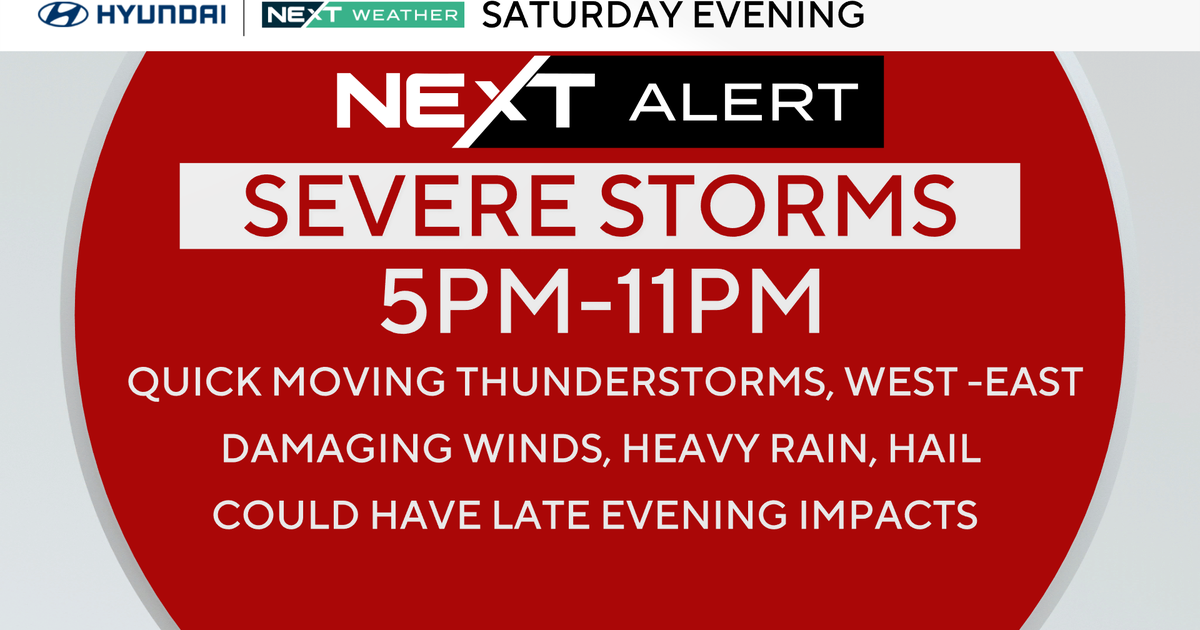
By Saturday evening, showers and storms will be on the move in advance of a primary cold front that will move through the area early Sunday morning.
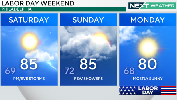
Scattered showers and thunderstorms will be possible Saturday evening into Saturday night ahead of the main cold front. Right now the threat for severe weather looks relatively low, but the NEXT Weather team will continue to monitor the chance for a few stronger storms.
After the initial front moves through, the more widespread showers will taper off through early Sunday, but a mix of clouds will remain through the day Sunday. Sunday's highs will be in the middle 80s once again.
By Sunday night into Monday morning a secondary cold front will sweep through the area and usher in a nice pattern chance that will carry us through the first half of next week. High temperatures for our Labor Day will be around 80 degrees under mostly sunny skies.
Low temperatures will settle into the mid-upper 50s for at least the first half of next week with highs Tuesday and Wednesday in the mid-upper 70s.
Here's your 7-day forecast:
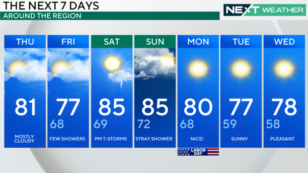
Thursday: Cloudy, some shower chances early. High 81
Friday: Chance of showers. High 77, Low 68
Saturday: PM/evening storms possible. High 85, Low 69
Sunday: A few showers with some sunshine as well. High 85, Low 72
Monday: Mostly sunny! High 80, Low 68
Tuesday: Sunny. High 77, Low 59
Wednesday: Sunny. High 78, Low 58