Philadelphia weather: More storms, flooding possible Tuesday
PHILADELPHIA (CBS) -- Tuesday is another NEXT Weather Alert Day due to the continued impacts of Monday's storms, plus an additional round moving in this afternoon and evening.
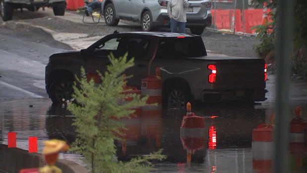
The region awoke to flooding in some spots and a few lingering scattered showers. Flights were delayed at Philadelphia International Airport, multiple SEPTA train routes experienced delays and some buses were detouring due to downed trees or power issues.
In Ridley Township, damaging winds accompanying Monday's strong storms toppled trees.
As we're still recovering from these impacts, we're watching yet another round of storms firing up.
A few severe storms have already fired up this afternoon, west of Philadelphia. More storms are likely to move closer to the city this evening, with the biggest threat being flash flooding.
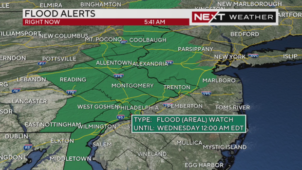
Periods of heavy rain will fall on in areas where the ground is already saturated and into creeks, streams and rivers that are already running high. Much of our region is under a Flood Watch until midnight Tuesday night.
Expect road closures and detours, especially nearby streams and creeks. Water was still on some roads hours after the storms clear out as rainwater continues to run off into the lower laying areas.
In the flash flood zone, if you encounter a flooded road, turn around and find an alternate route -- even if you see cars or trucks going through it ahead of you. It can take less than a foot of fast-moving water to carry away a vehicle. Even if the water doesn't look like it is moving, there could be a current under the water that you can't see.
Remember the saying "turn around, don't drown."
There is a flood watch in effect in Philadelphia through midnight Wednesday, the city's Office of Emergency Management said.
Storms this afternoon and evening will move a bit quicker than the ones that came through yesterday, but there is still plenty of available moisture to work with.
The Storm Prediction Center has placed the entire area in a "Marginal" risk for severe storms for today, which is a 1 on a scale of 0-5.
As far as timing goes, expect storms to move into the city between 3 p.m. and 5 p.m., and the Jersey Shore between 6 p.m. and 8 p.m.
High temperatures will reach 81 degrees in Philadelphia and the mid-70s around the Jersey Shore and Lehigh Valley.
Stay with the NEXT Weather team for updates on this storm.
