Wednesday starts another wave of hot weather around Philadelphia after morning rain clears out
PHILADELPHIA (CBS) -- We're seeing some batches of showers to kick off Wednesday, with no parts of our region free of a little light rain in the early morning hours.
The showers and clouds will clear out and give way to sunshine in the afternoon. We could see some spotty thundershowers in the evening, but nothing major. Otherwise, it's just a hot day.
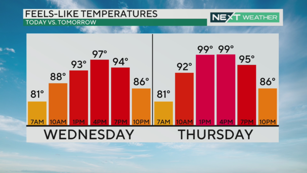
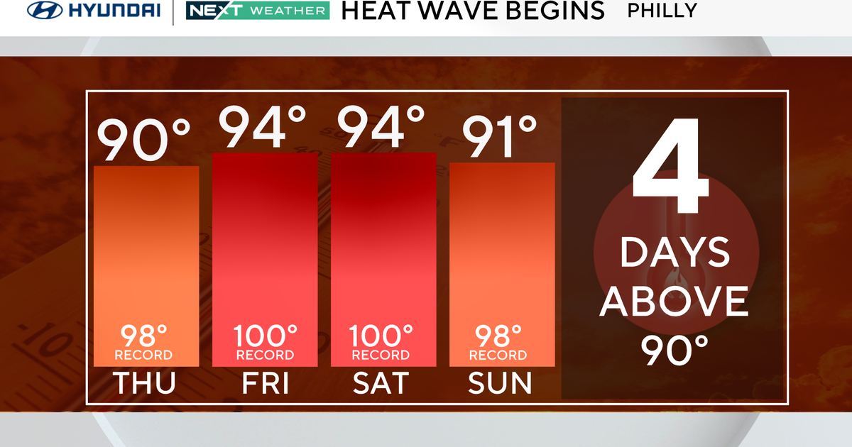
Our fourth heat wave of the year will begin on Wednesday with the high expected to reach 90 degrees. In the hottest part of the day Wednesday afternoon, the humidity will make it feel like 97 degrees.
Thursday and Friday will be even hotter.
Even though this looks to be a rather low-end heat wave — the normal high is 87, so highs in the low 90s aren't far from normal — the humidity may make Thursday and Friday feel near 100.
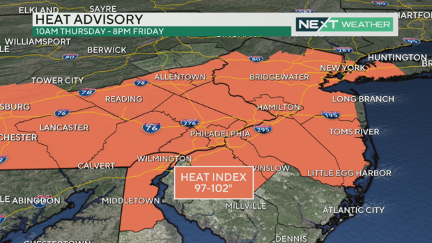
A heat advisory will be in effect from 10 a.m. Thursday to 8 p.m. Friday due to the heat index likely exceeding 100 degrees. The advisory is in effect for Philadelphia and other counties in the I-95 corridor, as well as the Lehigh Valley, Berks County and Lancaster County.
Into the weekend, it will stay very muggy. There will be clouds and some scattered chances of storms. Any storms that do form will have plenty of moisture to tap into, and they could bring potentially heavy rain.
It's looking like a very damp weekend, though there will be some moments of sunshine.
Wildfire smoke could affect Philadelphia area sunrise, sunset
You have probably heard about the giant wildfires across California, Oregon and Canada. Hundreds of thousands of acres have burned destroying homes, towns, state and federal forests. Sadly, the largest fire in California, the Park Fire in Chico, California, was caused by arson.
The Park Fire is almost three times the size of Philadelphia and remains out of control as of Tuesday night. Smoke from the Park Fire is so thick that it is visible on satellite imagery and we may see signs of the smoke all the way in the Philly area -- thousands of miles away.
While it will not be like last summer with thick, dense smoke at the surface, watch for a "milky" sun and darker colors around sunrise and sunset. Smoke in the atmosphere scatters more light waves, so we end up seeing only the longer waves -- the reds and oranges.
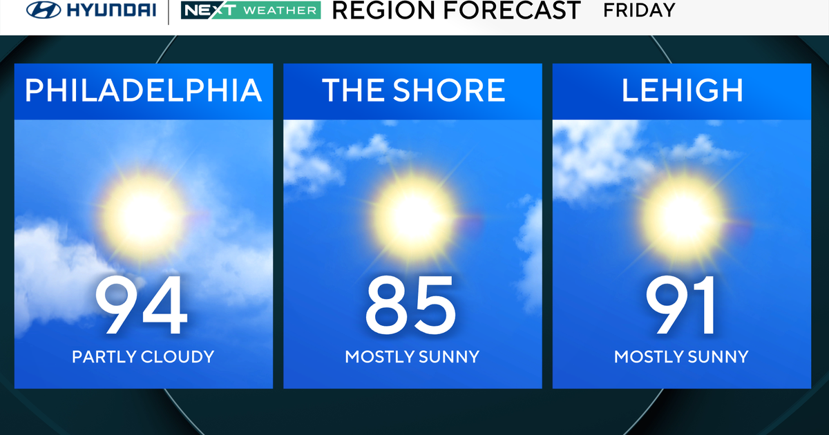
Here's your 7-day forecast:
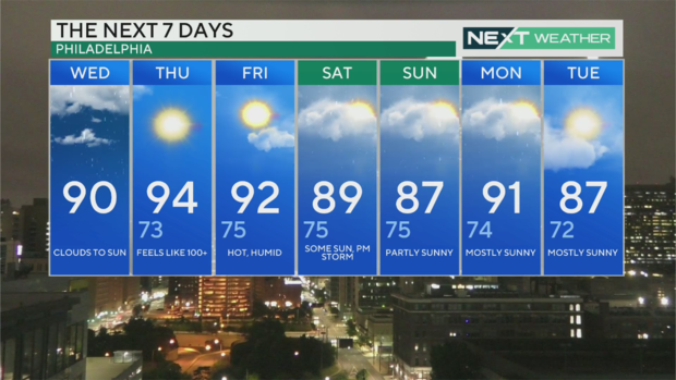
Wednesday: High of 90, clouds give way to sun
Thursday: High of 94, low of 73. Feels like 100.
Friday: High of 92, low of 75. Hot and humid
Saturday: High of 89, low of 75. Some sun, then PM storms
Sunday: High of 87, low of 75. Partly sunny
Monday: High of 91, low of 74. Storms and sunshine.
Tuesday: High of 87, low of 72. Mostly sunny.
Get the latest weather info on the CBS News Philadelphia app