Sunny and warm Sunday in Philadelphia, chance for some showers and stormy weather Monday
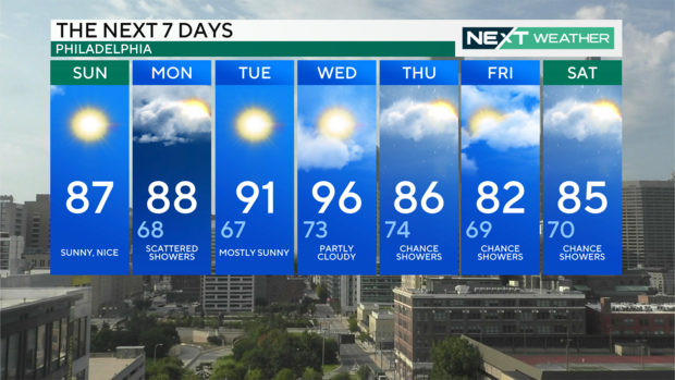
PHILADELPHIA (CBS) -- Today will be a great end to the last full weekend of August. After some early morning clouds there will be plenty of sunshine with a light southwest wind. Highs will be a few degrees above average in the upper 80s with low humidity.
Tomorrow is the first day of school for many children across the Delaware Valley, and it will be a mild start to the day with temperatures in the mid to upper 60s at 7 a.m.
They'll need to dress for a warm day in the upper 80s, under a mix of clouds and sun. There is a threat of scattered showers mainly in the afternoon. Much of the area will remain dry.
On Tuesday and Wednesday, summer-like warmth appears once again with highs in the low to mid 90s with higher humidity and a heat index feeling like the mid to upper 90s. Tuesday will be dry and sunny, but clouds increase on Wednesday with a chance of scattered showers.
Temperatures drop back to the mid-80s Thursday with increasing shower and storm chances each day through Saturday, the start of Labor Day weekend.
Labor Day Weekend forecast
This has been a rare dry weekend for Philadelphia, just the 3rd dry weekend of the 13 weekends since Memorial Day. That means only 23% of our weekends have been dry and 77% have had rain. Looking ahead to Labor Day Weekend, there is a chance of scattered showers and storms both Saturday and Sunday.
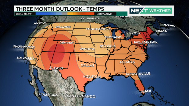
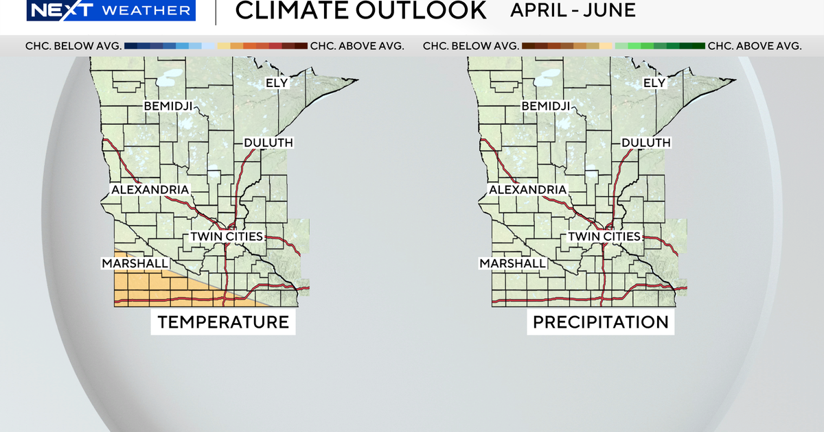
The September 1-7 outlook for temperatures, from the Climate Prediction Center, has us in a near normal pattern for one of the few times this summer. However, for the next three months the trend is warmer than normal. For precipitation, we are trending slightly higher than normal over the next three months.
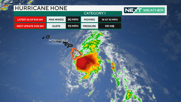
Hone now a Category 1 hurricane
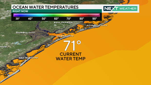
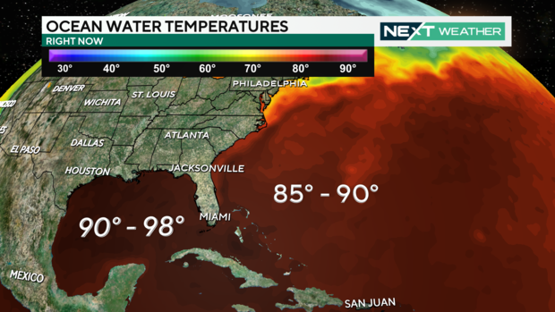
Ocean temperatures off the Jersey Shore and Delaware Beaches are in the low 70s. Those sea surface temperatures increase to the 90s off the southeastern U.S., the Caribbean and the Gulf of Mexico. These are the 2nd warmest Atlantic basin water temperatures since records began.
This extremely warm water is the fuel for hurricanes to strengthen rapidly. Currently the Atlantic is quiet with no developing storms, but we are just approaching the peak of Hurricane season and storms are expected to develop more frequently now through October.
In the Pacific basin, two named storms are churning away. Hurricane Gilma is a Category 4 storm with 130 mph winds in the eastern Pacific and Hurricane Hone is a Category 1 storm with 75 mph winds passing the southern shores of Hawaii's Big Island, producing large waves, high surf and heavy rain.
7-day forecast
Sunday: High of 87, mostly sunny
Monday: High of 88, low of 68, a few showers
Tuesday: High of 90, low of 67, turning sunny
Wednesday: High of 94, low of 73, hot and humid
Thursday: High of 85, low of 73, cooling off
Friday: High of 80, low of 68, seasonable
Saturday: High of 83, low of 69, scattered storms
