Sunny with highs in the low 80s around Philadelphia Monday, northern lights could be visible again tonight


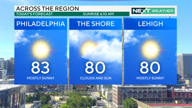
PHILADELPHIA (CBS) — Today will be an extension of our beautiful weekend with mostly sunny skies and comfortable temperatures in the low 80s in the Philadelphia region.
A disturbance to the north over Canada will trigger some fair weather clouds this afternoon. There may even be an isolated instability shower or sprinkle although the odds are low because the atmosphere overhead is very dry with limited moisture.
The remainder of our week will be mainly dry and sunny, with isolated shower chances each afternoon. High temperatures will remain in the 80s, climbing to the upper 80s by the end of the week. Overnight, our low temperatures will be refreshing, with 50s and 60s across the region — perfect sleeping weather!
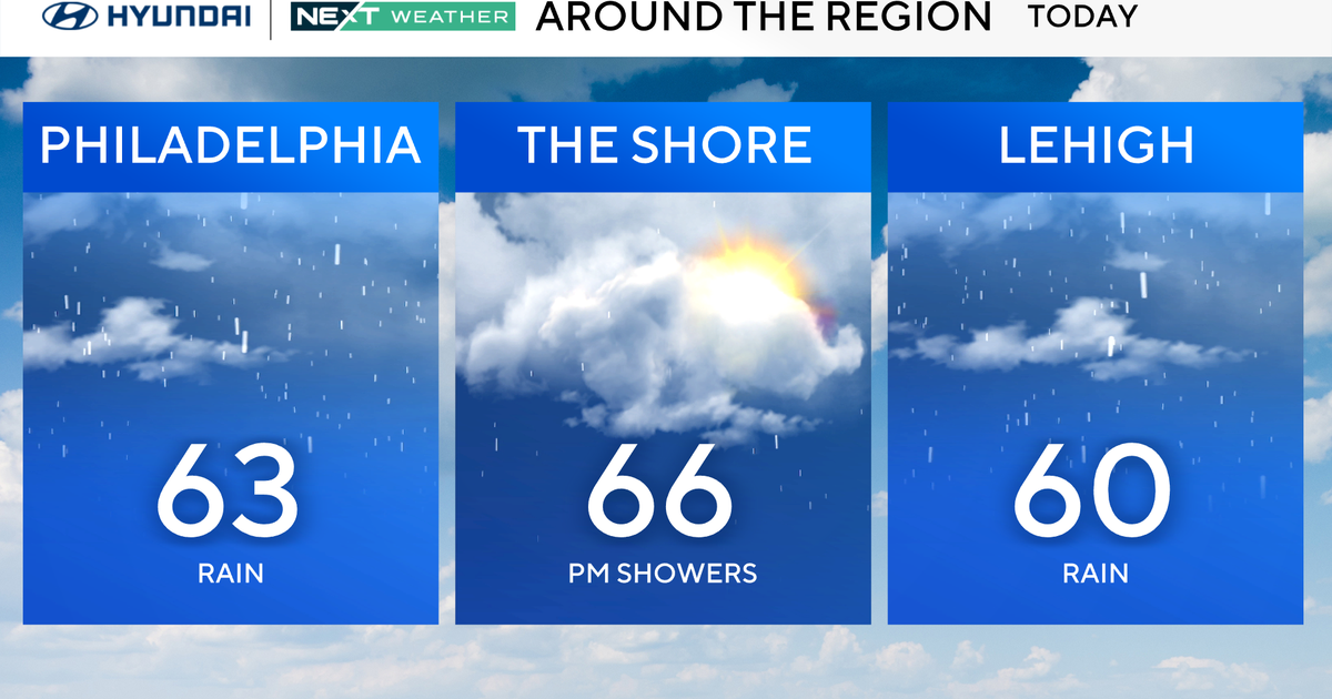
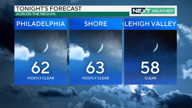
Tonight across the region, temps will dip to 62 degrees in the city, 63 down the shore and 58 in the Lehigh Valley.
The next chance for organized rain and thunderstorms is next weekend.
Sunsets may be a bit more colorful this week due to smoke from the Canadian and California wildfires. The smoke will be high in the atmosphere, but nothing like the dangerous air quality we faced last year.
Our slightly cooler-than-normal pattern is expected to continue for the next 10 days.
Turning to the tropics, possible Tropical Cyclone Five" is located east of the Lesser Antilles Islands and is expected to strengthen into a tropical storm "Ernesto" sometime on Tuesday. It will be the fifth-named storm of the season, and it is expected to strengthen into a strong hurricane.
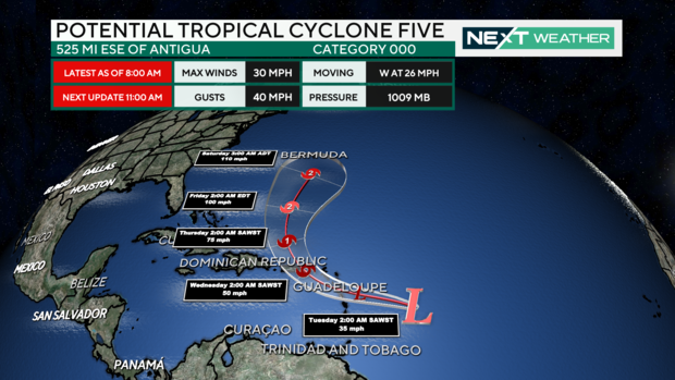
The National Hurricane Center's current track crosses the Virgin Islands and Puerto Rico before curving north and east toward Bermuda, keeping the storm away from the United States.
Although the skies will be clear tonight, the Perseid Meteor Showers and the Northern Lights will be less visible than last night. The Perseids are considered one of the best meteor showers of the year, and they peaked last night with 50-100 meteors per hour.
If visible tonight, look to the northeast horizon between 11 p.m. and 3 a.m. The Perseid meteor showers are the result of Earth passing through the debris trail of a comet.
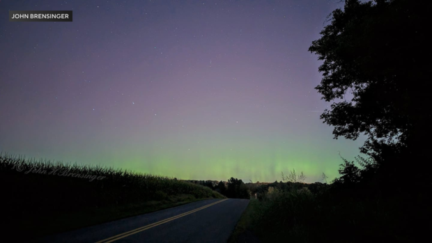
As for the Northern Lights, last night, there was a moderate to strong geomagnetic storm, and with clear skies, much of the northern U.S. was able to see the brilliant colors on the horizon. There will be a lower chance tonight as the viewing oval has retreated farther north, but if you are determined, the best viewing chance will be from 11 p.m. to 3 a.m. ET, away from city lights, and looking to the northern horizon.
If you missed either heavenly show, don't fret. There will be more chances for Northern Lights this year during what has become a busy solar cycle, and the Perseid Meteor Showers will return again next August.
7-day forecast
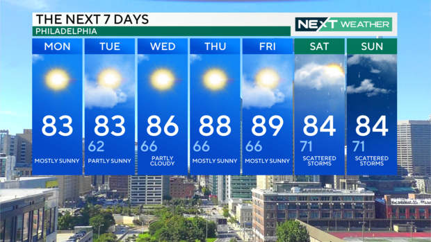
Monday: High of 83, mostly sunny
Tuesday: High of 83, low of 62, partly sunny
Wednesday: High of 86, low of 66, partly cloudy
Thursday: High of 88, low of 66, mostly sunny
Friday: High of 89, low of 66, mostly sunny
Saturday: High of 84, low of 71, scattered storms
Sunday: High of 84, low of 71, scattered storms