Severe storms in Philadelphia region taper off overnight ahead of beautiful week
PHILADELPHIA (CBS) -- A severe thunderstorm watch ended in the Philadelphia region at 10 p.m. on Sunday, and the severe storms will taper off overnight into Monday.
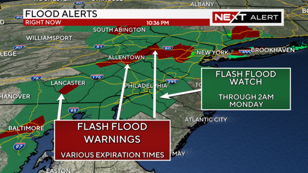
The National Weather Service has issued a flood watch for most of the Philadelphia region until 2 a.m., including parts of Pennsylvania, New Jersey and Delaware.
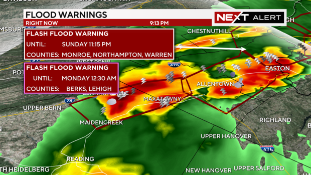
Storms are continuing to fire up mainly in our area's western counties. Due to this, the National Weather Service has issued a few flash flood warnings with the possibility of considerable damage in parts of Berks and Lehigh Counties.
According to our NEXT Weather radar, estimates show about 2-5 inches of rain has fallen per hour in parts of Lehigh and Berks counties.
A flash flood warning is in effect until 12:30 a.m. for Berks and Lehigh counties.
The Philadelphia region wasn't the only part of the country dealing with severe weather Sunday. Sunday's risk of severe weather encompasses a large portion of the eastern U.S. It actually forms a large smile shape extending from Philadelphia to the deep south and back up to the Midwest. This smile area is where a strong cold front and trough will drop through today and tonight, triggering the severe storms.
Travel impacts
The weather forced Amtrak Northeast to temporarily suspend service between New York Penn Station and Philadelphia's 30th Street Station due to flooding in the Newark area, but that has since been lifted. But Amtrak said delays could be as long as 30-90 minutes.
According to the NJ Transit website, the Newark Light Rail Service has resumed in both directions but they could also see delays up to 90 minutes.
Latest on Tropical Storm Ernesto
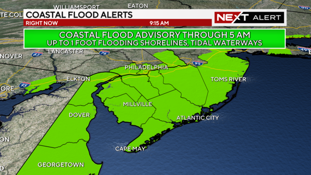
There is also a Coastal Flood Advisory in effect through 5 a.m. Monday during the high tides for areas along the Delaware River, back bays and tidal waterways. Up to 1 foot of water inundation is possible with minor flooding expected.
Remember to use caution if driving during heavy rain. Do not risk driving through flooded roads, as it only takes a few inches of water to stall your vehicle, and a few inches more could float the entire thing. Remember, "turn around and don't drown."
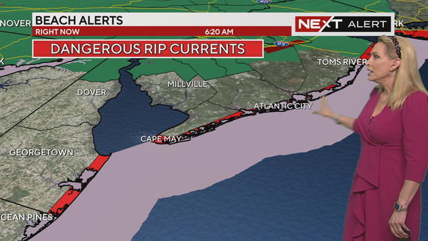
Speaking of the coast, beach conditions will be dangerous along all of the Jersey Shore and Delaware beaches through early Monday. The rip current risk is very high with high surf and nearshore waves reaching 5-10 feet. It's best to avoid swimming at the shore. Lifeguards are prepared to restrict swimmers to waist-deep water or close the beaches to swimming altogether.
The high surf and rip current threat are being caused by Tropical Storm Ernesto. The storm is nearly 700 miles offshore but as it heads north in the Atlantic, the giant swells it produces will reach the east coast, creating dangerous conditions.
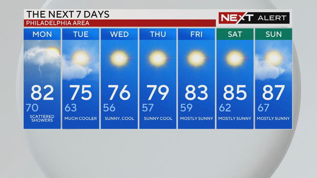
Monday will be our weather transition day. Scattered showers are possible in the afternoon with highs in the low 80s.
By Tuesday a touch of fall arrives with sunshine and highs in the low to mid-70s with overnight lows in the 50s.
7-day forecast
Monday: High of 82, low of 70, scattered showers
Tuesday: High of 75, low of 63, much cooler
Wednesday: High of 76, low of 56, sunny and cool
Thursday: High of 79, low of 57, sunny and cool
Friday: High of 83, low of 59, mostly sunny
Saturday: High of 85, low of 62, mostly sunny
Sunday: High of 87, low of 67, mostly sunny
