Philadelphia under excessive heat warning through Wednesday; air quality alert in effect Monday

PHILADELPHIA (CBS) -- The searing heat is back again, with highs today approaching the mid and upper 90s.
Add in humidity, and many areas across the Delaware Valley will feel like 98-102°.
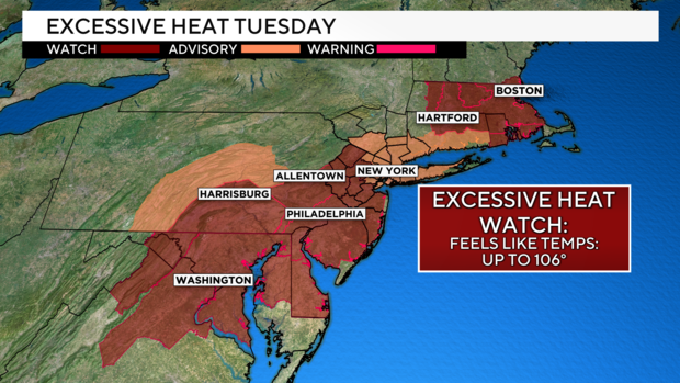
The National Weather Service issued an excessive heat warning from 3 p.m. Sunday through Wednesday morning. As of now, Wednesday remains under an excessive heat watch.
While a few afternoon pop-up storms cannot be ruled out, we're likely to see them stay below severe weather criteria. Lightning will be the main threat, so if you're outside, make sure to head in at first sight.
With added humidity, it could easily feel in the low 100s on Monday and 105 to 110 degrees on Tuesday and Wednesday. For this reason, we've issued Next Weather Alert days for all three days.
Watches and warnings
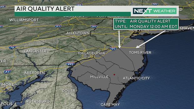
An air quality alert is in effect for all of Central and South Jersey until 12 a.m. Monday. The Air Quality Partnership and the Philadelphia Department of Public Health issued an air quality alert: Code Orange Ozone Action Day for Monday.
The Health Department said that during Air Quality Action Days, people should protect their health by limiting strenuous outdoor activities.
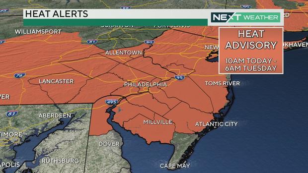
A heat advisory will cover the entire Philadelphia region and Delaware Valley from 10 a.m. Sunday until 6 a.m. Tuesday. Feels-like temperatures during that time will be anywhere between 98 and 102 degrees.
Then on Tuesday morning, an excessive heat watch will go into effect for the region until Wednesday night. During that time, temperatures could feel as high as 104 to 106.
Another, but shorter, heat wave
The next heat wave shouldn't be quite as long, with another brief cooldown expected on Thursday following another cold front on Wednesday.
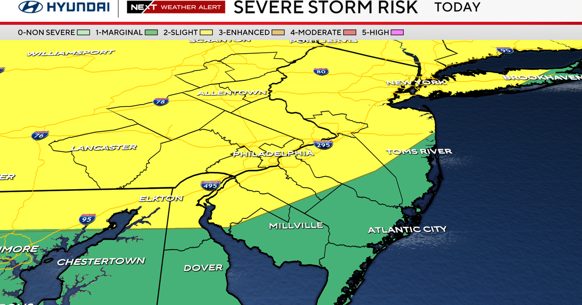
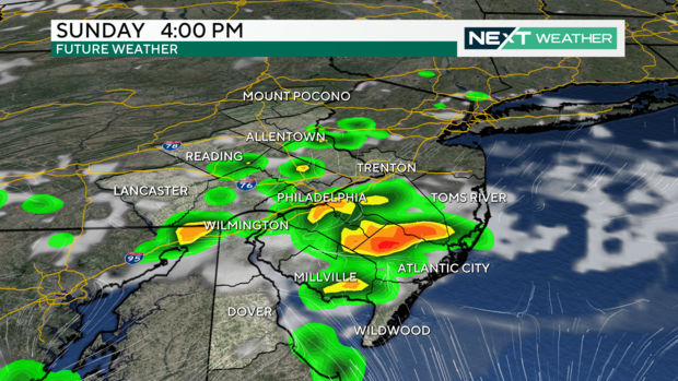
We're watching for a few scattered strong to severe storms Wednesday along the cold front, which will help to keep us cooler as well into the end of the week and into the weekend.
Stay with the Next Weather alert Team for the latest updates on the heat and the storms.
7-day forecast
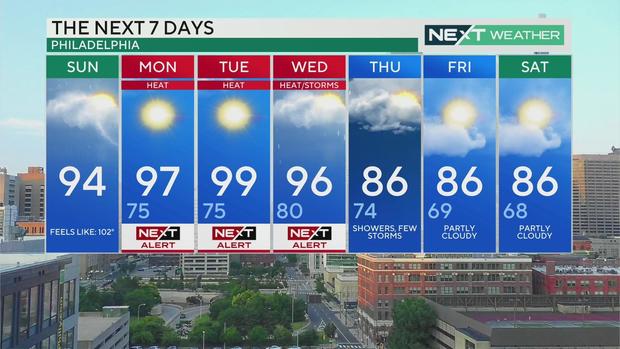
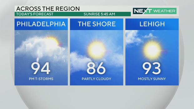
Sunday: High of 94, feels like 102
Monday: High of 97, low of 75, NEXT Weather Alert
Tuesday: High of 99, low o 75, NEXT Weather Alert
Wednesday: High of 96, low of 80, NEXT Weather Alert
Thursday: High of 86, low of 74, showers and a few storms
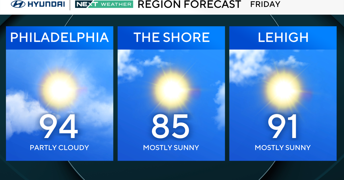
Friday: High of 86, low of 69, partly cloudy
Saturday: High of 86, low of 68, partly cloudy