Tracking showers, storms in Philadelphia region on 4th of July
PHILADELPHIA (CBS) -- After a few gorgeous days, things change on the Fourth of July in the Philadelphia region as showers and storms could develop, mainly during the afternoon and evening.
While Thursday is no washout, you'll need to stay tuned to the forecast throughout the day and keep your eyes on the sky as lightning will be a threat.
Remember, if you hear thunder, you are close enough to be struck by lightning. Make sure you are indoors if thunder roars.
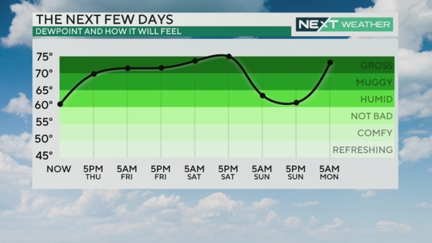
The heat and humidity will also be ramping up, so get ready to sweat.
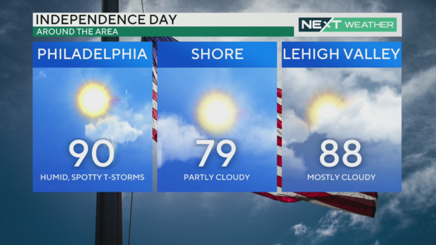
Temperatures will reach a high of 90 degrees in Philadelphia and 88 in the Lehigh Valley, with cooler temps at the Jersey Shore. With the humidity, wherever you are will feel a few degrees warmer.
We're expecting the temperature will be 82 degres for the Fourth of July parade down Market Street in Philadelphia. It will be dry but humid with a mix of clouds and sun.
Potential for storms interrupting fireworks around Philadelphia area
With sunset set for 8:33 p.m., most fireworks shows in our area are going off sometime in the 9 p.m. hour, when there still could be some lingering showers, but there's still a chance we could stay dry.
As of now, the greatest likelihood for storms is in the evening but looking like we may clear out around the city in time for fireworks displays.
4th of July kicks off unsettled holiday weekend
The pattern of heat, humidity and afternoon storms will continue through the holiday weekend with highs in the low 90s, morning lows in the 70s and shower or storm chances each day.
A heat advisory has been issued for Friday, July 5 due to potential heat index values as high as 103. Take all the necessary heat-related precautions and stay in the air conditioning whenever possible. We may need another Heat Advisory for Saturday.
As of now, it looks as though Saturday may be the most active. Storm chances look isolated but where they do pop up, they could be heavy, with plenty of moisture to work with. The best chancefor storms is across Delaware and South Jersey.
Behind that line of storms we'll feel a slight reduction in the humidity on Sunday, but it's still hot.
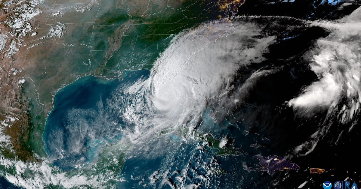
In the tropics, Hurricane Beryl remains a dangerous hurricane, heading toward the Yucatán Peninsula by Friday morning and eventually toward southern Texas by Monday. While it will be much weaker, it could bring flooding rains to an area recently impacted by Alberto.
Keep it close to CBS Philadelphia as we continue to monitor the tropics and forecast for the upcoming holiday and holiday weekend!
Here's your 7-day forecast:
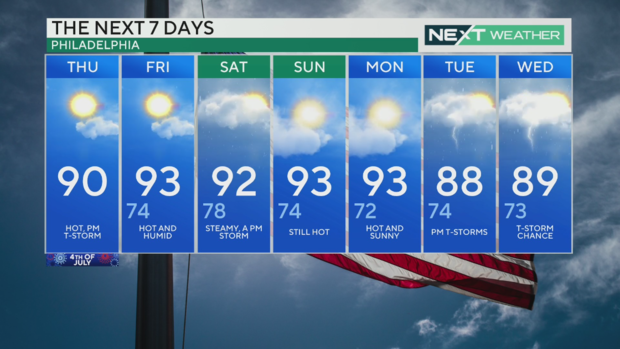
Thursday: High of 90, low of 69, steamy, thunderstorm
Friday: High of 93, low of 74, hot, isolated storm
Saturday: High of 92, low of 78, storms likely
Sunday: High of 93, low of 74, partly sunny
Monday: High of 93, low of 72, some sun, a storm
Tuesday: High of 88, low of 74, p.m. t-storm
Wednesday: High of 89, low of 73, a few storms