Winds die down Thursday in Philadelphia region, tracking cold weather to start February
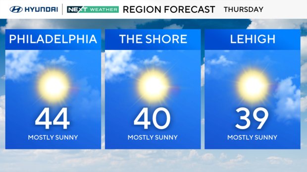
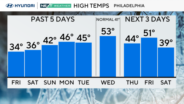
After a windy day Wednesday, the winds of change will knock us back to the low 40s for highs on Thursday.
The winds will not be nearly as strong. In fact, it turns out to be a pretty nice day and a rose between two thorns, so to speak.
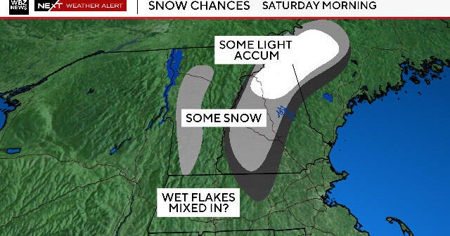
Thursday night clouds will increase ahead of a storm system that will bring scattered areas of rain to the area during the day Friday and may linger into the early hours of Saturday. This could start as some freezing rain in the Poconos Friday morning depending on arrival time and then may end as a brief mix to the far north. Highs will likely be back into the 30s on Saturday and 40s on Sunday, but at this point, the weekend is trending dry.
We are going to then warm up briefly on Monday — maybe making a run at the upper 50s — before another shot of cold air arrives.
February is still very much winter, and while there is no snow in the immediate forecast, our average snowfall in Philadelphia is 8.4 inches, our snowiest month!
We'll get more, and the NEXT Weather Team will keep you well ahead of it!
7-day NEXT Weather forecast:
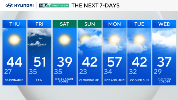
Thursday: Seasonable. High 44, Low 27.
Friday: Rain. High 51, Low 35.
Saturday: Chilly start to February. High 39, Low 35.
Sunday: Clouding up. High 42, Low 23.
Monday: Nice and mild! High 57, Low 34.
Tuesday: Cooler, sun. High 42, Low 32.
Wednesday: Turning colder. High 37, low 29.