Sunny and a bit warmer in Philadelphia today, Ernesto to create rough surf at Jersey Shore, Delaware beaches
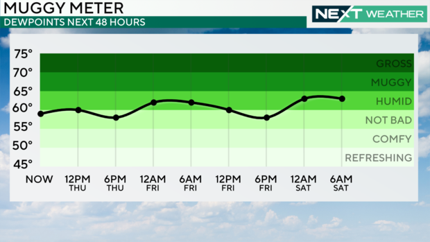
PHILADELPHIA (CBS) — We'll have two more dry, sunny summer days with highs in the upper 80s and humidity remaining comfortable for August. A few high clouds may drift in later Friday. Otherwise, we'll see sunshine on both days.
A sea breeze will develop at the shore and head inland, where it could spark a stray sprinkle this evening but the vast majority of us are dry into the weekend.
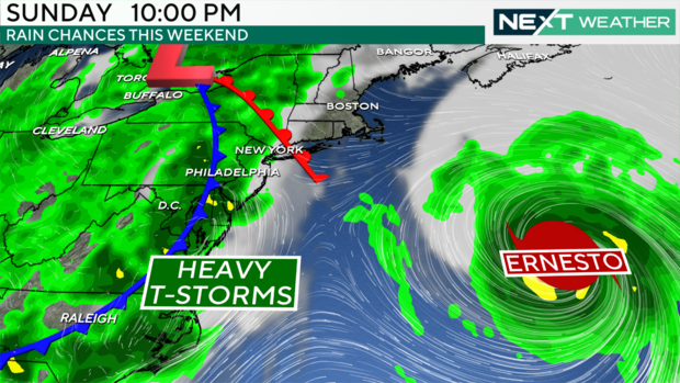
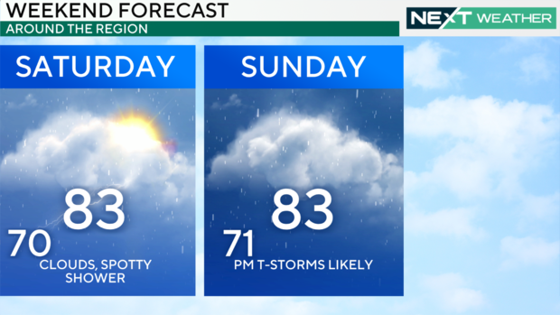
As a slow-moving system approaches Saturday, we'll feel the humidity rise. We'll start the day with a few showers north and west as a warm front tries to lift through. While Saturday isn't looking like a washout, it will be unsettled with more clouds than sun and a few spotty shower chances.
The cold front associated with that system will push through later Sunday into Monday, triggering another round of scattered storms.
With the increase in humidity, some of these may produce heavy downpours, though as of now, the threat of severe weather appears low.
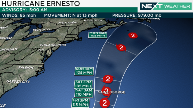
Where is Ernesto?
Ernesto is headed north, and eyes are now on Bermuda as the storm is expected to intensify into a Major Hurricane, possibly making a direct landfall or passing just west of Bermuda by Saturday. After dumping torrential downpours on Puerto Rico, at least two-thirds of homes and businesses in the U.S. territory are without power.
Local impacts will be increased wave heights and rip current threats, most notably Sunday into next week down the Jersey Shore and Delaware beaches.
Stay with the NEXT WEATHER Team to keep you ahead of the next weather-maker.
7-day forecast
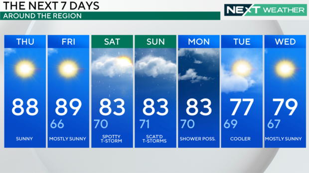
Thursday: High of 88, sunny
Friday: High of 89, low of 66, mostly sunny
Saturday: High of 83, low of 70, spotty thunderstorm
Sunday: High of 83, low of 71, scattered thunderstorms
Monday: High of 83, low of 70, showers possible
Tuesday: High of 77, low of 69, cooler
Wednesday: High of 79, low of 67, mostly sunny