Nor'easter storm weakening quickly after causing flooding, erosion across New Jersey and Delaware


A strong nor'easter that delivered flooding rain, damaging winds and coastal flooding to the Jersey Shore and Delaware beaches on Sunday is now rapidly weakening.
Expect windy and damp conditions to continue through Sunday into Monday morning in the Philadelphia area, but the storm will begin falling apart Sunday night, and nicer weather will soon follow.
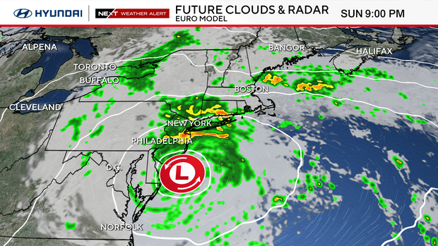
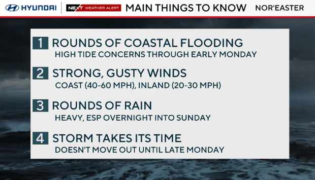
Coastal flooding is still a concern on Sunday night, but less so than earlier in this weekend. The worst of the beach erosion is over.
What to know about nor'easter hitting East Coast
Sunday is the last day of truly nasty weather conditions, and indoor plans would be best as our nor'easter is still hovering directly overhead and will continue to deliver windy and damp conditions as it rotates over the region.
By Sunday night, the winds will diminish below advisory criteria and showers will be less frequent.
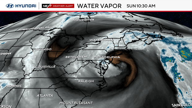
This satellite image of water vapor shows the clear circulation of the storm and the dry air (orange and black) wrapping into our area. Blue and white colors are the wetter air.
This storm has long overstayed its welcome, and after a few parting showers, it's heading north to fizzle out over New England.
A big problem: coastal flooding
Towns all along the New Jersey and Delaware coasts have dealt with coastal flooding and beach erosion from this storm. We've been there as waves crashed over the Atlantic City boardwalk and stormwater flooded major streets in shore points like Sea Isle, Margate and Ocean City.
Data from the National Water Prediction Service shows multiple flood monitoring sites reached major flood stage this weekend during the height of the storm.
In Ocean City, the monitoring site at Great Egg Harbor Bay recorded a high-water mark of 7.6 feet, above the major flood stage of 7.3 feet.
Cape May also saw major flooding on the bay side and the ocean side, data shows.
NEXT big change
Sunshine lovers rejoice! That golden orb in the sky returns Tuesday through the end of the week.
Warmth will also return with temperatures in the 70s Tuesday and low 80s possible Wednesday and Thursday.
October rolls in on Thursday, but it will feel more like late August, with high temperatures in the mid-80s.
Here's your 7-day forecast:
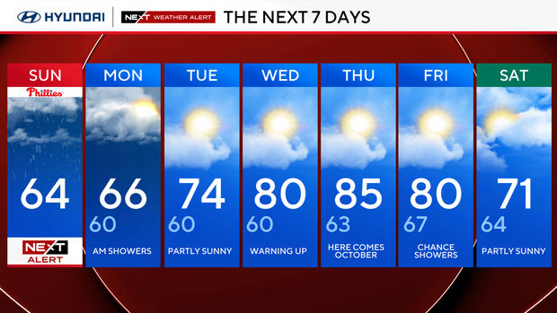
Sunday: NEXT Weather Alert. High 64
Monday: A.m. shower. High 66, Low 60
Tuesday: Partly sunny. High 74, Low 60
Wednesday: Warming up. High 80, Low 60
Thursday: October arrives. High 85, Low 63
Friday: Partly sunny. High 80, Low 67
Saturday: Chance of showers. High 71, Low 64
Get the latest weather info on the CBS News Philadelphia app.


