Hot weather on the way in Philadelphia area after seasonable, sunny Wednesday

PHILADELPHIA (CBS) -- There will be hot weather to end this week in the Philadelphia area and at the Jersey Shore, but it's not as hot as it's going to get.
Think of late this week as the "appetizer" and next week as the "main course", with a prolonged stretch of 90 degree or higher temperatures likely.
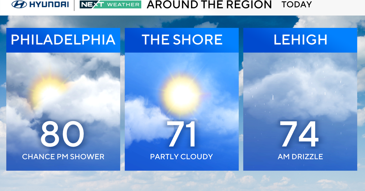
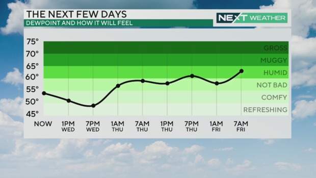
With mostly sunny to partly cloudy skies, enjoy the remainder of your Wednesday, with seasonable highs in the 80s. We'll enjoy a light breeze and relatively comfortable humidity levels.
Clear skies meet us Wednesday night, with lows in the upper 50s and low 60s.
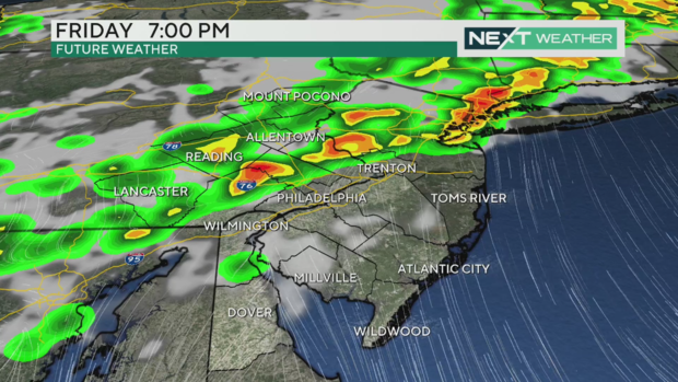
The heat reaches 90 on Thursday and 92 on Friday, with increasing humidity levels along with light south winds. By Friday night though, we're watching a front move closer to the area, sparking off our next chance of showers and possibly severe thunderstorms.
Severe weather risk for thunderstorms Friday, June 14, 2024 around Philadelphia region
Friday is a NEXT Weather Alert Day for the chance of severe weather in the evening.
A line of storms will develop along the front and push east across the Delaware Valley. This should likely reach the city by 8 p.m. or 9 p.m. and then hit the Shore around 10 p.m. or 11 p.m. before clearing out for the weekend.
Some of the storms this front could produce could be severe, and part of our region is under a Level 2 or "slight" risk of severe weather on Friday. Much of the rest of the region is under a Level 1 or "marginal" risk.
The Lehigh Valley as well as Berks, Upper Bucks, Upper Montgomery and the farthest points north in Chester County are included this "slight risk" zone. Philadelphia, Delaware County and South and Central Jersey are in the "marginal risk" zone.
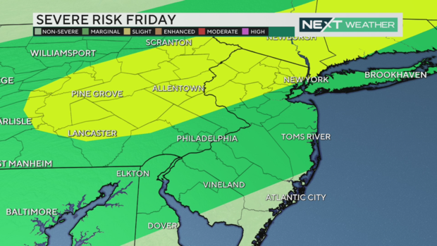
The main risks are heavy rain, minor flash flooding, gusty winds over 50 mph, and potentially small hail. The tornado threat is low.
There is a bright side after these storms move out: the weekend is noticeably cooler, with highs in the 80s for Saturday and Sunday, Father's Day with no precipitation expected.
Enjoy the weekend, because we're back into the low and even middle 90s next week!
Here's your 7-day forecast:
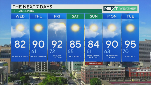
Wednesday: Mostly sunny. high 82
Thursday: Mostly sunny. High 90, Low 61
Friday: Hot with a PM T-storm. High 92, Low 72
Saturday: Not as hot. High 85, Low 65
Sunday: Delightful Father's Day weather. High 84, Low 61
Monday: Heating up again. High 90, Low 63
Tuesday: Very hot. High 95, Low 70