Storms bring high winds, hail, rainy weather today – and more on air quality alert in Philadelphia

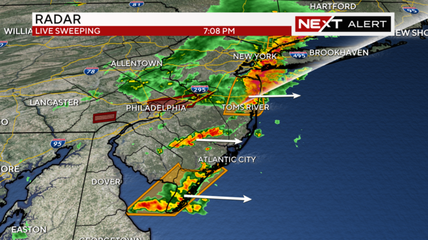
PHILADELPHIA (CBS) -- Severe weather moved through much of the Delaware Valley and covered our area with severe thunderstorm watches and warnings for hours Friday afternoon into the evening.
A flash flood warning for south central Chester County also remains in effect until 9:15 p.m. The National Weather Service also issued a flash flood warning for other parts of Pennsylvania until 10 p.m. including southeastern Bucks County, southeastern Montgomery County and Philadelphia County.
An additional flash flood warning is in effect until 10:45 p.m. for southeastern Mercer County and north central Burlington County in New Jersey.
When rainy weather Pennsylvania arrives: timing out storms today in Lehigh Valley, Poconos, Berks, Bucks and Montgomery counties
Severe weather in the Lehigh Valley earlier Friday is reduced to trailing showers as a cold front sweeps in from the Poconos.
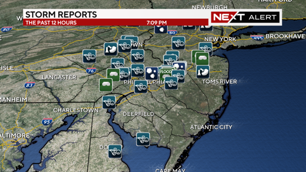
There were over 60 reports of storm reports across our region. The severe weather also brought reports of downed trees, flooding, umbrellas blown across backyards, and hail all across the Delaware Valley.
Our NEXT Weather team reminds drivers to never travel through flooded roadways, and always wait for the water to recede.
Showers and storms will advance east into South Jersey and down the shore as we head into Friday night. The severe weather will likely be done by around 8 to 9 p.m. However a few trailing showers will be possible over the next couple of hours before we really begin to clear and dry out for the weekend.
Air quality alert in effect in Philadelphia, Bucks, Montgomery, Chester and Delaware counties in Pa.
A Code Orange air quality action day is in effect on Friday, June 14, according to the Pennsylvania Department of Environmental Protection.
The DEP says conditions are ripe for "robust ozone development" during the afternoon ahead of today's storms.
"Code Orange" means the air is unhealthy for sensitive groups, including those with preexisting conditions, the elderly, young children and pregnant women. Anyone with breathing problems is recommended to stay inside until the air can clear up.
A Code Orange is level 3 out of 6 on the Air Quality Index.
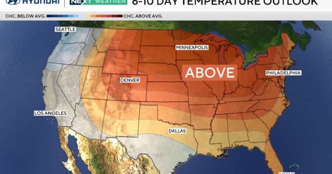
Heatwave on the horizon
After a wet Friday and a relatively pleasant and seasonably warm Father's Day weekend, the heat will be back in business.
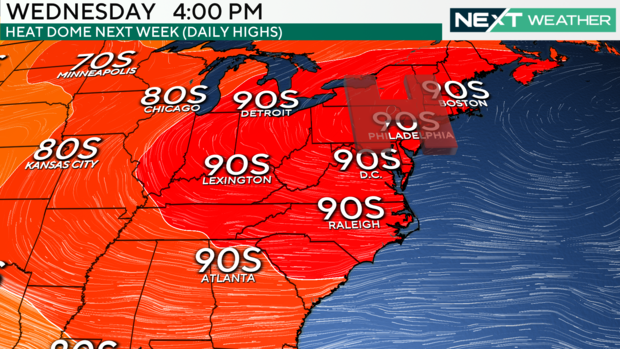
A week-long heat wave is expected to last into next weekend.
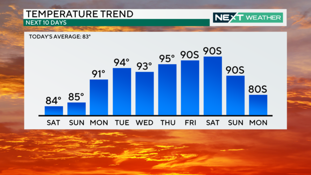
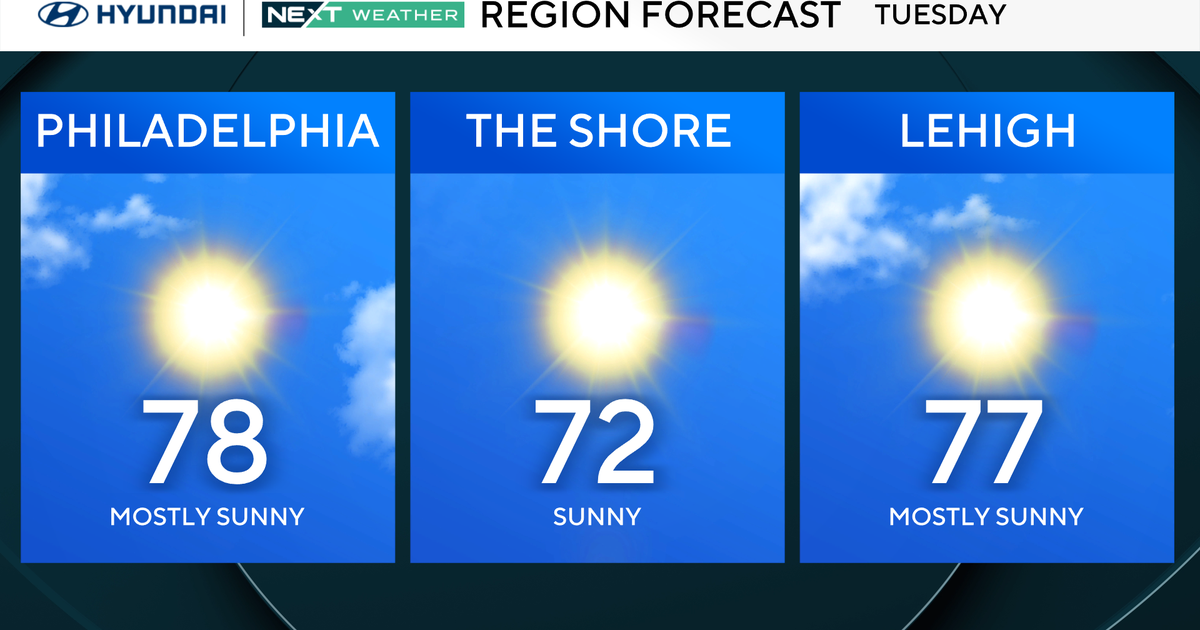
Here's your 7-day forecast:
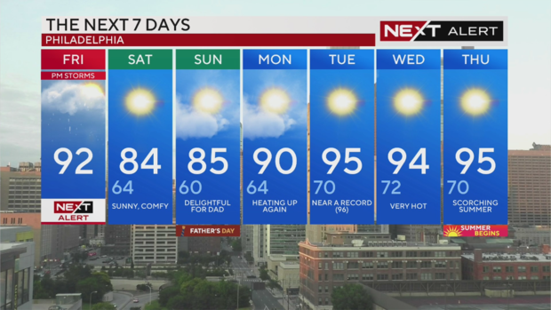
Friday: NEXT Weather Alert Day for PM T-storms. High 92
Saturday: Sunny and less humid. High 84, Low 64
Sunday: Delightful Father's Day weather. High 85, Low 60
Monday: Heating up again. High 90, Low 64
Tuesday: Near-record heat. High 95, Low 70
Wednesday: Very hot. High 94, Low 72
Thursday: Scorching start to summer. High 95, Low 70