Severe storms threaten Philadelphia region with heavy rains, damaging winds. Here's the weather forecast.


Saturday brings a trifecta of hot temperatures, poor air quality and severe storms to the Philadelphia region.
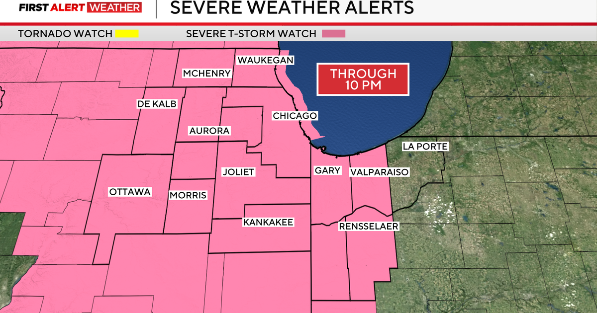
Several severe thunderstorm watches are now in effect across the Pennsylvania and New Jersey. When these storms will impact you depends on where you live.
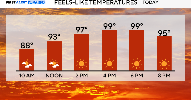
It will likely be the hottest day of this ongoing heat wave, with a high temperature in the mid-90s.
You know the drill: loose-fitting clothes, hydrate, seek shade and air conditioning, and special care for pets.
There will be a tiny bump in humidity with the feels-like temperature a few degrees warmer than the actual air temperature.
Most of our region except for Berks County, the Lehigh Valley and the Poconos are under a Code Orange air quality alert as well, meaning the air is unhealthy for sensitive groups due to high ozone levels.
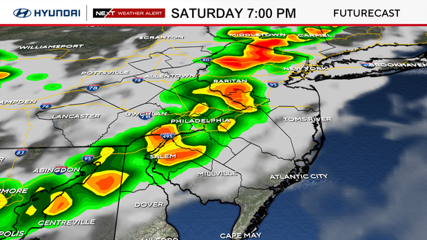
NEXT Weather Alert: storms hitting the Philadelphia region
Saturday evening, gusty scattered storms will develop, and a few of the storms may turn briefly severe with damaging winds and large hail as the main threats.
Any storm could bring downpours and cause wet roads and airport runways, as well as disrupt any evening outdoor plans.
We've issued a NEXT Weather Alert for these storms that will move across our region from west to east, hitting first in the 5 p.m. hour.
Here's a look at the timing:
- 5PM-8PM Lehigh Valley, Berks & Poconos.
- 6PM-9PM Philly and either side of I-95 and Northern Delaware.
- 8PM-11 PM The Shore and Southern Delaware
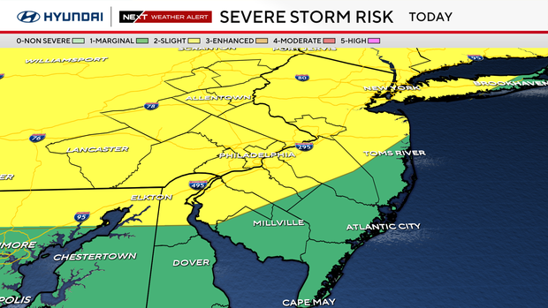
The Storm Prediction Center has most of our area under a "slight" risk of severe weather, level 2 out of 5. Areas closer to the Jersey Shore and in central Delaware are under a "marginal" risk, level 1 out of 5.
These storms could bring strong, damaging winds with gusts between 60 and 75 mph. Quickly-moving thunderstorms may also produce heavy rain and hail.
Sunday, we finish the heat wave with highs near 90 under mostly sunny skies. It will also be breezy.
A cold front passes the area Sunday night ushering in cooler and more seasonable air on Monday with highs near 80 which is normal this time of year.
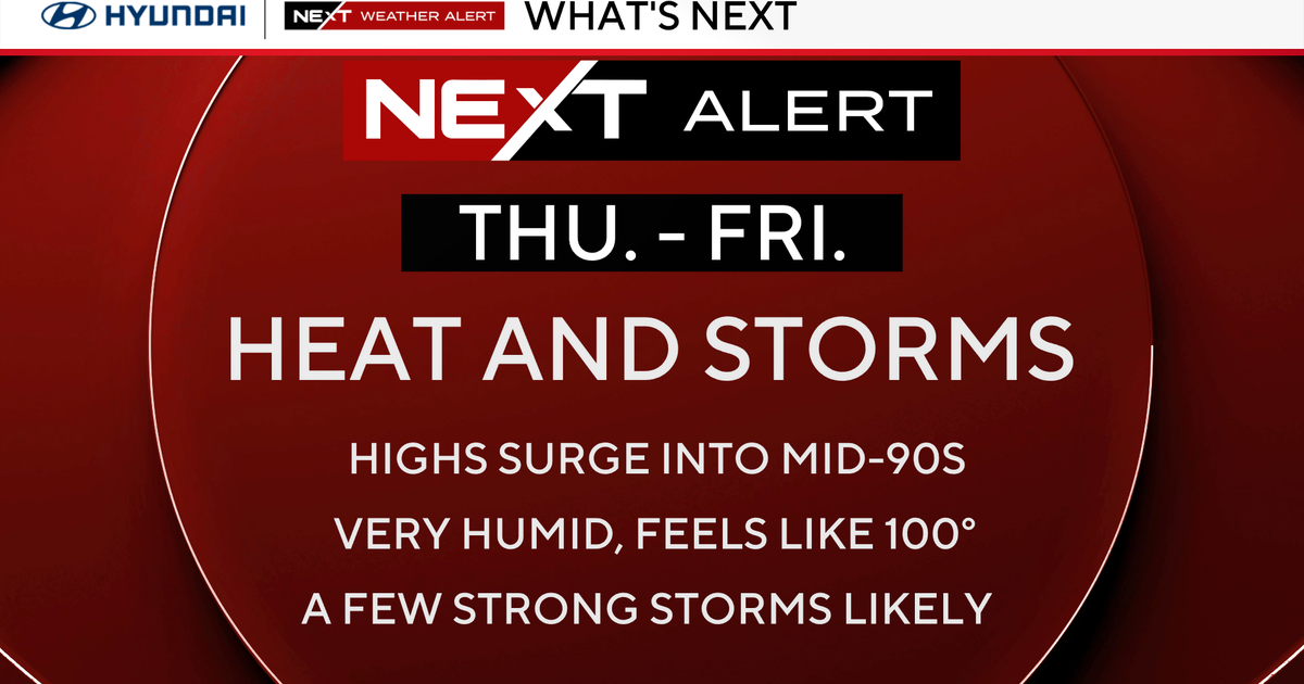
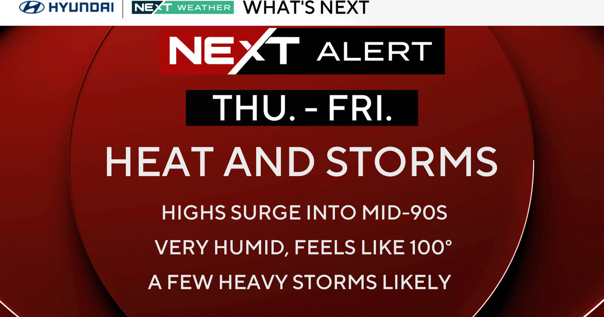
That cooler air won't stick around though; another big warmup begins Thursday and that could be the start of our 3rd heat wave of the year.
FYI: Despite the heat waves, it is still spring! Summer officially begins Sunday, June 21, at 4:24 a.m.
Here's your 7-day forecast:
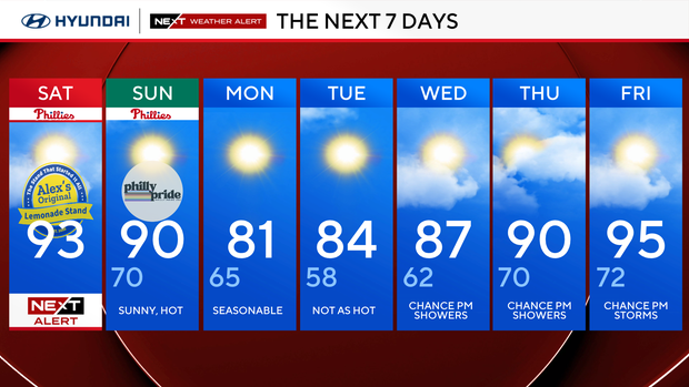
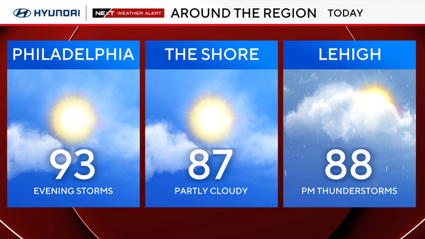
Saturday: Sunny, hot. High 93, low 68.
Sunday: Hot. High 90, low 70.
Monday: Not as hot. High 81, low 65.
Tuesday: Mostly sunny. High 84, low 58.
Wednesday: Warming up. High 87, low 62.
Thursday: Warm and sunny. High 90, low 70.
Friday: Heat returns. High 95, low 72.