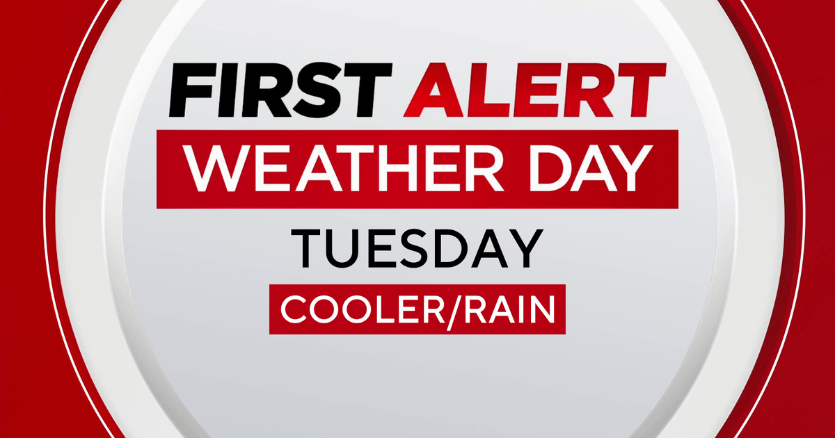
Strong storms move across Philadelphia region overnight; Thursday will be much cooler
PHILADELPHIA (CBS) — After a three-week stretch of weather without a single high temperature at or above 90 degrees, the Philadelphia region hit that temp for the 32nd time this year on Wednesday.
Now, we'll see things cool back down as a cold front pushes through the area, prompting scattered showers and storms around the Delaware Valley.
Some of the storms Wednesday evening into early Thursday morning could become severe, with damaging winds being the primary concern. The strong storms will be moving across the region through 2 a.m. and could bring flooding rain and large hail. The tornado risk is low and isn't likely.
The storms are moving from west to east toward Mercer and Ocean Counties in New Jersey from the Lehigh Valley and Poconos in Pennsylvania.
The threat of severe weather will then weaken as the storms continue to track southeast into Wednesday night.
The storms Wednesday afternoon will be ahead of a cold front that will sweep through the region to usher in more seasonable conditions for the second half of the week.
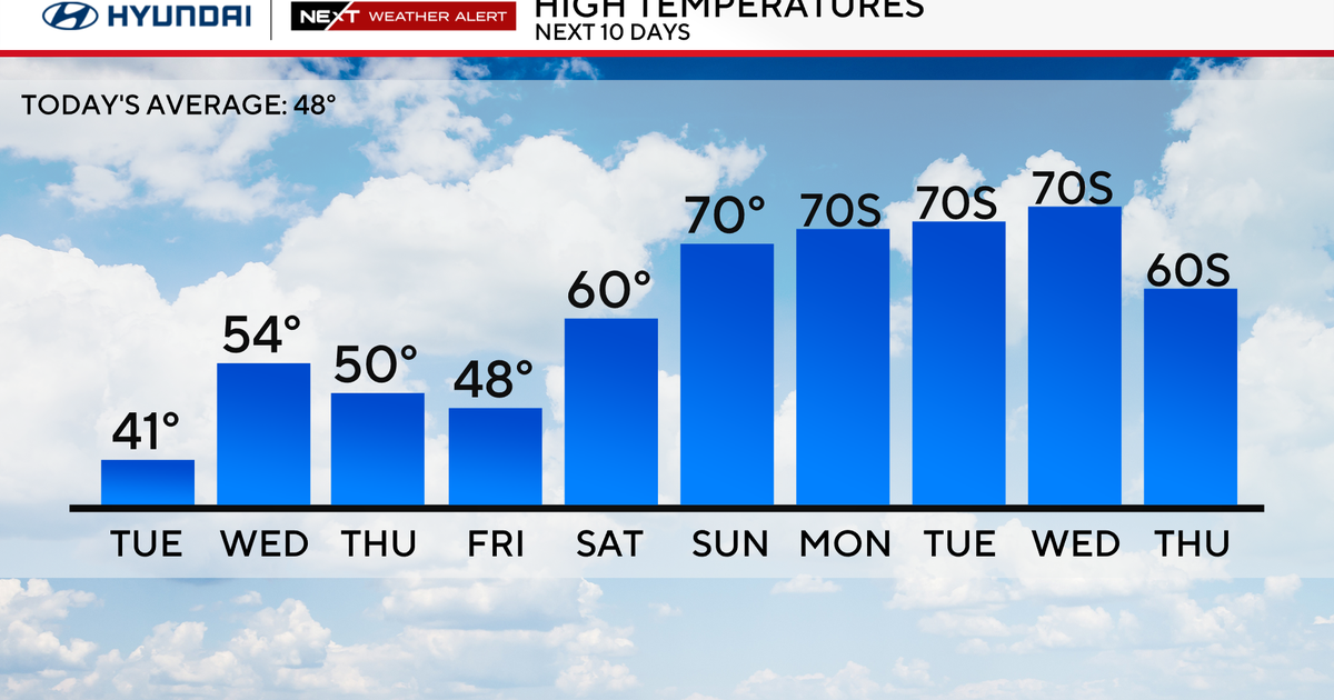
Weather Thursday and Friday and into Labor Day weekend around Philadelphia area
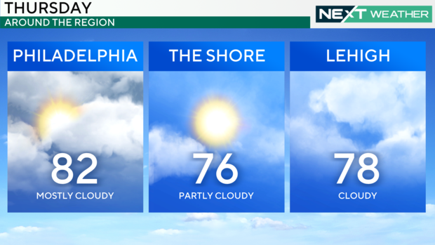
Highs on Thursday and Friday will struggle to get out of the 70s under mostly cloudy skies.
By Saturday, another storm system will bring the chance for scattered showers and storms to the region. These storms will be most likely through the afternoon and may linger overnight Saturday into early Sunday morning.
Your last unofficial day of summer, Labor Day, is looking dry but trending cool, with high temps topping out in the upper 70s.
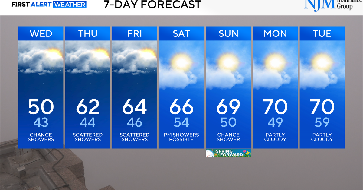
Here's your 7-day forecast:
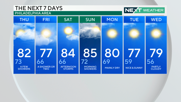
Thursday: High of 82, low of 73, a few showers
Friday: High of 77, low of 63, a shower or two
Saturday: High of 84, low of 66, afternoon storms
Sunday: High of 85, low of 72, morning showers
Monday: High of 80, low of 69, mainly dry
Tuesday: High of 77, low of 59, nice and sunny
Wednesday: High of 79, low of 56, partly cloudy