Remnants of Debby on track to reach Philadelphia on Friday. Here's a look at the latest path.
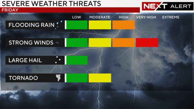
PHILADELPHIA (CBS) -- The remnants of Debby should make the biggest impact on the Philadelphia area Friday afternoon, dropping at least 1-2 inches of rain, with higher totals possible in some spots.
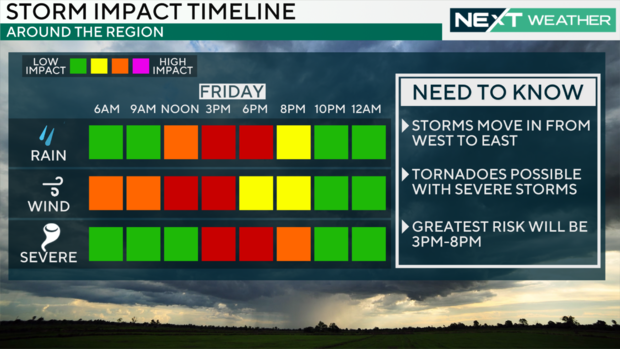
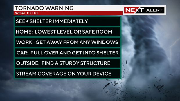
Debby could also bring a risk of isolated tornadoes, mainly during the afternoon and early evening hours. In fact, the Storm Prediction Center has a good portion of the Delaware Valley in a 5% risk. That may not sound like a large number, but it's enough that we could be under a tornado watch as the storm approaches. Get your prepping done early and have a plan before any warnings are issued.
In addition to the severe weather, another round of local flash flooding is also possible. As always, never drive through any flooded roads.
The NEXT Weather team here at CBS Philadelphia has been tracking Debby up the East Coast of the U.S. this week and timing out the storm's arrival in our region. Here's the latest on Debby's path toward Pennsylvania, New Jersey and Delaware.
When will Debby impact Pennsylvania, New Jersey and Delaware?
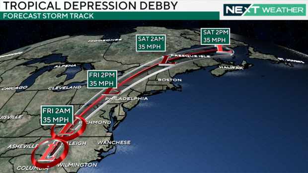
Debby has been downgraded to a post-tropical cyclone and after tracking through North Carolina and Virginia on Thursday, the bulk of the storm should pass west of the Philadelphia area.
Debby began accelerating as the storm emerged from the South.
It looks like Debby will center over central and western Pennsylvania when it reaches the area.
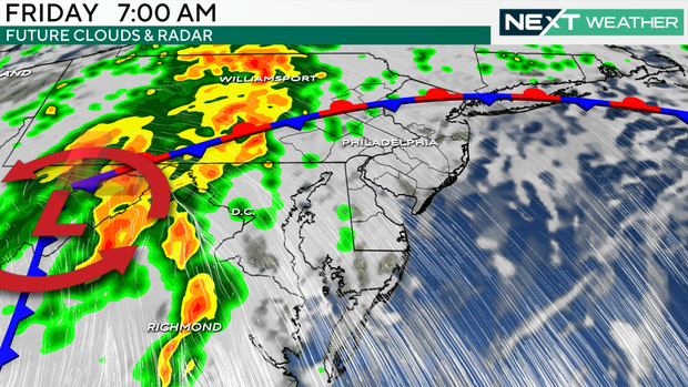
Friday morning, the heaviest rain arrives but should pass us to the west. We see some showers in the west and northwest parts of our region, like Berks, Lehigh and Northampton counties.
Friday, 7 a.m.
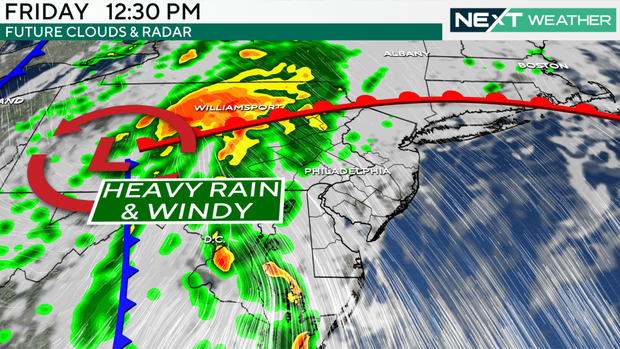
Friday, 12:30 p.m.
By 12:30 p.m., heavy rain will be over spots like Williamsport and farther west. Some steady rain will also be over those western and northwestern spots and in Chester, Lancaster and Montgomery counties.
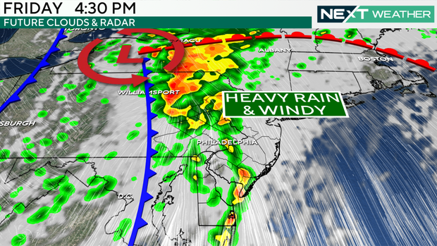
Friday, 4:30 p.m.
Later into Friday afternoon, bands of storms from Debby will sweep over the region, bringing pockets of heavy rain to some already wet spots and impacting more of southeastern Pennsylvania as well as South Jersey, the Jersey Shore and Delaware.
This is really the period of heaviest rain, midday and into the evening. This is when we see the greatest risks, including potential flash flooding, we've been telling you Debby could bring.
This band sweeps from west to east from the afternoon into the evening.
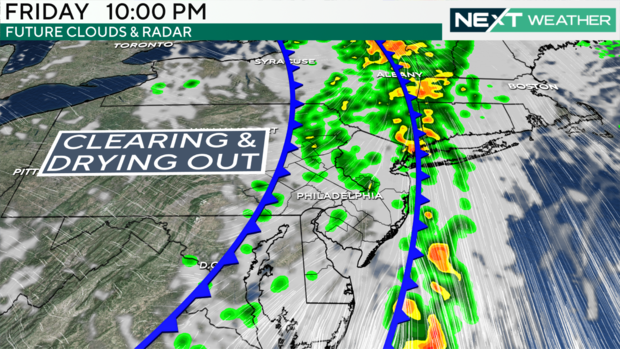
Friday, 10 p.m.
By this time, Debby is on the way out. There could still be some lingering lighter showers, but others will see clear skies or just clouds.
Weekend weather: sunny and clear
Once Debby is out of here, we've got a lovely weekend on tap. We removed our NEXT Weather Alert Day for Saturday after the latest models showed Debby was speeding up — and thus would be out of here more quickly.
Those of you who've been at the beach in this wet, unsettled and largely dreary week will have some great days in store if you're down the shore or at the Delaware beaches. Or you could just get out for a walk and enjoy the sunshine we've been missing.
Stay with the NEXT Weather team for any updates as Friday morning gets closer.
