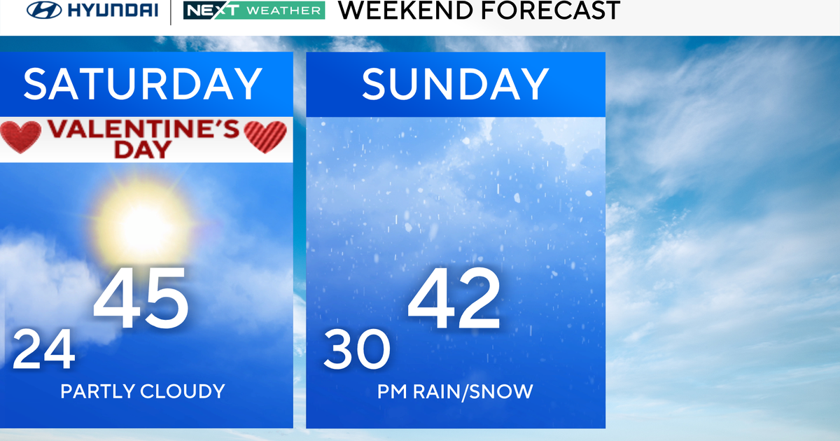
BLOG: 80 Degree Temperatures Possible This Week
By Justin Drabick
After a strong spring storm which brought 1.5-3.5" of rain, severe storms, strong winds, and flooding, we are able to dry out today with sunshine and comfortable temperatures.
Temperatures remain seasonable for the start of the workweek but will warm up for the middle of the week. The overall weather pattern remains progressive so more rain chances continue this week.
A weak frontal boundary will drop through the Delaware Valley on Monday. This will bring more clouds for Monday afternoon and a chance for a shower late in the day. The front will continue to remain across the region on Tuesday.
Expect more clouds and shower chances through the day on Tuesday. However, this time of year it is difficult to forecast where exactly the front will be located. If it remains farther north, then expect some more sunshine for Tuesday with warmer temperatures. For now, expect highs in the mid 60s on Monday and low 60s on Tuesday.
The front will eventually move northward Tuesday night allowing warmer temperatures to return, as a developing storm system moves into the Ohio Valley. Southerly winds will kick up on Wednesday with partly sunny skies. Enough sunshine combined with the warm air mass over the mid-Atlantic would allow highs to make it into the low 80s in some spots. Right now, I think we have a good chance at reaching at least 80 degrees in Philadelphia.
It does not look like a record breaker since the record high for Wednesday is 92 degrees set in 1941. Once again, the 80 degree temperatures are short lived as a cold front will make it through the region Wednesday night. There could be a few showers and a thunderstorm with it. High Temperatures return to the 60s for the rest of the week. Another storm system will bring the chance for showers for Easter weekend.