Another Messy Winter System To Make Its Mark On The Region
PHILADELPHIA (CBS) -- Just last weekend, a relatively potent system pulled into the region as the weekend ended and while the Philly area didn't have too much of a problem on Sunday, the Poconos and the north and west suburbs definitely had their fair share of issues.
By the time we reached into the morning hours on Monday, the wet roads from the rain on Sunday in Philly had refroze and the slippery conditions caused problems on the roads for the start of the week. A very similar set up is brewing for the middle of the work week.
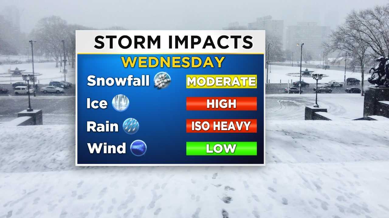
The low that will set off the weather event on Wednesday slowly starts to make its move into the region tonight with a couple of spotty flurries mainly in areas to west before the main area of precipitation enters the region in the early morning hours on Wednesday.
Right now, it appears as though the onset of the precipitation should kick off around daybreak or slightly before. We are likely to see some snow, especially in the western and northern areas by the 5-7 a.m. time frame. As we progress through the morning, the snow will spread farther to the east and the Philly region is likely to see some snow in the morning, but with temperatures rising relatively quickly on Wednesday morning as a warm front sweeps north, the change over to the wintry mix of rain, sleet, snow, and freezing rain is likely to start as early as 9-10 a.m.
Winter Weather Advisory has been issued for parts of the region.
Temperatures then should be warm enough for Philly that the wintry mix transitions to all rain by the early afternoon. This will keep snow and wintry mix amounts to a minimum for the I-95 corridor, with a coating to 1-inch being the best bet.
While Philly and the immediate suburbs in Pennsylvania and Jersey are likely to see little to no real snow accumulation, that is not the case the farther to the north you go. With our last system, a few inches fell across the Poconos and the Lehigh Valley and this system could actually be a bit more of a trouble maker for the northern reaches of the region. A winter storm watch has been posted by the National Weather Service for Carbon and Monroe Counties and goes into effect at 6 a.m. Wednesday, lasting until midnight Thursday.
In areas across the Poconos, the snow will likely start as early as tonight before picking up and becoming heavy at times during the morning hours on Wednesday. Temperatures should remain cold enough that snow will be the primary precipitation on Wednesday into the early afternoon. As the warm front pushes northward, though, temperatures could warm just enough to see a transition even in the northern counties to a wintry mix of sleet, snow and freezing rain. A purely rain event is unlikely at this point for the Poconos.
As you drop slightly south into the Lehigh Valley, there are not any watches or warnings since it looks as though travel will not be as impacted, and snow/sleet amounts will be lower compared to the Poconos. The Lehigh Valley is likely to see a mix of snow and sleet early on in the event with a change over to a snow, sleet, freezing rain mixture before precipitation transitions again into a freezing rain and rain mixture. The wintry mix will start in the Lehigh Valley as early as before daybreak on Wednesday and picking up during the daylight hours. Snow amounts in the Poconos could be as high as 4-8 inches in spots with the potential for icing due to freezing rain as high as a tenth of an inch. In the Lehigh Valley, amounts will take a slight hit, likely coming in at 1-3 inches, but again, be on the lookout for a glaze or more of ice due to freezing rain.
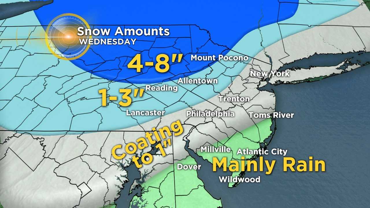
The spot that really looks to luck out, depending how you look at it for this event, is the southern Jersey and Delaware areas of the region. Most, if not all, precipitation will hold off tonight in South Jersey and Delaware, before a chance for a rain and snow mix is possible in the early morning on Wednesday, likely in the 6-8 a.m. time frame. There will be a quick transition to full snow however early in the event, likely by mid-morning thanks to temperatures that will warm above freezing early in the day. Rain across South Jersey could be heavy at times though. Rain is likely to hang on in the southeast parts of the area the longest, with showers lingering until midnight or even 1 a.m. Thursday before completely clearing the coast and allowing high pressure to build in for Thursday afternoon.
There does not look to be any accumulating winter precipitation for South Jersey or Delaware at this time.
