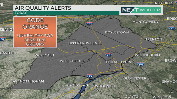
Air quality alert for Philadelphia area counties; sunny skies with rising temperatures

PHILADELPHIA (CBS) -- Our tranquil stretch of weather continues for the weekend with warm and sunny days and comfortable nights. We had some locally dense fog across South Jersey and Delaware this morning, but now the skies have cleared and the temperature is rising.
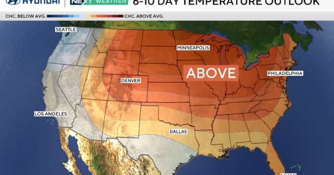
An onshore flow will keep temperatures along the coast a little cooler with highs down the shore in the middle 70s, but inland temperatures will return to the low and middle 80s Saturday afternoon -- roughly five degrees above average.
Air quality alert in Philadelphia area counties
With the warmth and the stagnant weather pattern, there will be higher than normal levels of pollution trapped close to the surface. This has prompted an air quality alert for parts of the area - Philadelphia, Delaware, Chester, Montgomery and Bucks counties. A code orange means unhealthy air quality for sensitive groups.
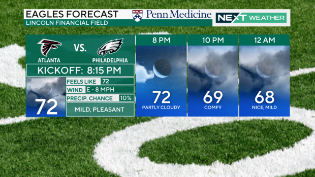
Football forecast
Skies will remain mostly clear Saturday night with the potential for some more fog developing into early Sunday morning as temperatures return to the upper 50s and low 60s. Sunday will be similar to Saturday, with mostly sunny skies and high temperatures in the low-middle 80s.
Tracking the tropics
In the meantime, a stalled-out frontal boundary positioning itself along the southeast coast will be the focus for the potential development of an area of low pressure that could turn tropical into early next week. Since we now have Tropical Storm Gordon in the open Atlantic, if this system were to become a tropical storm, it would be named Helena.
Forecast models have been split on how this system potentially develops, but there's been enough consistency in some of the models to bear watching.
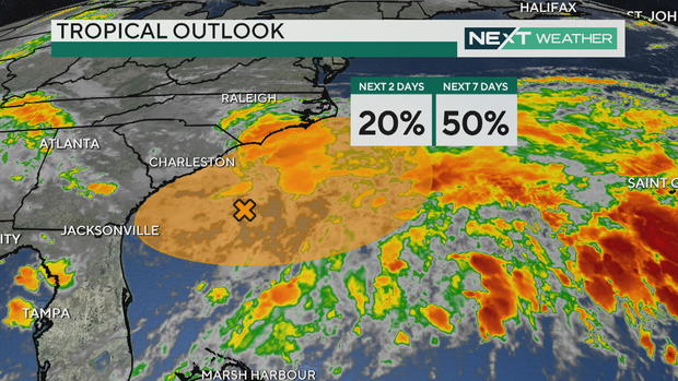
While the center of the low looks likely to remain south of the area as of now, it may send a plume of moisture into our area, bringing rain chances by late Tuesday into Wednesday. That system may stall and fizzle overhead, keeping things unsettled with shower chances through Friday.
There remains a fair amount of uncertainty in the forecast through this time, but the trend definitely signals toward bringing back the chance of rain to a good portion of the area.
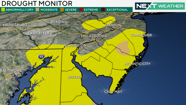
While it may not be what everyone wants, but from a drought perspective, some parts of the area could actually use a little rain. The latest drought monitor shows that parts of Burlington and Atlantic counties in New Jersey are now suffering from moderate drought conditions. While much of the area remains in the surplus for the year, the last couple of weeks have been especially dry for this time of the year.
The NEXT Weather Team will continue to monitor the chance of rain into the middle of next week or whenever our next weathermaker begins to take shape. Until then, enjoy this great stretch of weather through the weekend.
Here's your 7-day forecast:
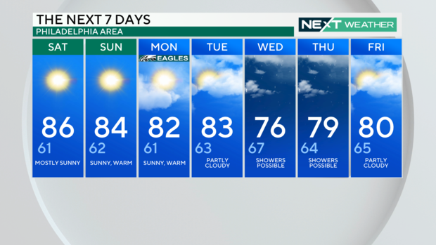
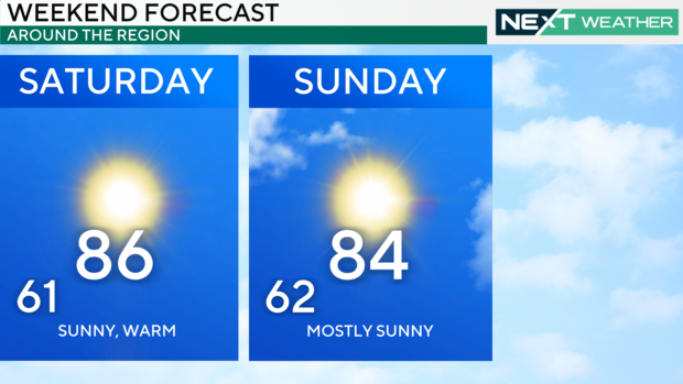
Saturday: High of 86, low of 61, mostly sunny
Sunday: High of 84, low of 62, sunny, warm
Monday: High of 82, low of 61, sunny, warm
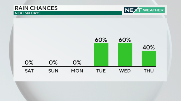
Tuesday: High of 83, low of 63, partly cloudy
Wednesday: High of 76, low of 67, showers possible
Thursday: High of 79, low of 64, shower possible
Friday: High of 80, low of 65, partly cloudy