Colorado Weather: Weak El Niño Formed In January, Expected To Last Into Spring
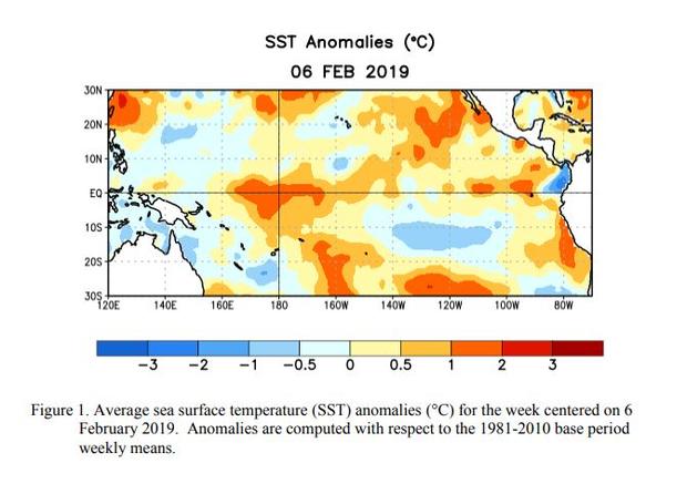
DENVER (CBS4) - A government report released on Thursday says a weak El Niño formed during January and it should last through the spring months in the Northern Hemisphere. El Niño was declared active due to above-average sea surface temperatures being observed across most of the equatorial Pacific Ocean. Corresponding changes in atmospheric circulation have also been noted by scientists.
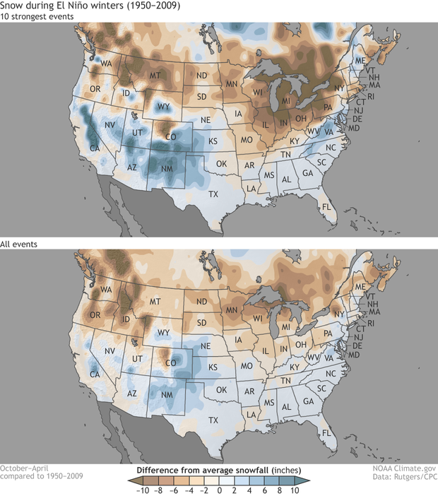
Weak El Niño conditions typically do not generate significant impacts on global weather patterns but can have an impact on the storm track across the United States. In Colorado the eastern and southern parts of the state often have the highest chance to receive above-normal snowfall while the northwest corner can sometimes be drier-than-normal during an El Niño winter.
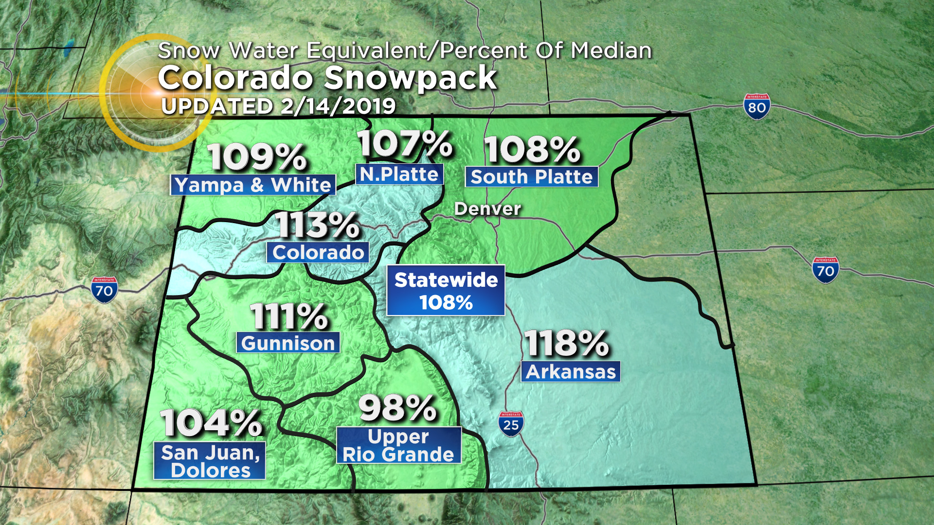
So far this season we've seen average to above-average snowfall across most of Colorado's high country with below normal snowfall in Denver, along much of the Front Range and on the plains.
One characteristic of an El Niño winter is an active southern storm track that often involves an appearance of the subtropical jet stream which can bring heavy rain and snow into California and the desert southwest.
