Storms return to Denver on Wednesday, cooler across Colorado

One final hot and dry day is on tap across the Denver metro area before strong to severe storms make a return on Wednesday.
Temperatures look to surge into the low 90s across the Front Range with 93 degrees as the forecast high in Denver. It will be a touch cooler across the Palmer Divide with temperatures in the upper 90s. A spread of the 70s is on tap for the High Country. Statewide, temperatures are running anywhere from 5-10 degrees above average.
A few mountain showers are expected on Tuesday. One or two storms will be capable of producing gusty winds of ~58+ MPH.
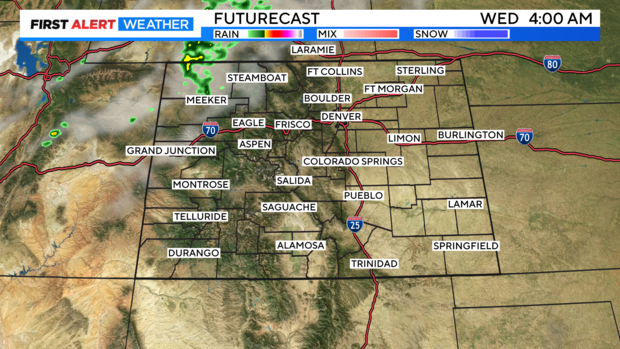
A pattern change arrives Tuesday night into Wednesday, bringing slightly cooler temperatures and the chance for a few strong to severe storms. 80s and 90s are on tap for the Eastern Plains with 70s once again for the High Country.
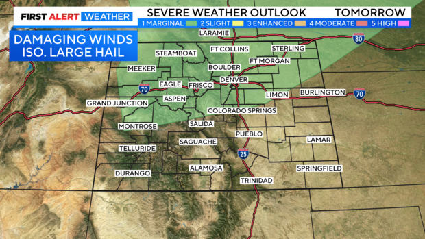
A low-level severe weather day is possible as marginal instability exists along and north of I-70. One or two storms will be capable of tapping into this instability and producing hail around 1" in diameter and gusty winds.
Rain chances will linger for the day on Thursday, but it is looking hot and dry for the weekend.