Colorado snowstorm will bring widely varied snow totals
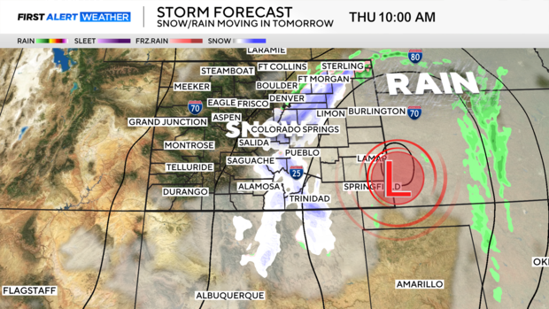
A relatively warm winter storm is swinging through Colorado. The storm will bring in a rain/snow mix for some and heavy snow for other parts of Colorado.
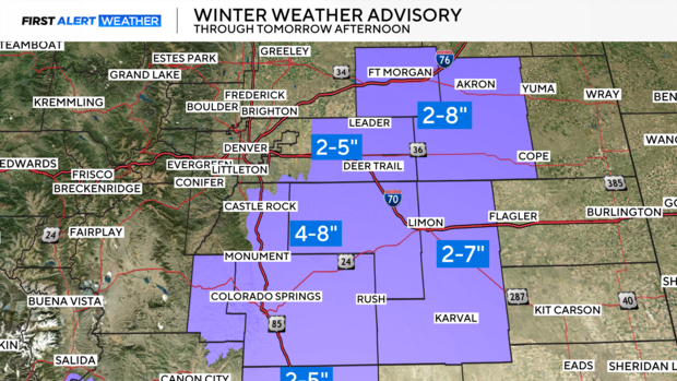
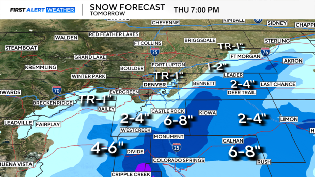
The bullseye for the heavier snow totals will be running across the Palmer Divide areas from Douglas County across Elbert into eastern Arapahoe and Adams Counties. These areas may see as much as 8 inches of snow in more favored areas. There is a Winter Weather Advisory posted for these areas from the north side of Colorado Springs up into Castle Rock, Parker up through Fort Morgan and east out to Limon.
Because this system is so warm it will have some convective elements with it and that means banded areas of heavy snow next to lighter amounts just a few miles away. As a result, areas south and east of Denver will see heavier snow, while, downtown Denver and areas west of I-25 will have hardly any accumulation at all.
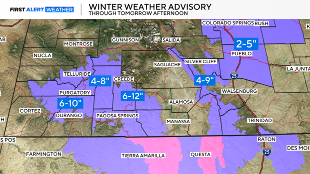
The San Juans are under a Winter Weather Advisory for up to 12 inches of snow with 4 to 9 inches for the Sangre De Cristo mountains. Pueblo and Colorado Springs should see 2 to 5 inches.
The cutoff low is a fast mover and snow should end by afternoon with clearing skies on Thursday. Friday kicks off a warming trend that may see Denver near 60 degrees over the weekend.