Impactful snow is making a return in Denver, be ready for several more inches Friday morning

A round of snow is expected to end the week in Denver followed by a surge of temperatures in the 60s.
Let's first unpack the new Colorado snow, then focus on the surge of heat that is on the way.
Odds increasing of impactful snow across the Front Range
Our next low-pressure system will spill across the Eastern Plain on Thursday afternoon. The system will track to our south, producing a favorable northeasterly wind direction at the surface. This easterly component will support upslope snow for Denver and the foothills.
Precipitation may begin as rain during the early afternoon hours but will quickly flip to snow.
Wet roads (from rain), accumulating snow, and overnight temperatures dropping to the 20s will make for a very messy Friday morning commute.
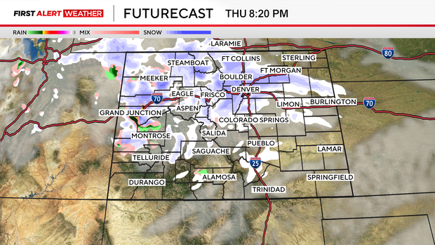
I'm going to throw a snow map out there to give you an idea of the magnitude of the snow totals:
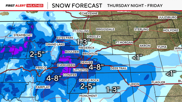
Moderate snow totals are possible in Denver with the greatest impact in the foothills. Adjustments will be made with the specific totals on this map, but it will not steer you in the wrong direction to base decisions and planning on these ranges.
Stay tuned as we continue to update the snow totals as needed!
Here comes the heat... and it is here to stay
Temperatures will begin to climb as snow comes to an end Thursday morning. By Friday highs will climb in the 40s, and 50s by Saturday.
The real fun starts on Sunday, Monday, and Tuesday as temperatures climb into the 60s. Monday will be the warmest day of the extended forecast with 65 degrees as the high.
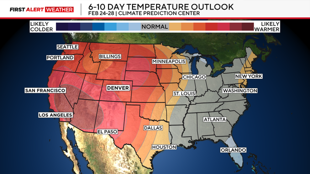
50s and 60s look to stick around in Denver through the remainder of February.