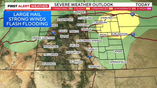
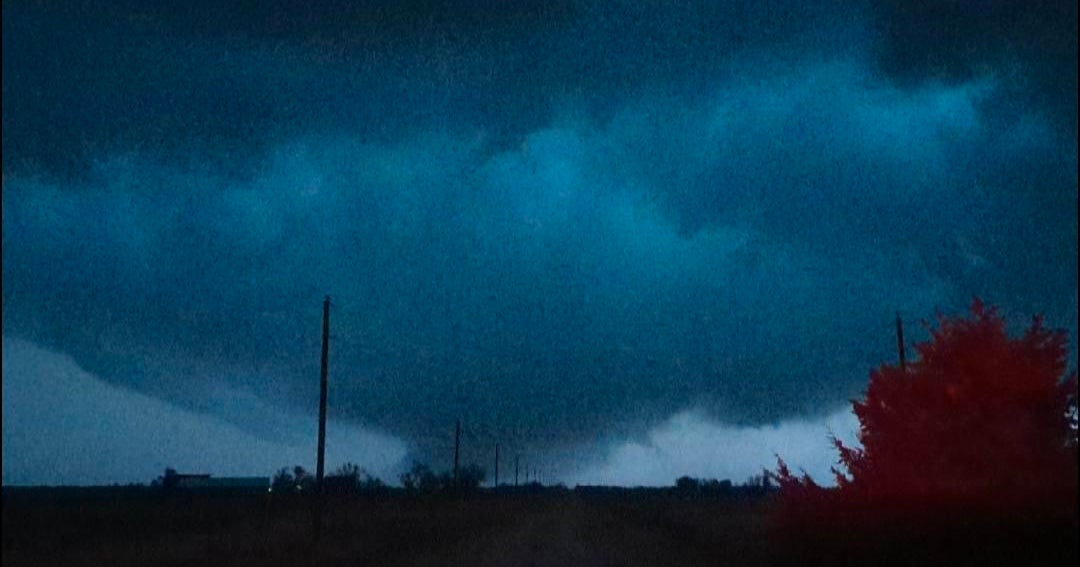
Isolated severe storms and heavy rain across Colorado, possible strong gusts and hail in Denver

Flash flood potential will increase Tuesday afternoon and evening as thunderstorms develop. A few strong to severe thunderstorms are expected across I-25, with the greatest probability across the Eastern Plains.
Some locations received over 3.0" of rain on Monday, so another day of moisture-filled storms has led to a First Alert Weather Day.
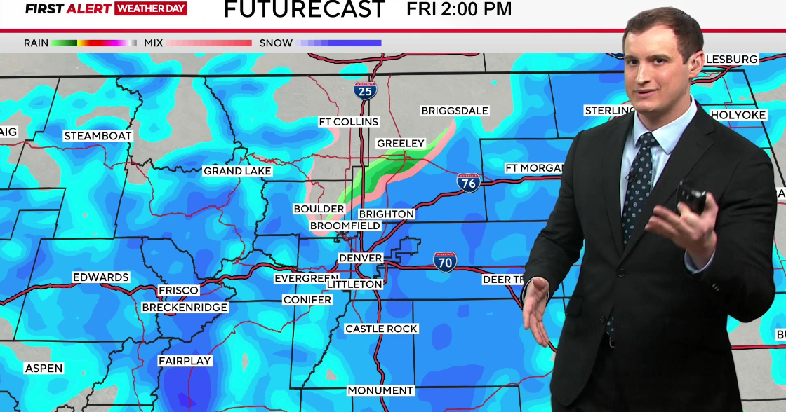
Once again on Tuesday, monsoon moisture is in place. This is bringing abnormally moist air across the Front Range. Storm motion improves a bit Tuesday afternoon, but storms are still slow moving in general (10-20MPH). The burn scars are at greatest risk including the Alexander Mountain, Stone Canyon and Quarry.
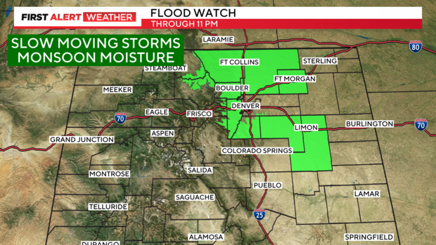
A flood watch will remain in effect until 11 PM Tuesday night as thunderstorms with heavy rain can produce 1-2" in as little as 30-45 minutes. The Palmer Divide including Douglas and Elbert Counties are included.
A few rogue storms will be capable of producing hail up to 1.75" in diameter (golf ball size) and wind gusts to 60 MPH.