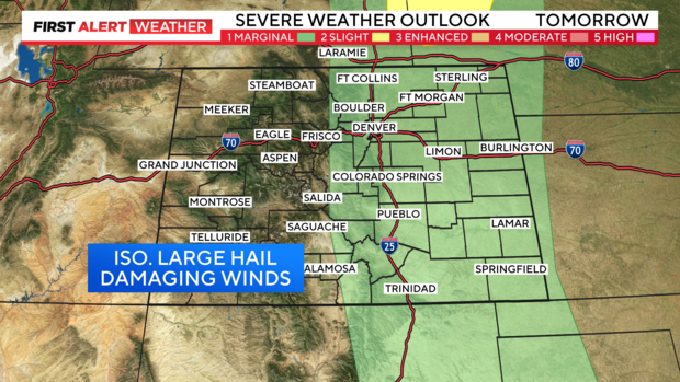
Severe storms forecast Sunday along Interstate 25 corridor, Colorado mountains

After a stormy Saturday, parts of Colorado are again at risk for scattered strong to severe thunderstorms to finish the weekend.
Storms are most likely along the Interstate 25 corridor, including Denver, Boulder, Fort Collins and beyond Colorado Springs.
The nearby foothills and mountains will also have the risk of severe thunderstorms by Sunday afternoon.
Risks
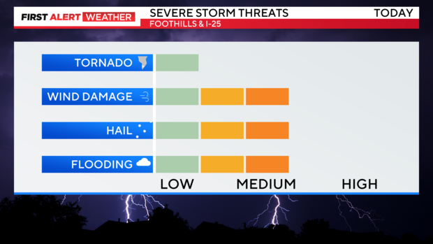
The greatest threats with thunderstorms will be isolated large hail and damaging winds, but localized flooding could also occur. Hail could be the size of quarters (1") or larger, and wind gusts could exceed 60 mph near any storms.
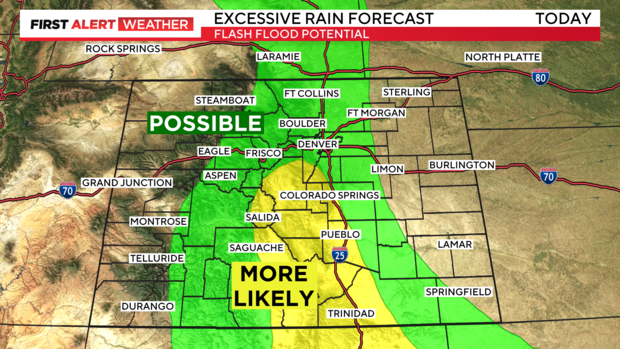
Storms may be slow to move, which could result in localized very heavy rainfall underneath storms. Remember to never drive through flooded roadways, as water may cover potential hazards or washouts that can be dangerous. The risk of tornadoes is low statewide.
Timing
Storms will initiate any time after noon and continue, scattered in coverage, through about 8 p.m. The day will not be a complete washout, as there will be plenty of dry hours, especially earlier in the day.
Storms will taper off during the evening as temperatures cool from around 80 midday, to the 60s and 70s in the evening.
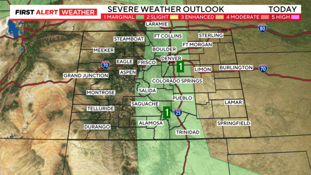
The risk of storms will flare up again on Monday afternoon. The risk areas will again include the mountains, foothills, I-25 corridor and Denver metro area, but also expand once again to the Eastern Plains. Threats will be similar on Monday with isolated large hail and damaging winds as the primary concerns.