Seasonal, breezy in Colorado Friday before mountain snow moves in, elevated fire weather in lower elevations
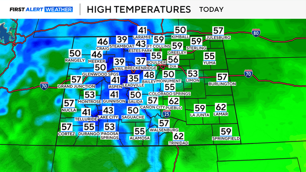
Friday afternoon will very closely resemble the weather we saw on Thursday with high temperatures climbing into the mid to upper 50s. At times, on Friday afternoons, winds could gust as high as 25 mph across the Denver metro area.
There will be a mix of sun and clouds throughout the day as a storm system begins entering the higher elevations.
Most of the day for the mountains will be quiet, with a chance at a few light flurries, but by tonight snow will build.
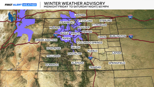
Winter Weather Advisories will be in place for the mountains from midnight Saturday to Saturday evening. The heaviest snow will be overnight and into the mid-morning, gradually lightening through the late afternoon on Saturday.
Roughly 6-10 inches of fresh snow is expected, with some places possibly picking up around 1 foot of snow.
Wind will also be an issue, gusting as high as 60 mph.
Travel along I70 on Saturday morning will likely be slow as snow and wind impact road conditions.
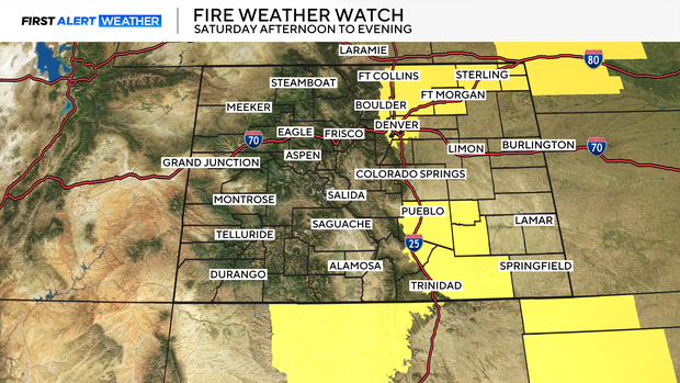
By Saturday winds will increase, and humidity will drop in the Denver metro area. That combination will increase the risk of fire weather. Fire weather watches are in place for the Denver metro area, into the Northeastern plains, and parts of Southern Colorado going into the day on Saturday.
Winds could gust as high as 45-50 mph.
Sunday winds relax, but breezy conditions will continue throughout the weekend.
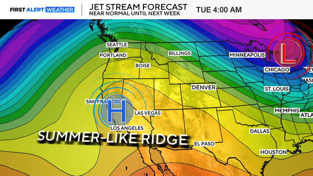
By early next week, a big ridge of high pressure builds off to the west, setting the stage for a summer-like warm up into early next week.