Lower North Fork Fire Included A Deadly Cascade Of Missteps
DENVER (AP) - The Colorado State Forest Service conducted a 50-acre prescribed burn on March 22, part of a normal plan to consume fuel in the rugged, pine-filled foothills southwest of Denver. It wasn't far from site of the monstrous Hayman Fire 10 years ago, and this burn was a precaution.
Once the fire was out, crews patrolled the perimeter daily to make sure it stayed that way. And it was on one such patrol the hot afternoon of Monday, March 26, that they spotted an ember blown across the perimeter and lighting grass. What they hadn't done in all their methodical planning was ask for real-time weather forecasts that would have predicted vicious, swirling winds.
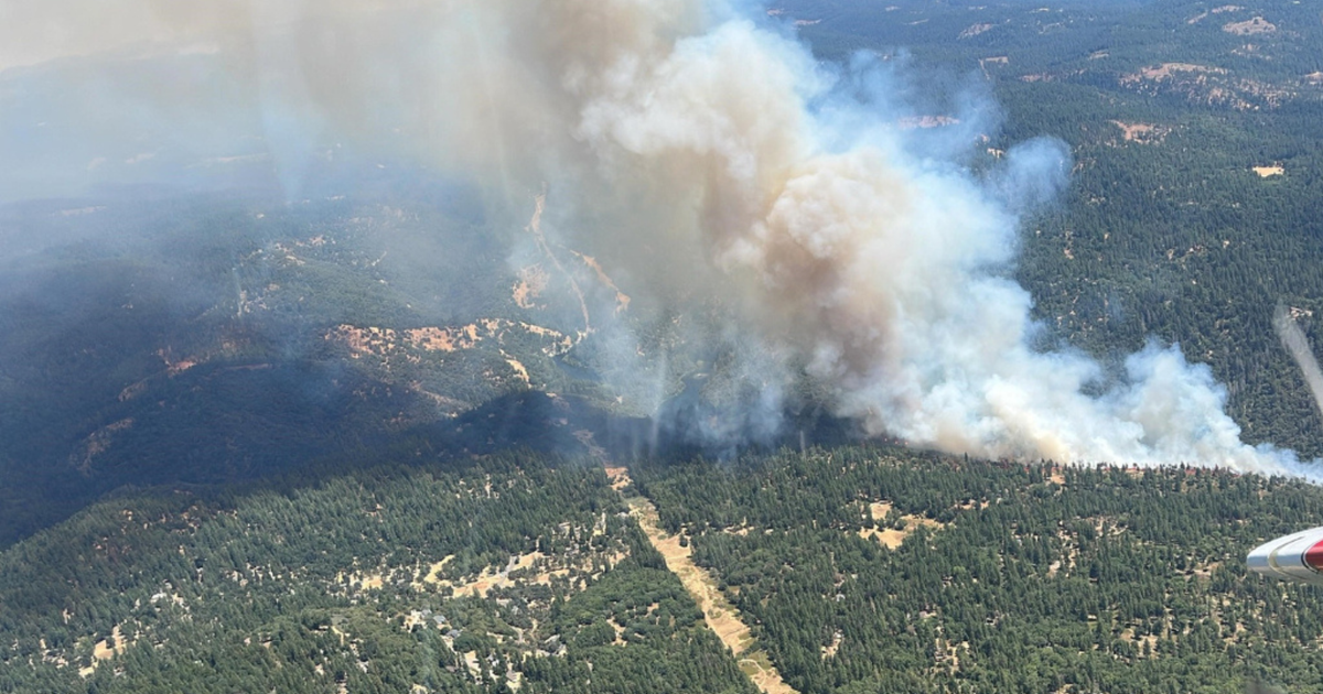
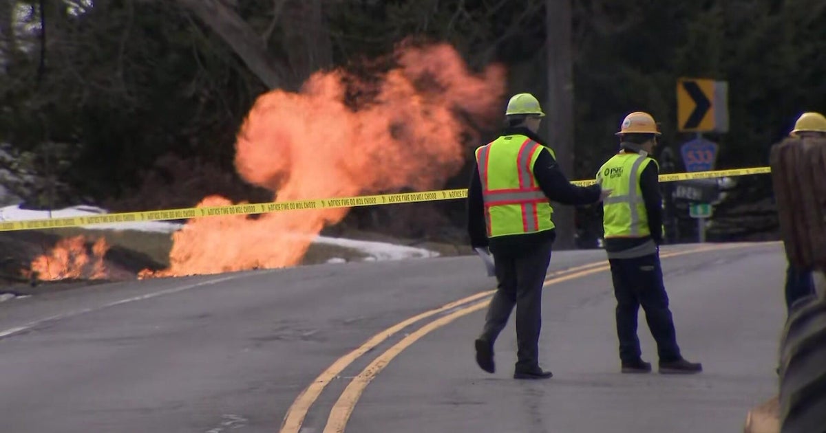
From there, a deadly cascade of missteps combined with the vagaries of wind and fire to produce another tragedy in the Rocky Mountains, new documents obtained this week show. The 6-square-mile blaze killed three people, destroyed dozens of homes near the small town of Conifer and raised questions about what could have been done to contain the human and material losses - questions that will be addressed by an out-of-state investigator.
"This is heartbreaking, and we are sorry," deputy state forester Joe Duda said.
"People up here want accountability," said resident Glenn Davis. "Telling me 'I'm sorry' doesn't really make a difference."
Volunteer firemen responding to the first reports of smoke couldn't talk to the state crew because it used a different radio frequency. One fire chief had to drive along the winding roads in the pine-dotted region to find out what was going on at the controlled burn site, losing precious minutes to act.
Dispatchers, too, were in the dark, reassuring some frightened residents as the smoke and winds gathered that events were under control. When authorities realized more than three hours later that, in fact, nothing was under control, they sent out waves of emergency evacuation telephone calls - some of which reached no one, while others went to out-of-state numbers.
Some early callers died in the inferno. Harried dispatchers hung up on other callers, too overwhelmed to respond.
It was 1:40 p.m. when the wind-blown ember ignited grass. Gusts would soon exceed 60 mph. The first evacuation orders wouldn't go out until 5:05 p.m.
Forest Service records show the controlled burn crew didn't ask for an updated special weather forecast - called a spot forecast - from the day of the burn until an hour after the burn reignited. Over that weekend the weather service had issued a red flag warning for dire fire conditions for the Conifer area, some 8,200 feet high in the Rockies.
"In the fire world we always have what we refer to as situational awareness, and as a burn boss who is leading crews, it is imperative that the burn boss is aware of the conditions, not only now, but what is going to be occurring in the future," said Chris Dicus, a professor of wildland fire fuels management at California Polytechnic State University in San Luis Obispo, Calif.
"Are you looking for a small happy fire, or a large angry fire?" Dicus said. "The weather forecast you need will change based on what your objectives are."
Bill McLaughlin, chief of the Elk Creek Volunteer Fire Department, couldn't talk to the forest service that Monday because it was on a different radio frequency.
"We didn't know in advance which (radio) channel they were on," McLaughlin said of the state forest service crew.
He wasted precious minutes driving to the controlled burn to find out what happened. The map he was using was 18 years old - new maps are too expensive - and it didn't show newer homes that likely were in the line of fire.
"We were making some educated guesses on where exactly the structures were," he said.
Within 10 minutes, residents began calling the Jefferson County 911 system, worried about the smoke. Some were found dead in the aftermath.
One who called 911 was Ann Appel.
"It's blowing smoke right over my house," she said.
"Yeah, it's about 5 acres and growing, so they've got crews on the way," a dispatcher told her.
"OK. Thank you," Appel replied before hanging up.
Human remains believed to be Appel's were found days later.
"It's important to note that her call came in very early. That's why the response is what it is," sheriff's spokeswoman Jacki Kelley said.
The Appel family said sheriff's officials told them Appel didn't receive an evacuation call because her property was listed at the wrong address in Morrison, where the family had never lived.
Some residents report never knowing about the controlled burn, despite policies mandating the public be informed well in advance of such burns.
"We've got 79 mph winds out here, and they've got a controlled burn?" asked an incredulous Sam Lucas in one 911 call.
The bodies of Lucas, 77, and his wife, Linda, 76, were later found at their destroyed home.
Firefighters asked for evacuations shortly before 5 p.m. The first wave of automated calls ordering residents to evacuate was sent at 5:05 p.m. but went to a wrong list of phone numbers, said sheriff's spokesman Mark Techmeyer. "That was a user error on our end."
A new round of calls began at 5:23 p.m. But the first bad round of notifications exacerbated confusion in the dispatch center, which was overwhelmed with calls from people asking about evacuation notices and others reporting smoke and fire.
That exasperation came out in several frantic exchanges on 911.
"You can turn on your news if you want coverage of it," a dispatcher told one resident who called to find out if he was being evacuated.
One woman called to report smoke and haze.
"It wasn't a prescribed burn, was it?" she said.
"It was, but it's now not prescribed any further," the dispatcher said.
"If it's prescribed, it's way out of control," the caller said.
"Well I'm telling you that it was prescribed and it's no longer in control," the dispatcher said.
The confusion led to frantic escapes where in some areas day turned to night, embers flying like tracer bullets. Many roads in the area are winding, down to one lane, creating the potential for jams to safety and emphasizing the need to get out early in case of disaster. A sheriff's deputy trying to knock on doors got lost in the smoke, drove into a ditch, and called for help as flames overtook his car. He escaped unharmed.
"If they're saying there's a controlled burn and the state forest service is on the scene, we don't just create evacuations for a fire that has gone outside the perimeter," Kelley said later, emphasizing the downside of creating undue panic and the county's dependence, too, on reports from the scene.
Ultimately, residents of some 900 homes were evacuated amid rapidly changing weather conditions typical of Colorado's foothills and mountains, where wind speeds and temperatures can change drastically within a matter of minutes - and in this case pushed a fire quickly through narrow canyons and fuel-choked grassland now populated, despite its alpine setting, as an exurb of Denver some 25 miles away.
Andy Hoover may be typical of them.
That Monday, he told a 911 dispatcher he was watching his house burn.
"I think I'm safe," he said.
"Can you get out of the area, because we don't know if we have a second wave (of fire) coming in there," the dispatcher said.
"You know what, ma'am, I could try," Hoover said. "I'm not sure that's a smart idea."
Wildfire Resources
- Visit CBSDenver.com's Wildfire Resources section.
- Read recent Wildfire stories.
Wildfire Photo Galleries
- See images from the most destructive wildfire (Fourmile Fire) and largest wildfire (Hayman Fire) in Colorado history.
By COLLEEN SLEVIN, Associated Press
(© Copyright 2012 The Associated Press. All Rights Reserved. This material may not be published, broadcast, rewritten or redistributed.)
