Enjoy near record temperatures in Colorado before weekend showers
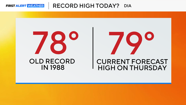
This week has been dominated by well-above-average temperatures, with highs across the Denver area in the 70s. For Thursday afternoon, those highs could become historical as several neighborhoods have the potential to break records. The previous record high temperature at the airport was set back in 1988 when the temperature climbed to 78 degrees. This afternoon, the forecast high is 79.
Other neighborhoods, such as Fort Collins, Boulder, Greeley, and even Dillon, have the potential to tie or break records this afternoon. Temperatures will climb quickly under plenty of sunshine, but by mid-afternoon, cloud coverage will begin to increase. With that cloud cover comes a slight chance of a scattered evening sprinkle.
Under the influence of high pressure, temperatures will stay above average going into the day on Friday, but the day will be dominated by more cloud cover.
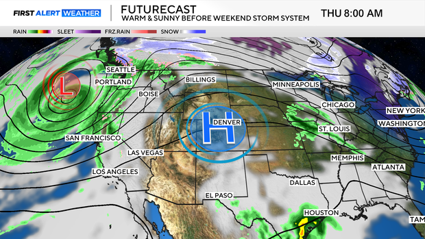
Changes arrive just in time for the weekend as a storm system from the west advances in.
Rain and snow changes build going into the evening hours on Friday for the mountains. Most of the lower elevations will stay dry on Friday, but there is a chance that some neighborhoods could see a few light rain showers Friday evening.
Overnight, more rain will begin to fall as the first wave of the weekend moisture moves through.
Off-and-on showers carry us through the day on Saturday before the second wave of moisture arrives late afternoon.
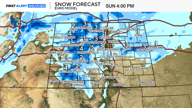
Overnight rain showers will turn to a slushy snow, which will linger into Sunday.
Most of the impactful weather will stay up in the higher elevations, with a few inches of snow possible. There is a chance that snow may accumulate in eastern plains neighborhoods as well through the day on Sunday as the storm system moves out.