El Nino charged Winter may deliver much needed moisture
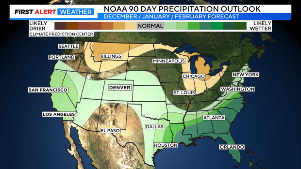
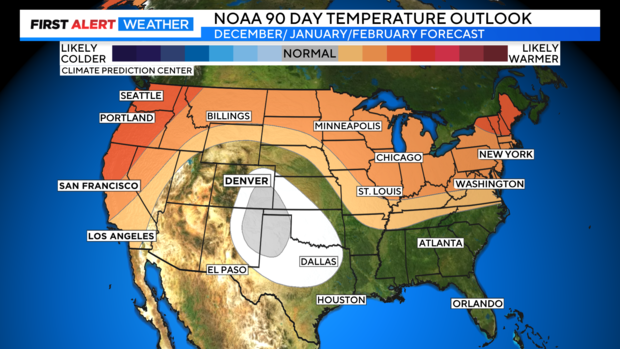
We have an El Nino charged winter season on the way. This could help to get the snow machine going in certain parts of the state. Along with that the new monthly 90-day outlook from the Climate Prediction Center is out this week. This is basically, the outlook for the winter season for the months of December, January and February. And it is looking promising for getting some above normal snowfall for at least the beginning of the winter season.
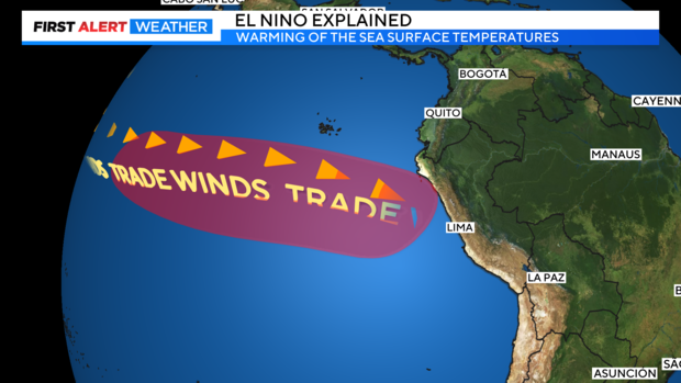
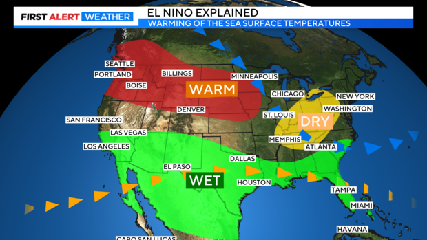
El Nino is stronger than normal going into the cold season. Snow amounts in a strong El Nino season can vary from a few inches to heavy above average snowfall. El Nino is the warming of the ocean water off the coast of South America. Trade winds reverse direction and flow west to east increasing the sea surface temperatures over the eastern Pacific. This can disrupt storm flow across the globe including the United States as El Nino tends to peak in the month of December on average.
Typically, in a strong El Nino year southern Colorado tends to see more moisture and if conditions are right storms can set up just southeast of Colorado and push southern moisture into the Front Range producing strong upslope Winter storms. One of Denver's biggest snow seasons was in 1987-88 this was the city's second snowiest winter on record and the strength of that El Nino was similar to the El Nino forecast for 2023-24.
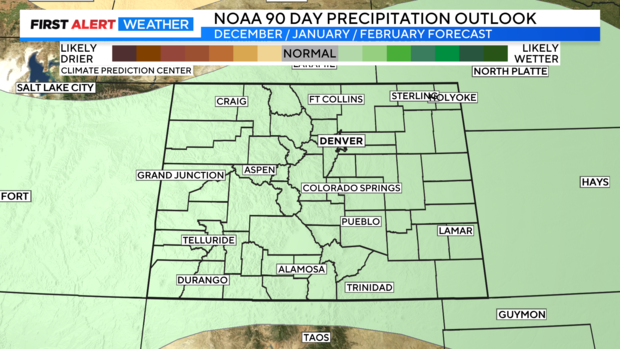
The new outlook for the the months of December, January and February from the Climate Prediction Center show precipitation to be slightly above normal for the entire state of Colorado. This would bode well for seeing more moisture over the season.
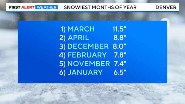
December is our 3rd snowiest month with 8 inches on average and February is our 4th with 7.8 inches on average. January is 6th with 6.5 inches.
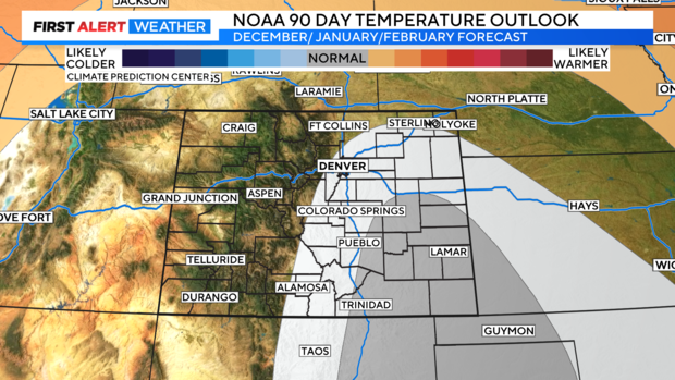
As far, as temperature goes the eastern half of the state is forecast to be close to normal levels. This would be good for snow production as the next three months are typically, the coldest.
Western areas of the state will be a little more of a question mark for temperature as there are equal chances for below or above normal highs and low.
So in a nutshell, it looks like with slightly above normal precipitation and near normal seasonal temperatures much needed moisture in the form of winter snow is looking promising for most areas of the state through the winter season.
