Colorado Weather: Wind & warmth increase Friday fire danger
Eastern Colorado has an unseasonably warm weather pattern underway to finish out the weekend. But, with strong wind expected to ramp up on Friday the fire danger threat will be a real issue as we get closer to the weekend. Denver clocked in a high of 75 degrees on Thursday. That's 10 degrees above normal for this time of year!
Friday will be in the same temperature territory of the mid to upper 70s. But, there is a problem with the wind and dry conditions that will be pushing in. As a result, we have a First Alert Weather Day posted for the Denver metro area on Friday.
Colorado will be caught between to strong pressure features. A warm High Pressure Ridge pushing over the Rockies and a deep Low Pressure Trough spinning into the west coast. A strong pressure gradient between the two and a surging jet stream will enhance the wind flow over the region.
This will boost the wind and dryness over the central Rockies. Temperatures statewide will also, be boosted to even warmer levels. Eastern Colorado will have highs in the 70s and 80s!
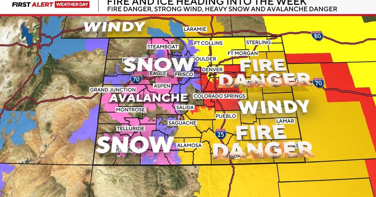
There is a Red Flag Warning for High Fire Danger posted for Friday morning into Friday evening. Wind gusts may reach 40 to 50 mph during the afternoon. That along with humidity levels down under 15% will create conditions favorable for rapid fire spread.
Western areas of the state will also be dealing with strong winds on Friday. These areas have a high wind warning or advisory form much of the Western Slope with some wind gusts up to 65 mph along with warm temperatures.
The National Weather Service advises avoid outdoor burning and any activity that may produce a spark. A Red Flag Warning means that critical fire weather conditions are occurring now or will shortly begin. A cold front will blow through on Saturday bringing in cooler temps, rain and snow along with even stronger winds.
There is a Winter Storm Watch for the eastern San Juan and La Garita mountains Friday night through Saturday for 7 to 12 inches of snow along with 70 mph winds. This could create blizzard-like conditions in the southwestern mountains.
The Front Range has a chance for a rain/snow mix along with gusty winds from the morning through the early afternoon on Saturday. With much cooler temperatures.
There is a High Watch for the Front Range and I-25 corridor on Saturday. Winds in the mountains and foothills may gust up to 75 mph with some isolated, wind-prone areas up to 100 mph! From Denver Eastward into the plains gusts may be 50 to 60 mph.


