Colorado Weather: Warmth and wind before next cold front
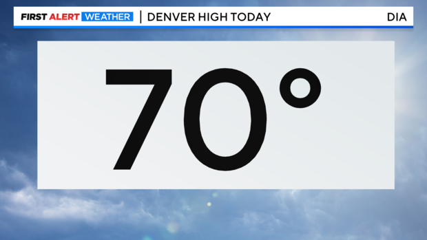
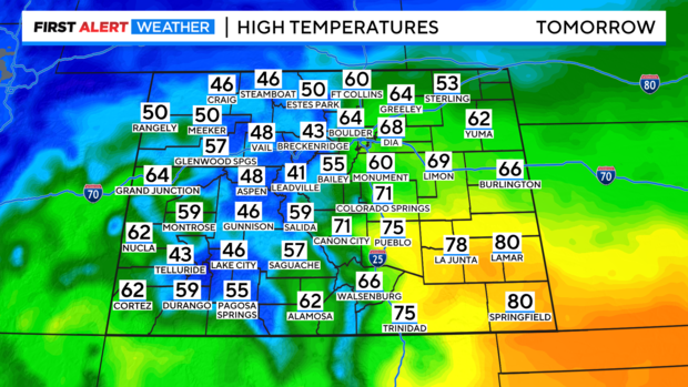
Sunday's wind gusts produced another unseasonably warm Spring day with a high at Denver International Airport of 70 degrees! A normal high this time of year for Denver is 60 degrees.
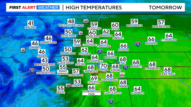
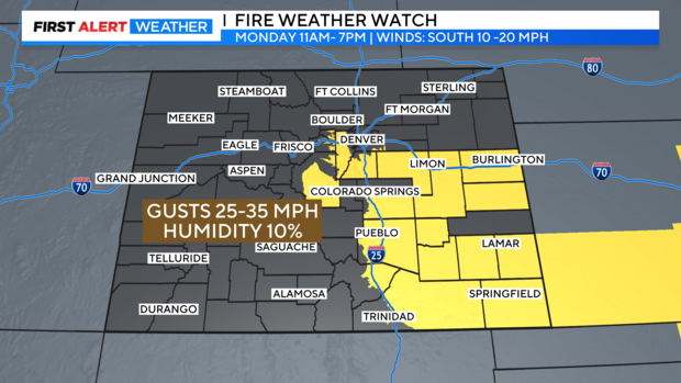
Monday will be another warm and windy day. Unfortunately, for the fourth day in a row there is a concern for high fire danger with the wind, warmth and dryness.
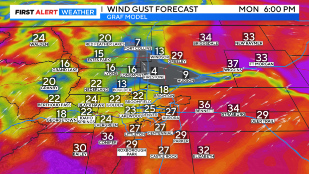
Wind gusts may peak as high as 35 mph Monday afternoon around the Denver metro area.
That along with temperatures in the 60s and 70s to start the week along with relative humidity levels down to 10 percent will make for dangerous fire weather conditions.
There is a Fire Weather Watch in place for Monday afternoon from Douglas and Elbert counties down into all of southeastern Colorado.
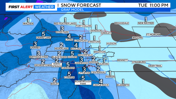
There is another snow storm moving into the mountains on Monday into Tuesday. Winter Storm Warnings and Advisories have been posted with some of the mountains near Steamboat getting up to another foot of snow! Wind gusts in the San Juan mountains may reach up to 80 mph with this wind driven storm system.
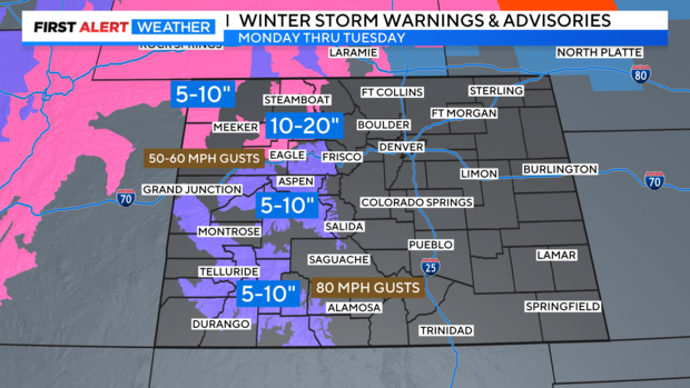
Denver will see snow developing overnight Monday into Tuesday. There is a chance for 1 to 3 inches of snow around the Denver metro area up into Fort Collins at this time. A lot of the snow should melt on the roadways. With most of the accumulation on the grassy areas.