Colorado Weather: Damaging winds possible in the foothills and mountains
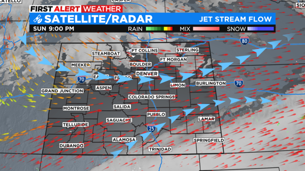
We have a two strong jet stream flows pushing across Colorado on Monday. One to the south and one to the north. It is the northern stream that will be blowing super strong winds over the mountains and foothills of the state through at least Tuesday morning.
There is a High Wind Warning for the entire Front Range of Colorado in the mountains and foothills thru Tuesday. Some gusts may reach up to 80 mph! Sustained winds will be in the 40-50 mph range.
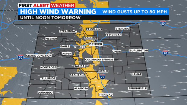
Denver is not in the High Wind Warning but areas west of I-25 may see wind gusts up to 45 mph on Monday and Tuesday.
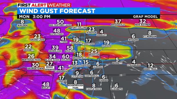
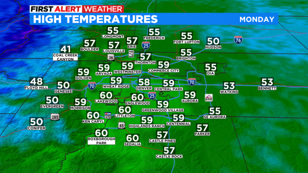
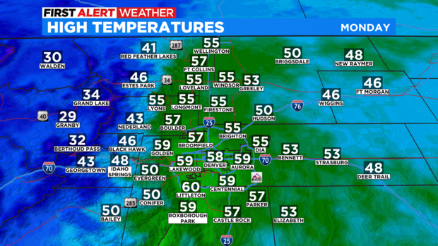
The wind flow is westerly so this will be a downslope, warming wind for the northern I-25 corridor including the Denver metro area. So President's Day may be windy but, mild as far as temperatures go.
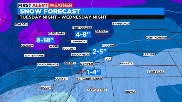
The next big thing will be a storm system coming in on Wednesday with another chance of snow for the Denver metro area.
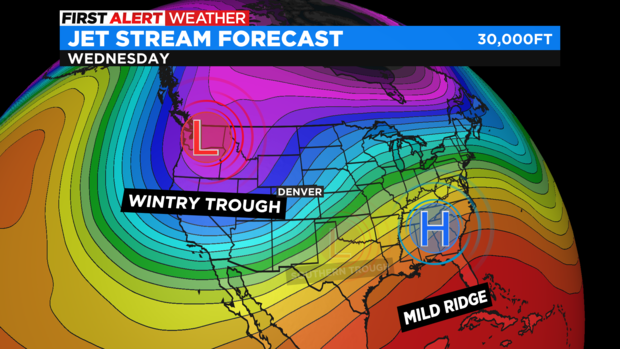
At this time, it appears the heaviest snow will be found across northern Colorado. The Fort Collins, Loveland, and even Greeley area could get 4-8 inches of snow. Amounts will be less farther south with Denver and the southern suburbs only getting 1-4 inches. The foothills of Boulder and Larimer Counties will likely get the most snow with more than a foot possible around Nederland and Estes Park.