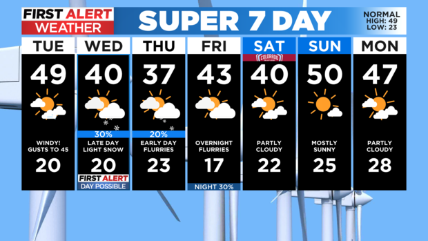
Colorado Weather: Stronger winds expected across Front Range

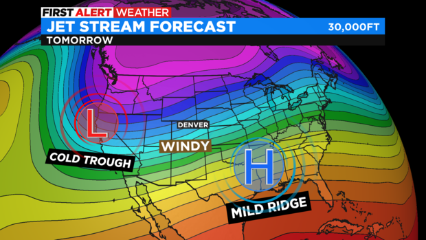
Colorado will be caught between a high pressure ridge to the east and a deep low pressure trough to the west. This will create gusty winds across the state again for Tuesday.
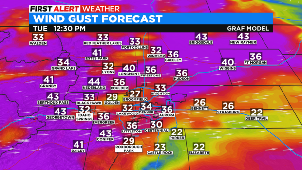
Sustained winds for the Denver metro area and surrounding suburbs could be 20 mph to 30 mph in the afternoon with some gusts getting up to 45 mph.
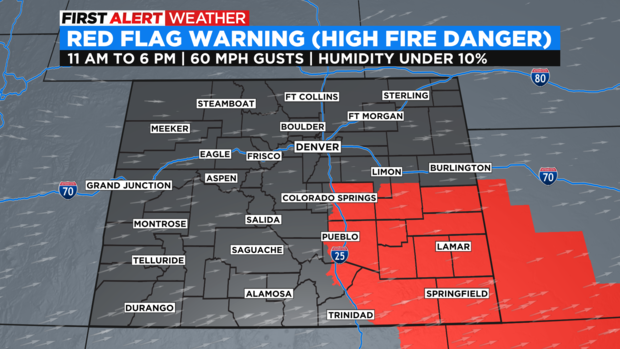
In southeast Colorado the combination of low relative humidity, dry soil, and wind gusts up to 60 miles per hour have prompted a Red Flag Warning from 11 a.m. through this evening. The Red Flag Warning for high fire danger does include: Colorado Springs, Pueblo, Lamar, and Springfield. A spark from any source today could carry fire very quickly.
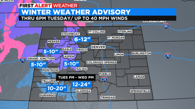
In the mountains another round of snow will be pushing in. There are Winter Weather Advisories for Tuesday in most of the Western Slope mountains and a Winter Storm Watch for the San Juan Mountain areas. Those spots may see one to two feet of snow by Wednesday afternoon.
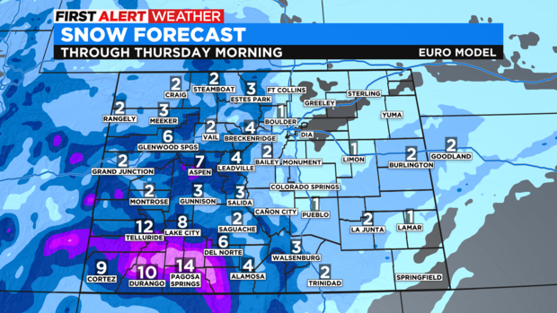
The Front Range is still expecting light snow Wednesday night. At this point, it looks like less than an inch for most of us in the metro area. On the eastern plains 1 to 2 inches are possible and in most mountain towns 3 to 6 inches. Higher amounts are likely in the San Juan Mountains where we could see more than a foot of snow.
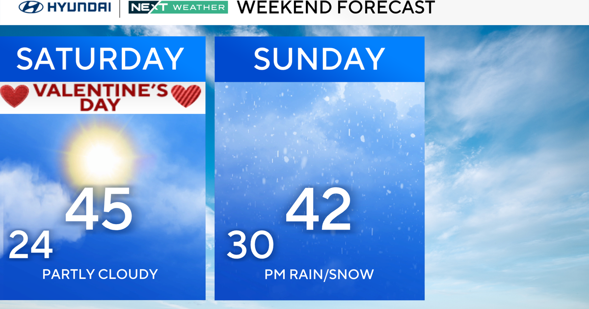
It will be cold on Thursday with daytime highs in the 30s. We wrap up the workweek on Friday night with another chance to see a few flurries overnight before we dry things out over the weekend.