Colorado Weather: Warm First Day Of Spring Precedes First Alert Weather Day On Monday
By First Alert Meteorologist Callie Zanandrie
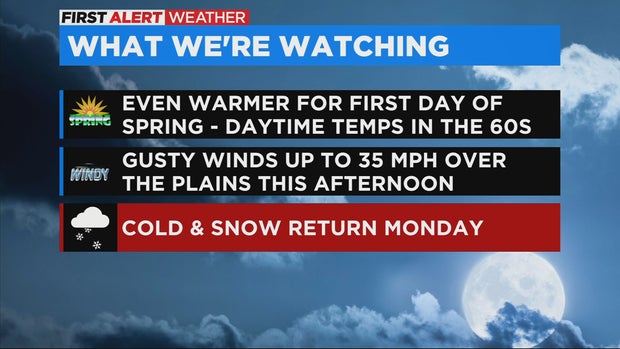
DENVER (CBS4) - Spring officially begins at 9:33 a.m. Sunday morning. Temperatures will feel spring-like today with daytime high temperatures in the 60s for the urban corridor. We will see clouds increase throughout the day with breezy conditions this afternoon with gusts around 25 mph.
Snow will start in the mountains Sunday in the late afternoon. In the metro area, we could see rain after midnight and after sunrise the rain will change to snow. Throughout the day on Monday we will see slushy snow on and off.
In the Denver metro area we could see 1-3 inches of accumulation by Monday night. The heaviest snow looks to be across the Palmer Divide and foothills, where we could see 3-6 inches of slushy snow.
Windy conditions on the eastern plains could cause blowing and drifting snow making for difficult travel.

Monday daytime high temperatures will be in the 30s for the Denver metro area. Because of the likelihood of snow and cold the CBS4 Weather Team has issued a First Alert Weather Day for Monday.
It stays cold on Tuesday with a high only in the 40s with the potential for a few light snow showers, but by next weekend the spring-like weather will be back with daytime highs well above normal, near 70 degrees.