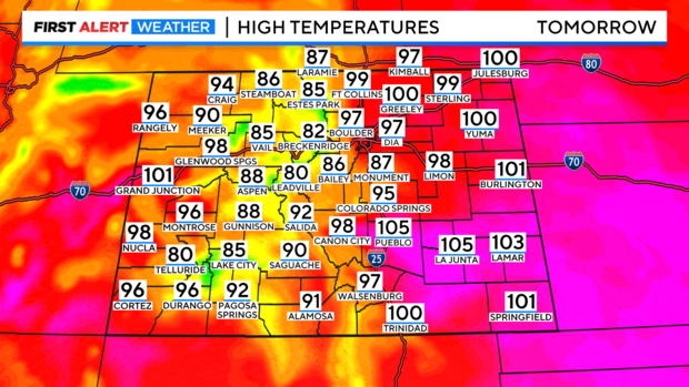
Monday meltdown brings in 90s and 100s around Denver metro and all of eastern Colorado

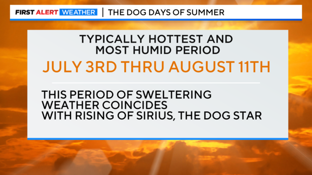
As the Dog Days of Summer bark into the last week of July extreme heat locks in for a few days. The dog days of summer run from July 3rd to August 11th and tends to deliver some of the warmest and most humid weather of the year.
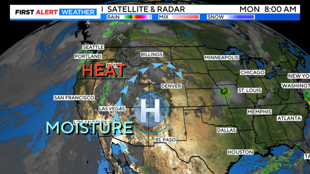
On the big weather map we have high pressure centered over the Four Corners of Colorado. With clockwise flow this feature will bring in the combination of monsoon moisture and extreme heat!
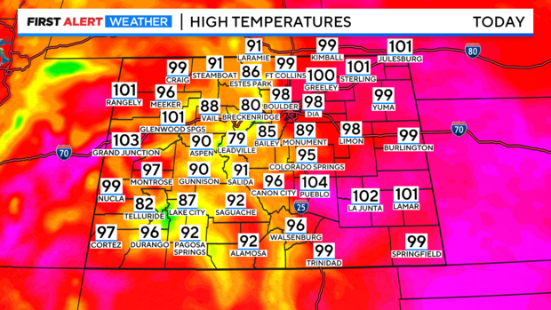
Temperatures will be zooming into the upper 90s and 100s across the eastern plains and western slope for Monday. With highs in the mountains topping out in the upper 80s to low 90s.
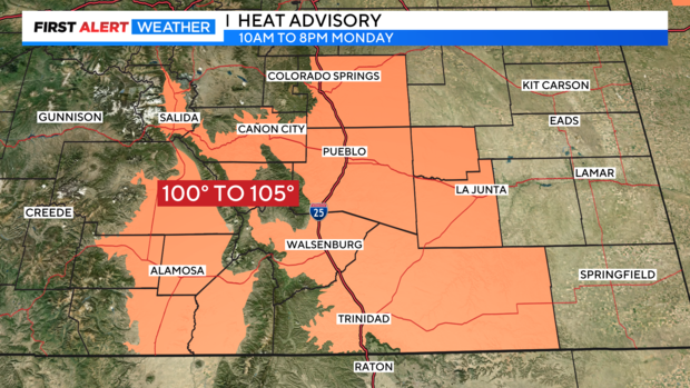
A Heat Advisory is posted for areas of southern Colorado from Colorado Springs down to Trinidad and over into the San Luis Valley thru 8pm.
In Denver, the record high is 100 degrees set in 2003. So the forecast high will be just a few degrees shy of that record with a forecast high of 98 degrees.
There is a bit of relief expected by afternoon and early evening from the mountains across the plains in the form of a few isolated showers and thunderstorms. This includes the Denver metro area.
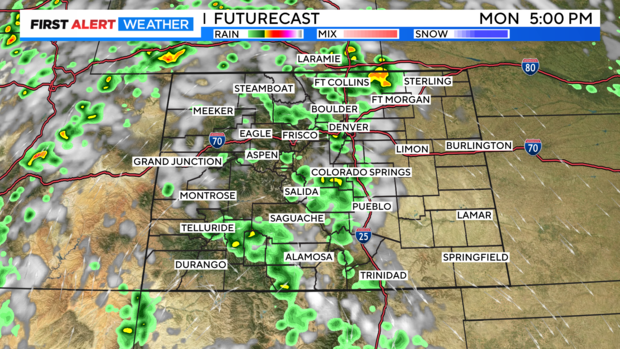
Another hot day with afternoon and early evening t-storms is also in the cards for Tuesday.