Colorado Weather: Winners and losers with snow but everyone feels the bitter cold
The latest winter storm to hit Colorado has brought a wide range of snow totals but universal cold. A First Alert Weather Day continues through Tuesday evening.
As expected, several waves of moderate and heavy snow moved over the Denver, Boulder, and Fort Collins areas before sunrise on Tuesday. Most areas experienced 2-4 inches of snow but some locations measured less while others had more. That is common with a "banded" snow storm. Generally speaking, the highest snow totals were in Boulder, Larimer, and Weld Counties.
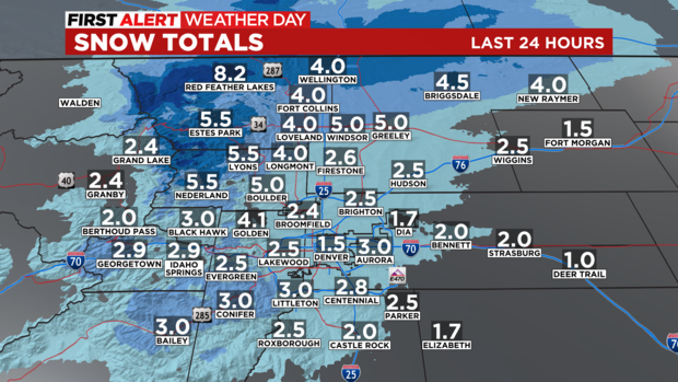
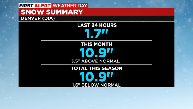
Meanwhile, Denver's official snow total at the airport (DIA) was 1.7 inch as of early morning. That brings total snowfall for November up to 10.9 inches which is 3.5 inches above normal.
Any additional snow accumulation on Tuesday will be minor and will mostly happen before 12 p.m. Skies should gradually clear in the afternoon but temperatures will remain bitterly cold.
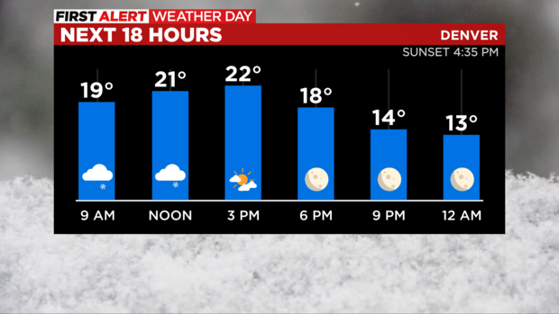
After sunset, the combination of clear skies, light winds, and fresh snow on the ground will cause temperatures to drop into the frigid category. Some neighborhoods along the Front Range may have the coldest night of the season so far.
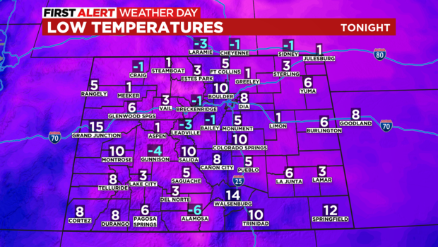
The very cold morning on Wednesday will make it difficult to warm up much in the afternoon but most areas will at least reach freezing thanks to ample sunshine. Some mountain towns could end up being warmer than Denver by a few degrees.
Then another storm system will race across the state on Friday brining snow back to the mountains. It should be warm enough in Denver that any light precipitation that reaches the metro area would be rain instead of snow. Then plan on windy and colder weather Friday night into Saturday.
Another First Alert Weather Day is possible next Monday for more snow.